County of Grande Prairie No. 1 facts for kids
Quick facts for kids
County of Grande Prairie No. 1
|
||
|---|---|---|

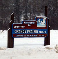
Welcome sign
|
||
|
||
| Nickname(s):
Alberta's First County
|
||

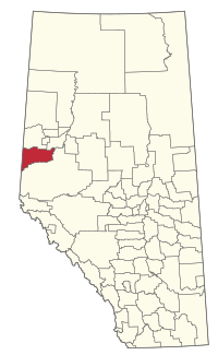
Location within Alberta
|
||
| Country | Canada | |
| Province | Alberta | |
| Region | Northern Alberta | |
| Planning region | Upper Peace | |
| Established | 1943 | |
| Incorporated | 1951 | |
| Area
(2021)
|
||
| • Land | 5,790.59 km2 (2,235.76 sq mi) | |
| Population
(2021)
|
||
| • Total | 23,769 | |
| • Density | 4.1/km2 (11/sq mi) | |
| Time zone | UTC−7 (MST) | |
| • Summer (DST) | UTC−6 (MDT) | |
The County of Grande Prairie No. 1 is a special type of local government area in northwestern Alberta, Canada. It's called a municipal district. This county is part of Census Division No. 19.
It is bordered by the Wapiti River to the south. To the east, you'll find the Smoky River. The western edge of the county meets the province of British Columbia.
Contents
Discovering the County of Grande Prairie
What is a Municipal District?
A municipal district is like a large rural area. It has its own local government. This government helps manage things like roads, services, and planning for the communities within its borders. The County of Grande Prairie No. 1 was officially started in 1943. It was incorporated in 1951.
Towns and Hamlets in the County
The County of Grande Prairie No. 1 surrounds several important towns and cities. These include the city of Grande Prairie. It also includes the towns of Beaverlodge, Sexsmith, and Wembley.
Many smaller communities, called hamlets, are also found within the county. Some of these hamlets are:
There is also an Indian reserve called Horse Lakes 152B located within the county.
People and Population in the County
How Many People Live Here?
The number of people living in the County of Grande Prairie No. 1 has grown over the years. In 1951, about 10,126 people lived here. By 2001, the population had grown to 15,638.
The most recent count was in 2021. The 2021 Census of Population showed that 23,769 people lived in the county. This was a small increase from 22,502 people in 2016.
Understanding Population Density
The county covers a large area of land. In 2021, its land area was about 5,790.59 square kilometers (2,235.76 square miles). With 23,769 people, the population density was about 4.1 people per square kilometer. This means there's a lot of open space in the county!


