Brentwood, Maryland facts for kids
Quick facts for kids
Brentwood, Maryland
|
|||
|---|---|---|---|
|
|||

Location of Brentwood, Maryland
|
|||
| Country | |||
| State | |||
| County | |||
| Incorporated | 1922 | ||
| Area | |||
| • Total | 0.39 sq mi (1.00 km2) | ||
| • Land | 0.39 sq mi (1.00 km2) | ||
| • Water | 0.00 sq mi (0.00 km2) | ||
| Elevation | 23 ft (7 m) | ||
| Population
(2020)
|
|||
| • Total | 3,828 | ||
| • Density | 9,942.86/sq mi (3,841.78/km2) | ||
| Time zone | UTC-5 (Eastern (EST)) | ||
| • Summer (DST) | UTC-4 (EDT) | ||
| ZIP code |
20722
|
||
| Area code(s) | 301, 240 | ||
| FIPS code | 24-09500 | ||
| GNIS feature ID | 0597122 | ||
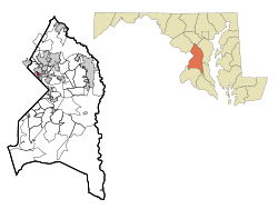
Brentwood is a town in Prince George's County, Maryland, United States. It's a small community located very close to Washington, D.C.. In 2020, about 3,828 people lived here.
Brentwood is surrounded by other towns like Mount Rainier, Cottage City, North Brentwood, and Hyattsville. It's also part of the "Gateway Arts District," which is a special area known for art and culture.
Contents
History of Brentwood
How Brentwood Started
The town of Brentwood officially became a town in 1922. It got its name from a large estate built in 1817 by Robert Brent in Washington, D.C. The town began to grow in the 1890s around train stations.
A man named Wallace A. Bartlett helped create Brentwood. He was a veteran from the Civil War and an inventor. In 1887, he bought a large farm and, with partners, started a company to develop the land.
Early Development
In 1891, Bartlett's company planned out a neighborhood called "Holladay Company's Addition to Highland." The lots were small, about 40 feet by 100 feet. Some lots were less expensive and were bought by African-American families. More expensive lots were bought by white working-class families, many of whom worked for the government.
By 1896, seven more houses were built. Later, Bartlett bought another farm and started a new company, the Brentwood Company, in 1899. Homes built during this time included popular styles like bungalows.
Growth in the 20th Century
Brentwood continued to grow in the early 1900s.
- A school was built.
- The Brentwood Citizens' Association formed in 1903.
- A church was built in 1904.
- A fire department started in 1905.
Street lamps were added in 1917, and electric lights came in 1920. When the town officially formed, it included the areas developed by Bartlett. Many small houses were built during this time. Growth continued through the 1940s and 1950s as more government workers moved to the area. Older homes were sometimes replaced with new cottages.
Most homes in Brentwood were built during and after World War II. Young people who came to Washington, D.C., for war efforts found Brentwood a good place to live and raise families. The town has two small shopping areas. Bartlett Park is a central spot, named after Captain Bartlett. The town hall is located in the Wohlfarth Building in this park.
Brentwood Today
In 2024, Brentwood removed a metal barrier that had been put up in 1957. This barrier used to separate Brentwood from the nearby town of North Brentwood. Removing it helped bring the communities closer together.
Geography
Brentwood covers a total area of about 0.38 square miles (1.0 square kilometer). All of this area is land.
Population and People
| Historical population | |||
|---|---|---|---|
| Census | Pop. | %± | |
| 1930 | 1,842 | — | |
| 1940 | 2,433 | 32.1% | |
| 1950 | 3,523 | 44.8% | |
| 1960 | 3,693 | 4.8% | |
| 1970 | 3,426 | −7.2% | |
| 1980 | 3,000 | −12.4% | |
| 1990 | 3,005 | 0.2% | |
| 2000 | 2,844 | −5.4% | |
| 2010 | 3,046 | 7.1% | |
| 2020 | 3,828 | 25.7% | |
| U.S. Decennial Census 2010 2020 |
|||
2020 Census Information
The 2020 census showed that Brentwood's population was 3,828 people. The town is very diverse.
| Race / Ethnicity (NH = Non-Hispanic) | Pop 2010 | Pop 2020 | % 2010 | % 2020 |
|---|---|---|---|---|
| White alone (NH) | 421 | 545 | 13.82% | 14.24% |
| Black or African American alone (NH) | 1,118 | 1,079 | 36.70% | 28.19% |
| Native American or Alaska Native alone (NH) | 7 | 10 | 0.23% | 0.26% |
| Asian alone (NH) | 57 | 83 | 1.87% | 2.17% |
| Pacific Islander alone (NH) | 0 | 4 | 0.00% | 0.10% |
| Some Other Race alone (NH) | 8 | 31 | 0.26% | 0.81% |
| Mixed Race or Multi-Racial (NH) | 56 | 115 | 1.84% | 3.00% |
| Hispanic or Latino (any race) | 1,379 | 1,961 | 45.27% | 51.23% |
| Total | 3,046 | 3,828 | 100.00% | 100.00% |
2010 Census Details
In 2010, there were 3,046 people living in Brentwood. There were 933 households, with many families. The population density was about 8,016 people per square mile.
About 45.3% of the people identified as Hispanic or Latino. The town's population was also made up of various racial groups.
Many households (41.1%) had children under 18. The average household had 3.26 people. The average age of residents was 32.8 years old.
Transportation
Two main roads serve Brentwood.
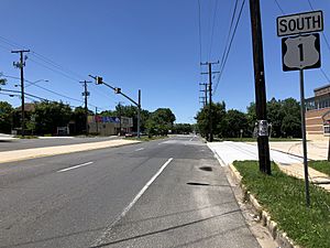
- U.S. Route 1 goes south to Washington, D.C. and north through towns like Hyattsville and College Park. It connects to major highways like Interstate 95.
- Maryland Route 208 goes southeast to Cottage City and northwest to Hyattsville.
Education
The Prince George's County Public Schools system runs the public schools that serve Brentwood.
Children in Brentwood can attend two elementary schools in the nearby city of Mount Rainier:
- Mount Rainier Elementary School
- Thomas S. Stone Elementary School
Both schools teach students from Pre-Kindergarten to 6th grade.
For middle and high school, students attend:
- Hyattsville Middle School (in Hyattsville)
- Northwestern High School (also in Hyattsville)
Notable people
- William R. Callahan, a Catholic priest
- Beethaeven Scottland, a professional boxer
See also
 In Spanish: Brentwood (Maryland) para niños
 | Sharif Bey |
 | Hale Woodruff |
 | Richmond Barthé |
 | Purvis Young |


