Bridge for Kids facts for kids
Quick facts for kids Bridge for Kids |
|
|---|---|
| Coordinates | 47°06′35″N 122°12′49″W / 47.10972°N 122.21361°W |
| Crosses | Carbon River |
| Locale | Rocky Road NE, Orting, Washington |
| Official name | Orting Emergency Evacuation Bridge |
| Characteristics | |
| Design | Suspension bridge with uneven footings |
| Total length | 540 feet (160 m) |
| Width | 20–30 feet (6.1–9.1 m) |
| Clearance below | 18.5 feet (5.6 m) |
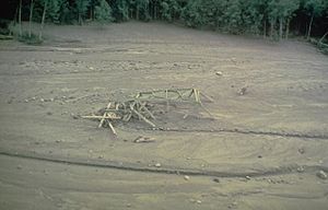
The Bridge for Kids is a planned bridge in Orting, Washington. It will cross the Carbon River. This bridge is super important because it will give school children a safe way to escape if a giant mudslide, called a lahar, comes from Mount Rainier.
A lahar is a very fast-moving mix of mud, rocks, and boulders. It can be as tall as a three-story building! As of 2016, this $40 million bridge was still being planned.
Contents
Why Orting Needs an Escape Bridge

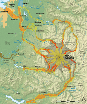
Giant mudslides, or lahars, have happened many times before from volcanoes like Mount Rainier. Orting is built on old mudslide areas from Mount Rainier. One huge mudslide, called the Osceola Mudflow, happened 5,600 years ago. It covered a huge area, reaching all the way to Puget Sound! Another one, the Electron Mudflow, was 30 meters (about 100 feet) deep when it reached the lowlands.
Today, the risk of a lahar in Orting is very high. Experts say there's about a one-in-seven chance of a big event happening during someone's lifetime there. Even though there's a risk, schools and homes have been built in this area.
How the Warning System Works
Since 2000, there's been a special warning system for lahars from Mount Rainier. This system gives people in risky areas some time to get to safety. However, practice drills in Orting have shown that school buses cannot get students out fast enough. Roads get too crowded, and there isn't enough time.
Schools in Orting started planning for evacuations way back in 1995. They quickly realized that the existing roads and paths weren't enough. As of 2016, drills showed that even using a 2-mile walking path, it still took too long for students to get out of the danger zone. This is why a special bridge is needed.
Designing the Kids' Escape Bridge
Pierce County started designing the bridge in January 2009. They worked with the Washington State Department of Transportation and local groups. They looked at other ideas, like new pathways or even a tunnel under the river, but decided a bridge was best.
The bridge is planned to be 20 to 30 feet wide. It's designed to help 12,000 people evacuate in just 30 minutes. Orting is estimated to have about 40 minutes to evacuate after the lahar warning system goes off.
Bridge Features
Early designs from 2014 show a special suspension bridge for people to walk on. It would have stairs leading up to a lower support tower. Another support tower would be 150 feet higher up on a ridge above Orting, near the community of Tehaleh. Part of the bridge deck would have stairs and be quite steep, with a 40% slope.
 | Victor J. Glover |
 | Yvonne Cagle |
 | Jeanette Epps |
 | Bernard A. Harris Jr. |


