Brownville, New Jersey facts for kids
Quick facts for kids
Brownville, New Jersey
|
|
|---|---|

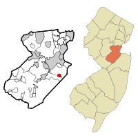
Location in Middlesex County and the state of New Jersey
|
|
| Country | |
| State | |
| County | Middlesex |
| Township | Old Bridge |
| Area | |
| • Total | 1.07 sq mi (2.77 km2) |
| • Land | 1.07 sq mi (2.77 km2) |
| • Water | 0.00 sq mi (0.00 km2) 0.15% |
| Elevation | 66 ft (20 m) |
| Population
(2020)
|
|
| • Total | 2,746 |
| • Density | 2,566.36/sq mi (991.15/km2) |
| Time zone | UTC−05:00 (Eastern (EST)) |
| • Summer (DST) | UTC−04:00 (Eastern (EDT)) |
| ZIP Code |
08857 (Old Bridge)
|
| Area code(s) | 732 |
| FIPS code | 34-08492 |
| GNIS feature ID | 02389253 |
Brownville is a small community in Old Bridge Township, New Jersey. It's located in Middlesex County, New Jersey. Brownville is known as a census-designated place (CDP). This means it's an area that the U.S. Census Bureau defines for gathering population data.
In 2020, about 2,746 people lived in Brownville. This number grew from 2,383 people in 2010.
Contents
Where is Brownville?
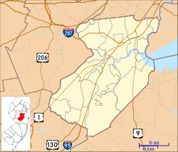
Brownville is in the eastern part of Middlesex County, New Jersey. It's less than 2 miles away from the border of Monmouth County. The community is also close to the center of Old Bridge Township.
The community of Old Bridge is right next to Brownville. It borders Brownville to the west and south.
Major Roads in Brownville
U.S. Route 9 forms the western edge of Brownville. This highway goes north to South Amboy (about 5 miles away). It also goes south to Freehold (about 11 miles away).
County Route 516 runs through the middle of Brownville. This road goes west to Route 18 in Old Bridge. It also goes east to the center of Matawan. A well-known intersection called Cottrell Corners is right in the middle of Brownville.
Land and Water
Brownville covers an area of about 1.07 square miles (2.77 square kilometers). Almost all of this area is land. There is very little water, only about 0.09% of the total area.
The water in Brownville flows north towards Tennent Brook. This brook then flows into the South River. The South River is part of the Raritan River system, which eventually leads to New York Bay.
Who Lives in Brownville?
| Historical population | |||
|---|---|---|---|
| Census | Pop. | %± | |
| 2000 | 2,660 | — | |
| 2010 | 2,383 | −10.4% | |
| 2020 | 2,746 | 15.2% | |
| Population sources: 2000 2010 2020 |
|||
The population of Brownville has changed over the years. Here's a quick look at how many people have lived there:
- In 2000, there were 2,660 people.
- In 2010, the population was 2,383.
- By 2020, it grew to 2,746 people.
Brownville in 2010
The 2010 United States census collected detailed information about the people living in Brownville.
- There were 2,383 people living in 1,000 households.
- About 659 of these households were families.
- The community had about 2,379 people per square mile.
Most people in Brownville were White (80.19%). There were also people who identified as Black or African American (5.04%) and Asian (10.07%). About 11.20% of the population identified as Hispanic or Latino.
Many households (27.5%) had children under 18 years old. About 49.0% were married couples living together. The average household had 2.38 people, and the average family had 2.97 people.
The median age in Brownville was 41.7 years old. This means half the people were younger than 41.7, and half were older.
See also

- Brownville (Nueva Jersey) para niños (This link goes to a Spanish version of this article for kids.)
 | Selma Burke |
 | Pauline Powell Burns |
 | Frederick J. Brown |
 | Robert Blackburn |


