Burnt Peak (California) facts for kids
Quick facts for kids Burnt Peak |
|
|---|---|

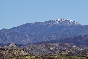
South face of Burnt Peak.
|
|
| Highest point | |
| Elevation | 5,791 ft (1,765 m) NAVD 88 |
| Prominence | 2,448 ft (746 m) |
| Listing | Hundred Peaks Section |
| Geography | |
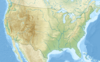
| Location | Los Angeles County, California, U.S. |
| Parent range | Sierra Pelona Ridge |
| Climbing | |
| Easiest route | Hike, class 1 |
Burnt Peak is the tallest peak in the Sierra Pelona Mountains. You can find it in the northwestern part of Los Angeles County, in sunny Southern California.
Where is Burnt Peak Located?
This amazing mountain stands tall at 5,791 feet (1,765 m) (about 1,765 meters) above sea level. It is a protected area within the huge Angeles National Forest.
Nearby Places to Explore
Burnt Peak is located north of the city of Santa Clarita. It sits west of a pretty spot called Lake Hughes. To its east, you'll find the historic Ridge Route. Just a short drive north is the small town of Three Points.
Part of a Mountain System
The Sierra Pelona Mountains, where Burnt Peak is located, are part of a larger group of mountains. This group is known as the Transverse Ranges System. These ranges stretch across Southern California.
Black History Month on Kiddle
Famous African-American Inventors:
 | Valerie Thomas |
 | Frederick McKinley Jones |
 | George Edward Alcorn Jr. |
 | Thomas Mensah |

All content from Kiddle encyclopedia articles (including the article images and facts) can be freely used under Attribution-ShareAlike license, unless stated otherwise. Cite this article:
Burnt Peak (California) Facts for Kids. Kiddle Encyclopedia.


