Canadian Border Peak facts for kids
Quick facts for kids Canadian Border Peak |
|
|---|---|

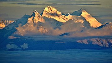
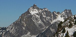
Canadian Border Peak (left), American Border Peak (middle) and Mount Larrabee (right) seen from Canada
|
|
| Highest point | |
| Elevation | 2,291 m (7,516 ft) |
| Prominence | 311 m (1,020 ft) |
| Listing | Mountains of British Columbia |
| Geography | |
| Parent range | North Cascades |
| Topo map | NTS 92H/04 |
| Climbing | |
| First ascent | 1932 by T. Fyles and . Henderson |
Canadian Border Peak is a mountain in British Columbia, Canada. It stands at 2,291 meters (7,516 feet) tall. This mountain was first known simply as "Border Peak." It's located at the start of Tamihi Creek in the Cascade Mountains.
As its name suggests, Canadian Border Peak is very close to the Canada–United States border. It's connected by a high ridge to another mountain called American Border Peak. American Border Peak is a bit taller, reaching 2,437 meters (7,995 feet). Together, these two mountains are often called the Border Peaks. You can easily see them from parts of Sumas Prairie and Chilliwack Prairie in British Columbia.
What's the Weather Like at Canadian Border Peak?
The area around Canadian Border Peak has a "marine west coast" climate. This means it's often wet and mild, especially because it's near the Pacific Ocean. Most of the weather systems come from the Pacific Ocean. They travel northeast towards the Cascade Range.
When these weather systems reach the North Cascades, the mountains force the air upwards. This causes the air to cool and drop its moisture. So, the west side of the North Cascades gets a lot of rain or snow. This happens especially during the winter months.
Because of the mild climate and ocean influence, temperatures rarely go below freezing (0°C or 32°F). They also rarely go above 27°C (80°F). In winter, it's usually cloudy. But in summer, high pressure systems often bring clear skies. The snow here tends to be wet and heavy. This can lead to a higher risk of avalanches.
How Were the North Cascades Formed?
The North Cascades mountains have very rugged shapes. They feature sharp peaks, long ridges, and deep valleys carved by glaciers. These amazing landforms and big changes in elevation were created by geological events over millions of years.
The formation of the Cascade Mountains began a very long time ago. This was during the late Eocene Epoch, millions of years ago. The North American Plate was slowly moving over the Pacific Plate. This movement caused many periods of volcanic activity.
Also, small pieces of the Earth's outer layer, called terranes, came together. These pieces formed the North Cascades about 50 million years ago.
During the Pleistocene period, which was over two million years ago, glaciers played a big role. These huge sheets of ice moved forward and backward many times. As they moved, they scraped and shaped the land. They left behind deposits of rock. The U-shaped valleys you see today were formed by these glaciers.
The main processes that created the tall peaks and deep valleys of the North Cascades are:
- Uplift: The land being pushed upwards.
- Faulting: Cracks in the Earth's crust where rocks slide past each other.
- Glaciation: The action of glaciers carving the landscape.
These forces working together created the stunning mountains we see today.
 | Claudette Colvin |
 | Myrlie Evers-Williams |
 | Alberta Odell Jones |


