Cannondale, Connecticut facts for kids
Quick facts for kids
Cannondale
|
|
|---|---|

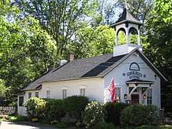
Cannondale Railroad Station
|
|
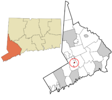
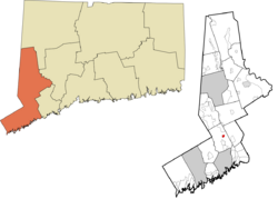
 Fairfield County and Connecticut Fairfield County and Connecticut Western Connecticut Planning Region and Connecticut Western Connecticut Planning Region and Connecticut |
|
| Country | |
| State | |
| County | Fairfield |
| City | Wilton |
| Area | |
| • Total | 0.309 sq mi (0.80 km2) |
| • Land | 0.309 sq mi (0.80 km2) |
| • Water | 0.000 sq mi (0.00 km2) |
| Population
(2010)
|
|
| • Total | 141 |
| • Density | 456.3/sq mi (176.3/km2) |
| Time zone | UTC-5:00 (Eastern) |
| • Summer (DST) | UTC-4:00 (Eastern) |
| Area code(s) | 203/475 |
| FIPS code | 09-11990 |
| GNIS feature ID | 2631221 |
Cannondale is a small community in Wilton, Fairfield County, Connecticut. It's known as a census-designated place (CDP), which means it's a special area defined for collecting census data. In 2010, about 141 people lived there.
Cannondale is famous for its old homes on large, wooded lots. English settlers first came to this land in the 1600s. At the heart of Cannondale is Cannon Crossing. This is a charming shopping area with unique shops and restaurants. It's made up of old 19th-century buildings. Actress June Havoc helped restore these buildings in the late 1970s. Cannon Crossing is right next to the Cannondale Railroad Station. Both are part of the Cannondale Historic District, which protects many important historical buildings in the area.
The local Native Americans originally called this area "Pimpewaug." This name was also used by the early settlers. The Cannon family became important here, partly because of the Cannon Store, which opened in the 1790s. In 1852, the Danbury and Norwalk Railroad opened a station near Cannon Road. They named it Cannon Station.
Later, Charles Cannon worked to get a post office in the neighborhood. It opened in 1870. At this time, the area became known as "Cannon Station." In 1882, the U.S. Post Office changed the name to "Cannon." But this was too similar to Canaan, another town in Connecticut. So, in 1915, the post office name was changed to Cannondale. The post office closed in 1967, but the name stuck. Today, Cannondale generally refers to the area around Danbury Road and Cannon Road.
In 1915, Samuel Miller, who helped with the name change, got a cannon. This cannon had been used in the Civil War battle of Galveston. It was placed at the intersection of Danbury and Cannon roads. It was knocked over twice: once as a Halloween prank and once in a car accident!
Contents
Exploring Cannondale's Landscape
Cannondale is located in the east-central part of Wilton. It's just north of Wilton Center, which is Wilton's downtown area. Route 7, the Norwalk River, and the train tracks (now the Danbury Line of Metro-North Railroad) all run close together through the neighborhood. They go from south to north.
The Norwalk River valley is about 250 feet (76 meters) above sea level in the north of Cannondale. It goes down to 200 feet (61 meters) above sea level at the southern end. Turner Ridge, on the western side, rises as high as 500 feet (152 meters). The ridges east of the river are 350 to 450 feet (107 to 137 meters) high. The Saugatuck River and Wilton's border with Weston are on the far eastern side.
According to the United States Census Bureau, Cannondale covers about 0.309 square miles (0.80 square kilometers) of land. There is no water area.
Cannondale's Rich Soil
The soil in Cannondale is considered some of the best in Connecticut. It's a dark brown, sometimes reddish, soil type called "Wilton Loam." This special soil stretches from New Milford in the north all the way down to Long Island Sound.
Outdoor Adventures in Cannondale
Cannondale has several beautiful public open spaces. These include the Gregg Preserve, the Belknap Preserve, and the Honey Hill Preserve. They are all in the northeast area of Cannondale.
Belknap Preserve
The Belknap Preserve is a 27-acre (11-hectare) area. You can enter it from Wampum Hill Road. The preserve has a 1.5-mile (2.4 km) Loop Trail, a 0.25-mile (0.4 km) Cut-Across Trail, and other access trails. The town bought this land from the Belknap family in 1999. It features woodlands, open fields, wetlands, and the Mayapple Brook valley. You'll see old stone walls that used to mark property lines. A trail at the southwest corner connects to the Gregg Preserve.
Gregg Preserve
The Gregg Preserve is much larger, at 74.5 acres (30 hectares). Its entrance is at the end of Mayapple Road. One trail goes around the edge of the property, with other trails crossing through the middle. You can ride horses here if you get permission from the Wilton Land Conservation Trust. This trust owns the property. Most of the preserve is open woods with some evergreen trees and open fields. A pond near the railroad tracks is not part of the preserve.
Honey Hill Nature Preserve
The Honey Hill Nature Preserve is about 37.5 acres (15 hectares). Most of it is actually in Weston. You can enter it from Wampum Hill Road. There's no special parking area, but you can park on Wampum Hill Road. The Aspetuck Land Trust created this preserve in 1968. It was expanded in 1974 and 1978. The preserve sits on the northern end of an oval-shaped hill.
Getting Around Cannondale
The Cannondale station is part of the Danbury Line of the Metro-North railroad. This train line helps people travel to and from Cannondale.
Cannondale's Past: A Look Back
Early Days: From Pimpewaug to Settlements
The Native American name for this area was "Pimpewaug." Early colonists spelled it in different ways. Pimpewaug was a bit larger than today's Cannondale. It stretched from Honey Hill in the north to the Wilton railroad station site in the south. It also went from Drum Hill in the west to Buckingham Ridge in the east.
Many Native American arrowheads have been found in Cannondale's flat meadows. There's a large flat rock east of the railroad tracks. People say it was a "Dancing Rock" for local Native Americans. By the 1720s, Native Americans and English settlers lived peacefully together in the area. One story says an Indian woman nursed a baby near what is now Hurlbutt Street in the early 1700s.
Cannondale, like the rest of Wilton, was originally part of Norwalk. Norwalk was founded in 1651. By 1726, Wilton became its own separate parish. This meant people didn't have to travel far to Norwalk for church. The parish also handled local matters like taxes for schools and roads.
Pimpewaug became one of Wilton's first three school districts in 1729. We don't know where the first schoolhouse was. But it might have been near the second one, south of Danbury Road and Olmstead Hill Road. Pimpewaug school met in August and September. For the rest of the year, children worked on their family farms. Farming was the main industry here until the 1800s.
The Norwalk River provided power for sawmills and gristmills. By 1809, Thomas Cole, a Cannondale resident, used the river's power for a machine. It made wheel hubs for carriages. His brothers and nephews later ran the business. They built wagons, chaises, and sulkies. Later, a wire mill called D&L Lockwood took over the site.
Many colonial homes still stand in Cannondale today. One example is William Belden's home at 5 Scribner Hill Road, built in 1740. It's a great example of colonial architecture. It was larger than most homes of its time.
Growth and Change: 18th and 19th Centuries
In 1792, Wilton established nine school districts. District 7 was the area that is now Cannondale. By 1795, these school districts became independent of the church. Wilton also received money from the state. This money came from the sale of lands in Ohio. It was to help residents whose towns were burned by the British during the American Revolutionary War.
The Cannon family, especially Charles Cannon (1824–1892), became very influential. The central area of Pimpewaug became known as "Cannon's" or "Cannon." This happened by the time the railroad was built and needed a name for its new station.
In the late 1780s, John Cannon (1752–1802) opened the Old Red Store, later called the Cannon Store. The building still exists today. By 1829, the store was on the east side of Danbury Road. The business did well until the 1850s. By 1860, it was gone, and Charles Cannon was listed as a farmer. However, Cannon also employed local women to sew clothing. Many women in Cannondale worked for his business.
In the early 1850s, Charles Cannon helped build the Danbury & Norwalk Railroad. He hired many Irishmen to build the tracks. The railroad line opened in February 1852. Thomas Cannon became a town leader. He was also involved with the D&L Lockwood Company's wire mill. This mill supplied brass and copper wire across the United States.
In 1860, about 250 people lived in Cannondale. This was 13 percent of Wilton's population. Most residents were farmers. A typical home had parents, children, and a helper. Farms were usually about 60 acres (24 hectares). They produced butter, cattle, potatoes, and other goods. People had various jobs. There were farmers, farm laborers, servants, shoemakers, and carpenters. The neighborhood also had a hub factory, a wagon maker, and a hoe manufacturer.
In 1872, a second schoolhouse was built in Cannondale. It was at the corner of Danbury and Olmstead Hill roads. By 1900, people in the neighborhood had more varied jobs. Many worked at the Gilbert & Bennett wire factory in Georgetown.
In 1899, the Cannon Grange was founded with 53 members. The Grange is a community organization. Members learned how it worked and what it did.
Cannondale in the 20th Century
In 1952–1953, the Zion Hill Methodist Episcopal Church was moved to a new spot on its property. Its old horse sheds, built in 1885, were removed to make way for more parking.
Cannon Crossing is an 8-acre (3.2-hectare) area. It's a restored village from before the Civil War. Actress June Havoc created it. It has 19th-century buildings right across the railroad tracks from the Cannondale train station. She sold the property in 1989.
See also
 In Spanish: Cannondale (Connecticut) para niños


