Wilton, Connecticut facts for kids
Quick facts for kids
Wilton, Connecticut
|
||
|---|---|---|
 |
||
|
||
 Fairfield County and Connecticut Fairfield County and Connecticut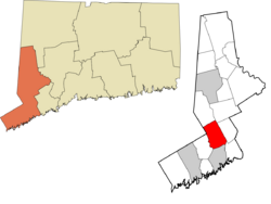 Western Connecticut Planning Region and Connecticut Western Connecticut Planning Region and Connecticut |
||
| Country | United States | |
| U.S. state | Connecticut | |
| County | Fairfield | |
| Region | Western CT | |
| Incorporated | 1802 | |
| Government | ||
| • Type | Selectman-town meeting | |
| Area | ||
| • Total | 27.3 sq mi (71.0 km2) | |
| • Land | 26.9 sq mi (69.8 km2) | |
| • Water | 0.4 sq mi (1.1 km2) | |
| Elevation | 335 ft (102 m) | |
| Population
(2020)
|
||
| • Total | 18,503 | |
| • Density | 677.8/sq mi (260.61/km2) | |
| Time zone | UTC−5 (Eastern) | |
| • Summer (DST) | UTC−4 (Eastern) | |
| ZIP Code |
06897
|
|
| Area code(s) | 203/475 | |
| FIPS code | 09-86370 | |
| GNIS feature ID | 0213535 | |
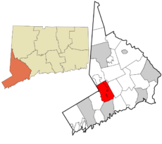
Wilton is a town in Fairfield County, Connecticut, United States. In 2020, about 18,503 people lived here. Wilton is part of the Western Connecticut Planning Region.
Wilton became an official parish in 1726. Today, it is a community with many homes, open spaces, and historic buildings. You can see old colonial homes and the unique Round House. Many people who live in Wilton travel to work in nearby cities like Stamford or New York City.
Wilton is home to several big companies. These include ASML, Breitling SA, Cannondale Bicycle Corporation, and Melissa & Doug.
The town has worked hard to keep its small-town feel. It has rules to control new buildings and protect its historic landmarks. Almost 1,000 acres (4 square kilometers) of open land are set aside for outdoor activities. The Cannondale Historic District is a special area in north-central Wilton. It still looks much like it did long ago and was added to the National Register of Historic Places in 1992.
Contents
Wilton's Early History
How Wilton Began
The first records of the Wilton area are from 1640. Roger Ludlow and his friends bought land from Native Americans. This land was between the Norwalk and Saugatuck Rivers. They called this area Norwalk.
The first settlers, called Proprietors, arrived in Norwalk in 1651. They owned a large area of land together. On the edges of Norwalk, they could own small plots of land for farming. But cattle, sheep, and hogs grazed in a shared pasture. This pasture's edge is close to Wilton's current southern border.
By the late 1600s, the Norwalk Proprietors started selling land further north. The first non-Native American settlements in Wilton were in the Norwalk River valley. They also settled on hills like Belden Hill, Chestnut Hill, and Ridgefield Road. To farm, settlers had to clear forests and remove many rocks. These rocks were used to build the stone walls you can still see today.
Creating Wilton Parish
Families who bought land in Wilton had to go to church in Norwalk every Sunday. As more people moved to Wilton in the early 1700s, the land became more valuable. The Proprietors realized that having a local church would make the land even more desirable.
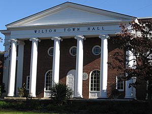
By 1725, about 40 families lived in Wilton. They wanted their own Congregational church. Norwalk allowed them to hire a minister, open schools, and build roads. So, in 1726, Wilton Parish was created. It was a village with its own church and local rights, but still part of Norwalk. A copy of the petition to create the parish is in the Town Hall.
The Wilton Parish handled many local matters, not just church business. They managed shared animal herds and regulated trades and taverns. Road conditions and taxes were often discussed. Even though the parish couldn't send a representative to the state government, it was in charge of local education and military training. The first minister, Mr. Robert Sturgeon, was also Wilton's first schoolmaster.
Once the first church building, called a meetinghouse, was built in 1726, Wilton had a "center." Other areas like Belden Hill and Chestnut Hill were already settled by farmers. By 1738, the first meetinghouse was too small. A second one was built. Less than 60 years later, this second building was in bad shape. A third church was built in 1790 on Ridgefield Road. It is still the oldest church building in Fairfield County, Connecticut.
Wilton in the Revolutionary War
During the Revolutionary War, over 300 men from Wilton joined the military. One of them was Cato Treadwell, an African American who served for three years. In 1777, British soldiers marched through Wilton. They were returning after attacking Danbury. Several homes were burned, but the town mostly stayed safe. About 52 graves of Revolutionary War veterans are still in Wilton cemeteries.
Becoming an Independent Town
In 1802, Wilton became a separate town. This happened even though Norwalk didn't want it to. The Connecticut General Assembly approved Wilton's request for its own government. Wilton chose the traditional New England Town Meeting-Selectmen style of government. This system is still used today.
In the 1800s, education was handled by nine different school districts in Wilton. Many Wilton children also went to five private schools.
Wilton's population grew slowly in the 19th century. Most of the land was farmland for dairy cows, horses, or crops. But the rocky soil didn't produce much. Also, railroads brought cheaper farm products from the Midwest. So, local industries grew instead. Shoemaking, shirt making, and carriage building were common. Mills were built along streams. The Gilbert and Bennett Manufacturing Co. started making wire products in 1834.
Wilton and the Civil War
Before the Civil War, many people in Wilton were against slavery. Wilton was a stop on the Underground Railroad. This was a secret network that helped enslaved people escape to Canada. The house of William Wakeman, a strong abolitionist, was a key stop. The Civil War itself didn't greatly affect Wilton, but local businesses benefited from wartime spending.
Changes in the Industrial Age
The railroad arrived in 1852. It didn't bring many benefits to Wilton's small farms and home industries. But it made it easier to move to the rich farmlands out west.
After the Civil War, Wilton's population dropped. Cities grew, industries expanded, and home-made products were less popular. Farms were left empty. Between 1860 and 1900, the population fell by about 30%. By 1900, only 1,598 people lived in Wilton.
This drop in population helped save many old homes from the 1700s and 1800s. In the 1910s, people from New York City started buying abandoned farms for summer homes. By the 1930s, there were clear differences between the "old-timers" and the "new people" at town meetings. Wilton was changing from a farming town to a place where people traveled to work. By 1935, the last two of Wilton's nine schoolhouses closed. All the school districts joined together into the Center school in Wilton Center.
After World War II, new neighborhoods with many houses were built. Light industries also began moving to town. To manage this growth, the town created zoning rules. As the population and businesses grew, there was a need for new schools, roads, and services. The biggest growth happened from 1950 to 1970. During this time, the population jumped from 4,558 to 13,572.
Wilton's Geography
Wilton covers about 27.4 square miles (71.0 square kilometers). Most of this is land, with about 0.4 square miles (1.1 square kilometers) of water. This includes the South Norwalk Reservoir. Wilton is surrounded by other towns: Ridgefield to the northwest, Norwalk to the south, New Canaan to the southwest, Westport to the southeast, and Weston and Redding to the northeast. It also shares a border with Vista, New York, to the west.
Homes and Land Use
Wilton still has about 500 homes built in the 1700s and 1800s. In 2005, the director of the Wilton Historical Society noted that people were replacing newer homes from the 1950s and 1960s. This was making the town less affordable for people who worked with their hands, like artisans and mechanics. Now, more residents work in management roles.
Between 1999 and 2005, Wilton voters approved spending $23 million to protect open land.
South Norwalk Electric and Water (SNEW) owns a reservoir on the western side of town. It has about 350 acres (1.4 square kilometers) of land. In the fall, a small number of hunters are allowed to hunt deer on this property. This helps control the deer population.
Wilton town center has many local restaurants, shops, and stores. These were added around 2000, next to the older Wilton Center. The old center includes the Wilton Library, the Wilton Post Office, and the Village Market. In the southern part of town, US 7 has a business area.
A recent development is the expansion of the Norwalk River Valley Trail. This is a path for walking and biking that will connect Norwalk and Danbury.
Wilton's Neighborhoods
The southwestern part of Wilton includes a piece of the Silvermine neighborhood. This area also stretches into New Canaan and Norwalk. Georgetown is mostly in Wilton, but also goes into Redding and Weston. It is in the northeastern corner of town. Other neighborhoods in Wilton are South Wilton, Wilton Center, Gilbert Corners, Cannondale, and North Wilton.
Wilton's Population
| Historical population | |||
|---|---|---|---|
| Census | Pop. | %± | |
| 1820 | 1,818 | — | |
| 1850 | 2,066 | — | |
| 1860 | 2,208 | 6.9% | |
| 1870 | 1,994 | −9.7% | |
| 1880 | 1,864 | −6.5% | |
| 1890 | 1,722 | −7.6% | |
| 1900 | 1,598 | −7.2% | |
| 1910 | 1,706 | 6.8% | |
| 1920 | 1,284 | −24.7% | |
| 1930 | 2,133 | 66.1% | |
| 1940 | 2,829 | 32.6% | |
| 1950 | 4,558 | 61.1% | |
| 1960 | 8,026 | 76.1% | |
| 1970 | 13,572 | 69.1% | |
| 1980 | 15,351 | 13.1% | |
| 1990 | 15,989 | 4.2% | |
| 2000 | 17,633 | 10.3% | |
| 2010 | 18,062 | 2.4% | |
| 2020 | 18,503 | 2.4% | |
| U.S. Decennial Census | |||
Wilton's population has changed a lot over the years. In 1820, there were about 1,818 people. By 1900, the population had dropped to 1,598. But after that, it started to grow rapidly. Between 1950 and 1970, the population nearly tripled! In 2020, Wilton had 18,503 residents.
The town is mostly White, with smaller percentages of African American, Asian, and Hispanic or Latino residents. Most households are married couples with children. The average household has about 2.91 people. The median age in Wilton is 40 years old.
Arts and Fun in Wilton
Events to Enjoy
- Relay for Life: A community event to raise money for cancer research.
- Wilton Singers Holiday Feast: A traditional holiday music show in December. It features the Wilton Singers and the Wilton High School Madrigal Singers.
- Jazz in the Garden: This event happens every September at Weir Farm.
- Wilton Rocks for Food: An annual concert by local musicians. All the money raised goes to the Wilton Food Pantry and the Connecticut Food Bank.
- Wilton Farmers' Market: An outdoor market held at the Wilton Historical Society. You can find fresh produce from June through October.
- Wilton's annual Street Fair & Sidewalk Sale: An outdoor sales event in the town center during the summer.
Historic Places to Visit
Wilton has several places listed on the National Register of Historic Places. These are important sites that are protected for their history.
- Cannondale Historic District
- David Lambert House
- Georgetown Historic District
- Hurlbutt Street School
- Marvin Tavern
- Sloan-Raymond-Fitch House
- Weir Farm National Historic Site
- Wilton Center Historic District
Parks and Recreation
The Wilton Parks and Recreation Department offers many activities for all ages. They have programs for young children, seniors, and youth sports like soccer and basketball. There are also many walking paths, including part of the Norwalk River Valley Trail. Merwin Meadows is a great place for families. It has a picnic area, a pond, a playground, and a sports field.
Education in Wilton
Public Schools
About 3,750 students attend Wilton's four public schools.
- Miller-Driscoll School: For students in Pre-Kindergarten through 2nd grade.
- Cider Mill School: For students in 3rd through 5th grade.
- Middlebrook School: The middle school, for 6th through 8th graders.
- Wilton High School: Offers advanced classes for gifted students. It also has great music and visual arts programs. The language lab teaches six languages: French, German, Spanish, Latin, classical Greek, and American Sign Language.
Elementary school classes usually have 18 to 22 students. There is about one teacher for every 19 students. Middlebrook School has teams of teachers for different subjects. These include languages, science, math, social studies, and art. Class sizes range from 20 to 25 students, with about 13 students per teacher.
Private Schools
Wilton also has four private schools:
- Connecticut Friends School: A Quaker preschool.
- Seven Acres Montessori School: Teaches students from preschool through eighth grade.
- The Goddard School: A preschool.
- Zion’s Hill Preschool: A play-based learning preschool for ages 2-5.
Media in Wilton
The Wilton Bulletin is a weekly newspaper. GOOD Morning Wilton is an online news website that updates daily. Virgin Mobile Live, an online radio service, is based in Wilton. There is also another weekly newspaper called the Wilton Villager.
Getting Around Wilton
Roads and Highways
The main roads that go north and south through Wilton are U.S. Route 7 and Route 33. State highways Route 53 and Route 106 also pass through the town. The nearby Merritt Parkway (Route 15) can be reached from Wilton using the Route 33 exit or the Route 7 exits.
Train Travel
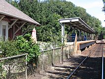
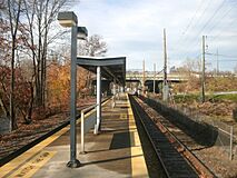
Wilton has two train stations: Wilton (near the town center) and Cannondale. Both are on Metro-North Railroad's Danbury Branch. You can take a commuter train south to Norwalk (15 minutes), Stamford (25 minutes), and Grand Central Terminal in New York City (90 minutes). You can also go north to Danbury (33 minutes). From Norwalk and Stamford, you can connect to other train lines that go to places like New Haven and Boston.
Bus Services
The town has the 7 Link bus route, which is part of the Norwalk Transit District. This bus runs between Norwalk and Danbury along the Route 7 corridor. There is also a special shuttle bus during busy hours. It takes commuters from South Wilton to the South Norwalk train station.
Famous People from Wilton
- Max Andrews (born 2004), soccer player
- Theodore Bikel (1924–2015), actor
- Jeremy Black, actor
- Linda Blair, actress
- Chance Browne, cartoonist for Hi and Lois
- Dik Browne (1917–1989), cartoonist, created Hägar the Horrible
- Dave Brubeck, famous jazz musician
- David Canary (1938–2015), actor
- Paul Dano, actor, graduated from Wilton High School in 2002
- Ray Dalio, founder of Bridgewater Associates
- Matt Davies, Pulitzer Prize-winning cartoonist
- George Devol, inventor, founded the first industrial robotics company
- Abby Elliott, actress and comedian
- Chris Elliott, actor and comedian
- Ace Frehley, guitarist for Kiss
- Charles Grodin (1935–2021), actor
- Johnny Gruelle, artist who created Raggedy Ann and Raggedy Andy
- June Havoc, actress
- Daryl Hawk, photographer and explorer
- Sterling Hayden, actor
- Henry Hazlitt, economics writer
- Patty Hearst, heiress and actress
- Lydia Hearst-Shaw, supermodel and heiress
- Russell Hoban, writer; Lillian Hoban, writer and illustrator; and their daughter Phoebe Hoban, journalist
- Richard C. Hottelet, broadcast journalist
- Ira Levin, writer, based his fictional town of Stepford on Wilton
- Kristine Lilly, US Olympic Soccer Team, holds a world record for most professional soccer appearances
- Katherine Maher, executive director of the Wikimedia Foundation
- Jay Manuel, director of photo shoots for America's Next Top Model
- Joe Pantoliano, actor
- Ingri and Edgar Parin d'Aulaire, writers and illustrators of children's books
- Aldo Parisot, cellist
- Dean Parisot, film and television director
- Sarah Phillips, fashion designer
- Steve Phillips, former NY Mets General Manager
- Charles E. Pont, artist and minister
- Jane Powell and Dickie Moore, actress and former child actor
- Randy Rasmussen, former New York Jets football player
- Vicki Sue Robinson, actress and singer
- John Scofield, jazz guitarist
- Zachary Cole Smith, frontman of DIIV
- Donald B. Verrilli Jr., U.S. solicitor general
- Christopher Walken, actor
- Marcy Walker, actress
- Emily Weiss, founder of Glossier
- Cathie Wood, founder of ARK Investment Management
See also
 In Spanish: Wilton (Connecticut) para niños
 | DeHart Hubbard |
 | Wilma Rudolph |
 | Jesse Owens |
 | Jackie Joyner-Kersee |
 | Major Taylor |


