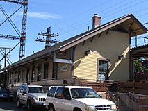
Westport, Connecticut facts for kids
Quick facts for kids
Westport, Connecticut
|
|||||
|---|---|---|---|---|---|
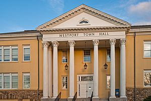
Westport Town Hall
|
|||||
|
|||||
| Nickname(s):
WePo
|
|||||
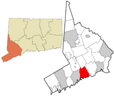 Fairfield County and Connecticut Fairfield County and Connecticut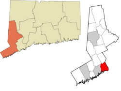 Western Connecticut Planning Region and Connecticut Western Connecticut Planning Region and Connecticut |
|||||
| Country | United States | ||||
| U.S. state | Connecticut | ||||
| County | Fairfield | ||||
| Region | Western CT | ||||
| Established | 1835 | ||||
| Incorporated | May 28, 1835 | ||||
| Founded by | Bankside Farmers | ||||
| Government | |||||
| • Type | RTM | ||||
| Area | |||||
| • Total | 33.45 sq mi (86.6 km2) | ||||
| • Land | 19.96 sq mi (51.7 km2) | ||||
| • Water | 13.49 sq mi (34.9 km2) | ||||
| Elevation | 26 ft (8 m) | ||||
| Population
(2020)
|
|||||
| • Total | 27,141 | ||||
| • Density | 1,359.8/sq mi (525.0/km2) | ||||
| Time zone | UTC−5 (Eastern) | ||||
| • Summer (DST) | UTC−4 (Eastern) | ||||
| ZIP Code |
06880
|
||||
| P.O. Boxes |
06881
|
||||
| Area code(s) | 203/475 | ||||
| FIPS code | 09-83500 | ||||
| GNIS feature ID | 0213532 | ||||
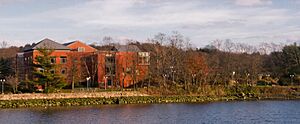
Westport is a town in Fairfield County, Connecticut, United States. It is located along the Long Island Sound, a beautiful coastal area. Westport is about 48 miles (77 km) northeast of New York City. It is part of the Western Connecticut Planning Region. Westport's public schools are considered among the best in Connecticut. They are also ranked highly across the United States.
Contents
History of Westport
Early Days and Founding
People have lived in the Westport area for a very long time. Archeologists have found signs of inhabitants from 7,500 years ago. The first European settlers met the Pequot Indians. The Pequot called the area Machamux, which means "beautiful land."
The first European settlers arrived in 1693. They were known as the five Bankside Farmers. Their families grew, and the community expanded. At first, it was called "Bankside" in 1693. In 1732, it was named Green's Farm to honor John Green, one of the Bankside Farmers.
The community wanted to be separate from the Town of Fairfield. They had their own church and local government. This allowed them to become independent. In 1835, the area officially became the Town of Westport.
Revolutionary War Events
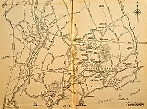
During the American Revolutionary War, a big event happened in Westport. On April 25, 1777, British soldiers landed at Compo Beach. There were 1,850 soldiers led by Major General William Tryon. Their goal was to destroy American military supplies in Danbury.
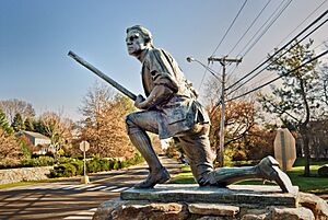
Local citizen soldiers, called Minutemen, hid as the British passed. Then, they attacked the British from behind. A statue on Compo Beach remembers this brave act. It shows a crouching Minuteman looking away from the beach. This shows how they attacked the British from the rear. Two cannons were also placed on the beach in 1901. They represent the strong resistance of the Minutemen.
Growth and Changes in Westport
Westport officially became a town on May 28, 1835. It was formed from parts of Fairfield, Weston, and Norwalk. Daniel Nash led 130 people who asked for Westport to become its own town. They wanted to help their seaport grow.
For many years, Westport was a successful farming town. It was famous for growing onions. It was the top onion-growing center in the U.S. Westport also became a shipping hub to send onions to market.
Later, a plant disease ruined the onion crops. So, Westport's economy changed. Mills and factories became more important than farming.
Westport as an Arts Center
Around 1910, Westport started to become a cultural hub. Artists, musicians, and writers moved to the town. Famous people like F. Scott Fitzgerald lived here. They liked Westport because it was a peaceful place away from the city. This is when Westport became known as a "creative heaven."
In the 20th century, more people moved to Westport. Many New Yorkers were attracted to its artistic vibe. Farmers began selling their land. Westport changed from a farming community to a suburban area.
From the 1950s to the 1970s, Westport's population grew quickly. It was easy to travel to New York City for work. People also loved the town's natural beauty and rolling hills. Westport also had stylish shops and excellent schools. These things helped the town grow even more.
By the 21st century, Westport became a center for finance and insurance. It also became known for professional, scientific, and technical services.
Geography of Westport
Westport covers about 33.45 square miles (86.63 km²). About 19.96 square miles (51.70 km²) is land. The rest, about 13.49 square miles (34.94 km²), is water.
Westport is surrounded by other towns. Norwalk is to the west. Weston is to the north. Wilton is to the northwest. Fairfield is to the east. To the south is the Long Island Sound.
Westport's Climate
Westport has a climate with warm summers and cold winters.
| Climate data for Westport, Connecticut | |||||||||||||
|---|---|---|---|---|---|---|---|---|---|---|---|---|---|
| Month | Jan | Feb | Mar | Apr | May | Jun | Jul | Aug | Sep | Oct | Nov | Dec | Year |
| Record high °F (°C) | 68 (20) |
71 (22) |
79 (26) |
95 (35) |
97 (36) |
97 (36) |
102 (39) |
97 (36) |
99 (37) |
89 (32) |
77 (25) |
66 (19) |
102 (39) |
| Mean daily maximum °F (°C) | 37 (3) |
39 (4) |
48 (9) |
60 (16) |
70 (21) |
79 (26) |
84 (29) |
82 (28) |
75 (24) |
64 (18) |
52 (11) |
42 (6) |
61 (16) |
| Mean daily minimum °F (°C) | 19 (−7) |
21 (−6) |
29 (−2) |
38 (3) |
47 (8) |
57 (14) |
62 (17) |
61 (16) |
53 (12) |
40 (4) |
33 (1) |
24 (−4) |
40 (5) |
| Record low °F (°C) | −15 (−26) |
−7 (−22) |
−2 (−19) |
17 (−8) |
21 (−6) |
34 (1) |
45 (7) |
41 (5) |
31 (−1) |
17 (−8) |
14 (−10) |
−9 (−23) |
−15 (−26) |
| Average precipitation inches (mm) | 4.2 (110) |
3.15 (80) |
4.33 (110) |
4.37 (111) |
4.36 (111) |
3.94 (100) |
3.83 (97) |
3.89 (99) |
4.54 (115) |
3.89 (99) |
4.04 (103) |
3.96 (101) |
48.5 (1,236) |
| Average snowfall inches (cm) | 7.6 (19) |
7.8 (20) |
4.9 (12) |
0.7 (1.8) |
0 (0) |
0 (0) |
0 (0) |
0 (0) |
0 (0) |
0 (0) |
0.6 (1.5) |
4.6 (12) |
26.2 (66.3) |
| Average precipitation days (≥ 0.01 in) | 6.3 | 5.9 | 6.8 | 7.3 | 7.7 | 7.1 | 6.6 | 6.5 | 6.3 | 5.7 | 6.4 | 6.3 | 78.9 |
| Average snowy days (≥ 0.1 in) | 3.5 | 2.9 | 1.2 | 0 | 0 | 0 | 0 | 0 | 0 | 0 | 0.1 | 1.4 | 9.1 |
| Source 1: The Weather Company Record Low & High Data & Average Low & High Data & Average Precipitation Data | |||||||||||||
| Source 2: USA.com Average snowfall inches & Average precipitation days & Average snowy days | |||||||||||||
Understanding Westport's Topography
About 26 percent of Westport residents live in a "100-year floodplain." This means these areas could flood once every 100 years. The train station is also in this area. Flooding happened in 1992 and 1996, causing damage. Because of this, the town has rules for building and renovating homes in these zones.
Neighborhoods of Westport
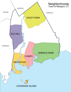
Westport has several unique neighborhoods:
- Saugatuck – This area is near the Westport train station. It has restaurants, shops, and offices. The name "Saugatuck" comes from the Paugussett tribe. It means "mouth of the tidal river."
- Saugatuck Shores – This is a curved piece of land surrounded by the Long Island Sound. It used to be part of Norwalk.
- Saugatuck Island – This island was founded in the 1890s. It became a special taxing district in 1984.
- Westport Village – This is the downtown area of Westport. It is around Post Road and Main Street, near the Saugatuck River. It has many shops and restaurants. Recent improvements include the Levitt Pavilion and Bedford Square.
- Greens Farms – This is Westport's oldest neighborhood. It has its own post office and train station.
- Cockenoe Island (pronounced "KuhKEEnee") – This is an uninhabited island off the coast. Westport bought it in 1969. This was to prevent a power company from building a nuclear plant there.
- Old Hill – This historic area is west of the Saugatuck River. It has many homes from the Revolutionary and Victorian eras.
- Coleytown – Located at the northern edge of town, near Weston. It is home to a fire station and schools. It was named after Farmer Coley, who owned a lot of land here.
- Compo – This area is around Compo Beach, the town's main beach. "Compo" comes from the Paugussett tribe. It means "the bear's fishing ground."
- SewTrol – This area contains the town's sewage treatment plant and animal control. It also has a state boat launch.
People in Westport
| Historical population | |||
|---|---|---|---|
| Census | Pop. | %± | |
| 1840 | 1,803 | — | |
| 1850 | 2,651 | 47.0% | |
| 1860 | 3,293 | 24.2% | |
| 1870 | 3,361 | 2.1% | |
| 1880 | 3,477 | 3.5% | |
| 1890 | 3,715 | 6.8% | |
| 1900 | 4,017 | 8.1% | |
| 1910 | 4,259 | 6.0% | |
| 1920 | 5,114 | 20.1% | |
| 1930 | 6,073 | 18.8% | |
| 1940 | 8,258 | 36.0% | |
| 1950 | 11,667 | 41.3% | |
| 1960 | 20,955 | 79.6% | |
| 1970 | 27,318 | 30.4% | |
| 1980 | 25,290 | −7.4% | |
| 1990 | 24,410 | −3.5% | |
| 2000 | 25,749 | 5.5% | |
| 2010 | 26,391 | 2.5% | |
| 2020 | 27,141 | 2.8% | |
| CT.gov | |||
In 2020, Westport had a population of 27,141 people. The average household income in 2019 was $206,466.
In 2010, there were 9,573 households in Westport. About 75.6% of these were family households. The population density was about 1,322 people per square mile (510 per km²).
About 92.6% of Westport's population was White in 2010. About 4.0% were Asian, and 1.2% were Black or African American. About 3.5% of the population identified as Latino. About 29.8% of Westport residents were under 18 years old in 2010. This is higher than the average for the U.S.
Westport is known as one of the wealthiest cities in the United States. In 2018, it was ranked the 9th wealthiest city.
Westport's Economy
Businesses and Industries
Westport has a strong economy, especially in financial services. Many people work in this sector. Some major financial companies in Westport include Bridgewater Associates and BNY Mellon. Bridgewater Associates is a large global investment company. It is also Westport's biggest employer.
Other companies in Westport offer professional, scientific, and technical services. These include Terex, which makes industrial equipment.
Non-Profit Organizations
Westport is home to several important non-profit groups:
- Save the Children is an American charity. It used to have its main office in Westport.
- The Smith Richardson Foundation is a public policy research group. It is based in Westport.
- The Joseph J. Clinton Veterans of Foreign Wars (VFW) Post 399 and August Matthias American Legion Post 63 are charities that support veterans.
Arts and Culture in Westport
Popular Attractions
Westport offers many interesting places to visit:
- The Westport Country Playhouse is a famous theater. It was founded in 1930. The actor Paul Newman, who lived in Westport, was a big supporter of the playhouse.
- The Museum of Contemporary Art (MoCA) Westport is part of the Westport Arts Center. It has a permanent collection of modern art.
- The Westport Museum for History and Culture was founded in 1889. It is dedicated to sharing Westport's history.
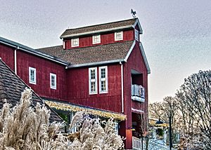
- The Wakeman Town Farm is a historic working farm. It also teaches about sustainable living.
- The Rolnick Observatory is a place where you can look at the stars. It is located on an old missile site.
- Earthplace, The Nature Discovery Center, is a 62-acre (25 ha) nature center. It has a natural history museum and a wildlife sanctuary.
Parks and Recreation
Westport has many beautiful parks and beaches. Sherwood Island State Park is a large park covering 234 acres (95 ha). It is located on Long Island Sound and has beach access.
Compo Beach and Burying Hill Beach are town beaches. Visitors from outside Westport can use them in the summer for a fee. Connecticut's 9/11 memorial is located in Sherwood Island State Park. On a clear day, you can even see the New York City skyline from there.
In 1960, Westport bought Longshore Club Park, a popular spot for recreation. In 2011, the estate of Paul Newman donated land to Westport. This land is now managed by the Aspetuck Land Trust.
Education in Westport
Public Schools
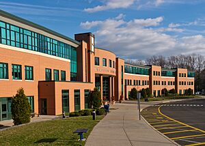
Staples High School is Westport's only public high school. It is often ranked as one of the best high schools in Connecticut. It is also highly ranked nationwide.
The town has two middle schools: Bedford Middle School and Coleytown Middle School. In 2009, Bedford Middle School received the "Blue Ribbon Award," a special government honor. In 2020, both middle schools were ranked among the top in the state.
Westport has five elementary schools:
- Coleytown Elementary School
- King's Highway Elementary School
- Green's Farms Elementary School
- Saugatuck Elementary School
- Long Lots Elementary School
Private Schools
Greens Farms Academy is a private school for students from kindergarten through 12th grade. It is located in the Greens Farms area. The school overlooks the Long Island Sound.
Media in Westport
Westport has a long history of local newspapers. The first newspaper, The Saugatuck Journal, was printed on December 26, 1828.
Today, Westport has local newspapers and news websites. These include Westport News and WestportNow. There is also a monthly magazine called Westport.
Transportation in Westport
Major roads like Interstate 95, the Merritt Parkway, and U.S. 1 run through Westport. The Saugatuck River also flows through the town.
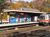
Westport has two train stations: Green's Farms and Westport. These stations are on the Metro-North Railroad's New Haven Line. This line connects Westport to places like Stamford and Grand Central Terminal in New York City. It also goes to New Haven.
Westport is a leader in electric vehicle use. In 2019, it had the highest number of electric vehicles per person in Connecticut.
Main to Train Study
A project called the "Main to Train" study is looking at ways to improve travel for walkers and bikers. This study focuses on the two-mile path from downtown Westport to the Westport Train Station. The goal is to make it easier for people to get around without a car.
The Norwalk Transit District also provides public transportation options in the area.
Public Safety
Police Department
The Westport Police Department has 64 full-time police officers. They work to keep the town safe. The department has also started using electric and hybrid vehicles.
Fire Department
The Westport Fire Department protects the town. It was started in 1929. The department has four fire stations located around Westport. They have six fire engines, one truck, one rescue vehicle, and a fireboat. They also have a special unit for high water situations. The Westport Fire Department responds to about 4,000 emergency calls each year. They also house the Fairfield County Hazardous Materials Truck.
Famous People from Westport
Many notable people have lived in Westport.
Sister Cities
Westport has special partnerships with four "sister cities" around the world:
- Lyman, Ukraine
- Marigny-le-Lozon, France
- Yangzhou, Jiangsu, China
- St. Petersburg, Russia
See also
 In Spanish: Westport (Connecticut) para niños
 | Dorothy Vaughan |
 | Charles Henry Turner |
 | Hildrus Poindexter |
 | Henry Cecil McBay |


