Carderock Recreation Area facts for kids
Quick facts for kids Carderock |
|
|---|---|
 |
|
| Location | Montgomery County, Maryland |
| Nearest city | Bethesda, Maryland |
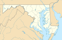
| Coordinates | 38°58′34.61″N 77°12′19.01″W / 38.9762806°N 77.2052806°W |
| Climbing type | top-rope crag, bouldering |
| Height | 50 feet |
| Pitches | 1 |
| Ratings | 5.0-5.12 with majority of climbs in 5.6-5.10 range |
| Grades | I |
| Rock type | Wissahikon Mica-schist with quartz crystals |
| Quantity of rock | days worth (over 150 climbs and boulder problems) |
| Development | very well developed |
| Cliff aspect | South west facing |
| Season | spring to fall |
| Ownership | National Park Service |
| Camping | none |
| Classic climbs |
|
| Stars | |
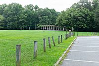
Carderock Recreation Area is a large park in Carderock, Maryland. It covers about 100 acres. This park is part of the Chesapeake and Ohio Canal National Historical Park. People love to visit Carderock for outdoor fun. You can enjoy rock climbing, hiking, and biking here.
The park is located between the Potomac River and the Chesapeake and Ohio Canal. You can get there easily from Clara Barton Parkway. Carderock Recreation Area has a picnic spot and is close to the Billy Goat Trail. It also offers easy access to the canal and popular rock cliffs. This area has a long history of climbing. It is the closest major climbing spot to Washington, D.C.. Because of this, it is one of the most climbed cliffs in the eastern United States. There is no cost to enter the park.
What is Carderock's Story?
The name Carderock first appeared in 1802. That's when Robert Peter of Georgetown registered a large piece of land. The Chesapeake and Ohio Canal was built between 1828 and 1850. It stopped being used in 1924. The U.S. Government bought the canal in 1938. Later, it became the park we know today.
Rock Climbing at Carderock
The rock cliffs at Carderock are made of a type of rock called Wissahikon Mica-schist. They are about 25 to 60 feet tall. Most climbs are around 35 feet high. There are over 100 different climbing routes here. They are all packed into about 200 yards of cliff.
The rocks have different shapes. Some are smooth slopes, some are overhangs, and some have cracks. Most routes are easy or medium difficulty top-rope climbs. There are also some harder climbs and many bouldering problems. Bouldering means climbing on smaller rocks without ropes.
Climbing History at Carderock
Carderock is one of the oldest climbing areas in the eastern United States. People started climbing here in the 1920s. Early climbers included Gustave Gambs, Don Hubbard, and Paul Bradt. The first climbing guide for the area was written by Don Hubbard. It was published in 1943.
In 1942, Herb and Jan Conn began climbing at Carderock. They climbed and named many routes. Some famous routes they named are Herbie’s Horror, Jan’s Face, and Ronnie’s Leap. Ronnie’s Leap was named after their dog! Herbie’s Horror was one of the first 5.9 difficulty routes in the eastern U.S.
 | Aaron Henry |
 | T. R. M. Howard |
 | Jesse Jackson |


