Carlisle, New York facts for kids
Quick facts for kids
Carlisle
|
|
|---|---|

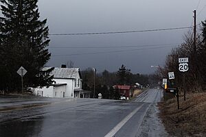
U.S. Route 20 in Carlisle, New York.
|
|

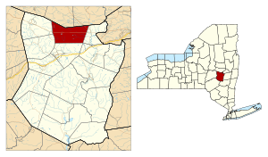
Location in Schoharie County and the state of New York.
|
|
| Country | United States |
| State | New York |
| County | Schoharie |
| Area | |
| • Total | 34.24 sq mi (88.70 km2) |
| • Land | 34.12 sq mi (88.36 km2) |
| • Water | 0.13 sq mi (0.33 km2) |
| Elevation | 1,263 ft (385 m) |
| Population
(2020)
|
|
| • Total | 1,768 |
| Time zone | UTC-5 (Eastern (EST)) |
| • Summer (DST) | UTC-4 (EDT) |
| ZIP code |
12031
|
| Area code(s) | 518 |
| FIPS code | 36-12452 |
| GNIS feature ID | 0978791 |
Carlisle is a small town in northern Schoharie County, New York, United States. In 2020, about 1,768 people lived there.
Contents
History of Carlisle
The first people settled in the area around 1760.
The town of Carlisle was officially created in 1807. It was formed from parts of two nearby towns, Cobleskill and Sharon. There are different ideas about how Carlisle got its name. Some say it was named after a local resident named Carlisle Pierce. Others believe it was named after a city in England.
In the 1800s, making plows was an important business in the town.
Civil War hero John Snyders Kenyon was born in Grovenor Corners, a part of Carlisle, on May 5, 1843. He received the Medal of Honor, which is the highest award for bravery in the U.S. military.
Geography of Carlisle
Carlisle covers a total area of about 34.2 square miles (88.7 square kilometers). Most of this area is land, with a small amount of water.
The northern border of the town touches Montgomery County. This is southwest of the city of Amsterdam.
Two important roads cross through Carlisle. U.S. Route 20, also known as Cherry Valley Turnpike, runs east to west across the town. New York State Route 162 goes through the northeastern part of Carlisle.
Population Changes
The population of Carlisle has changed over many years. Here's how it has grown and shrunk since 1820:
| Historical population | |||
|---|---|---|---|
| Census | Pop. | %± | |
| 1820 | 1,583 | — | |
| 1830 | 1,748 | 10.4% | |
| 1840 | 1,850 | 5.8% | |
| 1850 | 1,817 | −1.8% | |
| 1860 | 1,760 | −3.1% | |
| 1870 | 1,730 | −1.7% | |
| 1880 | 1,720 | −0.6% | |
| 1890 | 1,349 | −21.6% | |
| 1900 | 1,225 | −9.2% | |
| 1910 | 1,024 | −16.4% | |
| 1920 | 861 | −15.9% | |
| 1930 | 796 | −7.5% | |
| 1940 | 917 | 15.2% | |
| 1950 | 1,010 | 10.1% | |
| 1960 | 900 | −10.9% | |
| 1970 | 1,040 | 15.6% | |
| 1980 | 1,417 | 36.3% | |
| 1990 | 1,672 | 18.0% | |
| 2000 | 1,758 | 5.1% | |
| 2010 | 1,948 | 10.8% | |
| 2020 | 1,768 | −9.2% | |
| U.S. Decennial Census | |||
In 2000, there were 1,758 people living in Carlisle. There were 628 households, and 476 of these were families. About 39.3% of households had children under 18 living with them. The average household had 2.80 people.
The population was spread out by age. About 29.7% of the people were under 18. About 9.2% were 65 years or older. The average age in the town was 35 years old.
Communities and Locations in Carlisle
- Argusville – A place in the northwestern part of the town, right on the town line.
- Bear Swamp – A swampy area north of Little York.
- Becker Corners – A small hamlet in the southeastern part of the town, near Cripplebush Creek.
- Carlisle – This is the main hamlet in the town, located on US-20.
- Carlisle Center – A hamlet located near the southern town line on County Road 10. It is south of the main Carlisle hamlet.
- Cripplebush Creek – A stream that flows out of the eastern part of the town towards Schoharie Creek.
- Grovenor Corners – A hamlet on County Road 10 in the southeastern part of the town.
- Little York – A hamlet on US-20, located on the western side of the town.
- Russell Lake – A small lake found on the town line in the southwestern part of Carlisle.
Notable People
- Esther Lord McNeill (1812–1907) – She was a leader in the temperance movement, which worked to reduce or stop the use of alcohol.
See also
 In Spanish: Carlisle (Nueva York) para niños
 | James Van Der Zee |
 | Alma Thomas |
 | Ellis Wilson |
 | Margaret Taylor-Burroughs |


