Carlyle Lake facts for kids
Quick facts for kids Carlyle Lake |
|
|---|---|

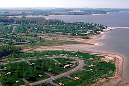
Carlyle Lake over the Coles Creek Recreation Area
|
|
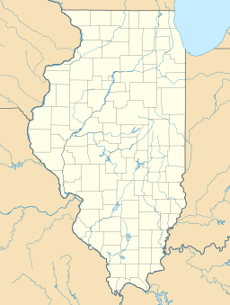
| Location | Clinton / Fayette / Bond counties, Illinois, U.S. |
| Coordinates | 38°37′8.18″N 89°21′10.28″W / 38.6189389°N 89.3528556°W (Dam) |
| Type | Reservoir |
| Primary inflows | Kaskaskia River, North Fork |
| Primary outflows | Kaskaskia River |
| Basin countries | United States |
| Max. length | 15 miles (24.1 km) |
| Max. width | 3.5 miles (5.6 km) |
| Surface area | 26,000 acres (105.2 km2) |
| Average depth | 11 feet (3.4 m) |
| Max. depth | 35 feet (10.7 m) |
| Shore length1 | 85 miles (136.8 km) |
| Surface elevation | 445 feet (135.6 m) |
| Settlements | Carlyle, Keyesport |
| 1 Shore length is not a well-defined measure. | |
Carlyle Lake is the biggest man-made lake in the state of Illinois, United States. It covers about 25,000 acres (100 square kilometers). Most of the lake is in Clinton County, Illinois, but parts also reach into Bond and Fayette counties. This huge lake was built to help control floods and offer lots of fun activities.
Contents
Building Carlyle Lake
Why the Lake Was Needed
The Kaskaskia River used to flood very often. This caused many problems for people living nearby. In 1933, citizens in Clinton County started talking about how to stop these floods. They wanted to study the river and find a solution.
Getting Started
Their ideas led to discussions about creating a large lake. In 1938, the U.S. Congress approved a plan to build a big reservoir at Carlyle. This plan also included building levees (walls to hold back water) downstream. However, World War II put the construction on hold for a while.
A Champion for the Lake
A person named Eldon E. Hazlet became very interested in the Kaskaskia River project. He formed a group called the Kaskaskia Valley Association (KVA). This group worked hard to get public support for the river project. In 1957, the U.S. Army Corps of Engineers made a full plan. Congress then officially approved the Carlyle and Shelbyville Reservoir Projects in 1958.
Construction Begins
Construction of Carlyle Lake started on October 18, 1958. The government bought about 25,000 acres of land for the lake. They also bought land around the lake to manage water flow. Many homes, country roads, and even a railroad had to be moved.
The Chicago, Burlington and Quincy Railroad tracks were moved. Now, five bridges carry these tracks over the water. These bridges divide the lake into two parts, near Keyesport and Boulder. To prevent pollution, the rights to 69 oil wells were bought, and the wells were sealed. More than 600 burial sites from seven cemeteries also had to be moved to higher ground.
Lake Completion
The Carlyle Lake project was finished in April 1967. The Carlyle Lake Dam was officially opened on June 3, 1967. This dam is 107 miles from where the Kaskaskia River flows into another river. It created the largest man-made lake entirely within Illinois.
Carlyle Lake Today
Recreation Areas
Today, Carlyle Lake is a popular spot for outdoor fun. The U.S. Army Corps of Engineers operates several recreation areas around the lake. These include Dam West, Dam East, McNair, Coles Creek, Boulder, and Keyesport.
The Illinois Department of Natural Resources also manages two important areas. These are the Eldon Hazlet State Recreation Area and the Carlyle Lake State Fish and Wildlife Area.
Activities at the Lake
Carlyle Lake has five developed campgrounds with over 300 campsites. There are also five beaches where you can swim and many boat ramps. These areas make it easy for people to enjoy the outdoors.
The lake was built mainly to manage flood risks. But it also helps with water supply and water quality. It's a great place for fish and wildlife to live. Plus, it's a very popular place for swimming and other fun activities.
Many people enjoy boating on Carlyle Lake, especially sailing. It's also a favorite spot for fishing. You can catch fish like channel catfish, flatheads, largemouth bass, white bass, crappie, and bluegill.
Lake Features
The lake is split into two parts by a 3.5-mile-long (6 km) railroad embankment. Five bridges carry the tracks of the BNSF Railway over the water. This unique feature helps define the lake's shape.
 | Laphonza Butler |
 | Daisy Bates |
 | Elizabeth Piper Ensley |


