Chamblee, Georgia facts for kids
Quick facts for kids
Chamblee, Georgia
|
|||
|---|---|---|---|

Downtown Chamblee
|
|||
|
|||
| Motto(s):
"A City on the Right Track"
|
|||
| Country | United States | ||
| State | Georgia | ||
| County | DeKalb | ||
| Area | |||
| • Total | 7.70 sq mi (19.94 km2) | ||
| • Land | 7.69 sq mi (19.93 km2) | ||
| • Water | 0.01 sq mi (0.02 km2) | ||
| Elevation | 1,020 ft (311 m) | ||
| Population
(2020)
|
|||
| • Total | 32,251 | ||
| • Density | 4,194/sq mi (1,620/km2) | ||
| Time zone | UTC-5 (Eastern (EST)) | ||
| • Summer (DST) | UTC-4 (EDT) | ||
| ZIP codes |
30341, 30366
|
||
| Area code(s) | 770 | ||
| FIPS code | 13-15172 | ||
| GNIS feature ID | 0331371 | ||
| Website | The City of Chamblee, Georgia Website | ||
Chamblee (pronounced SHAM-blee) is a city in northern DeKalb County, Georgia. It is located northeast of Atlanta, a major city in the United States. In 2020, about 30,164 people lived in Chamblee.
Contents
History of Chamblee
The area where Chamblee is now was once covered by dairy farms. In the late 1800s, two important railroads met here. One train carried people from Atlanta to Charlotte, North Carolina. The other moved workers and goods between a factory in Roswell and Atlanta.
A small settlement grew around this railroad crossing, called Roswell Junction. When the United States Postal Service decided to open a post office, they thought "Roswell Junction" sounded too much like nearby Roswell. So, they picked the name Chamblee from a list of people who wanted a new post office. Chamblee officially became a city in 1907.
Chamblee During World Wars
During World War I and World War II, Chamblee played a role in U.S. military operations. In World War I, a large military base called Camp Gordon was here. It housed about 40,000 soldiers. This brought many new people to the town, leading to a lot of new buildings being constructed.
After World War I, Camp Gordon closed. But it reopened for World War II as a Navy Flight Training Center.
Growth and Change After World War II
Right after World War II, Chamblee grew with new factories and more residents. This was because a large General Motors car plant opened nearby in Doraville. Other factories also set up shop along the new Peachtree Industrial Boulevard.
By the 1980s, many of these factories had become smaller or closed. In their place, new businesses opened that served immigrants and refugees. Many people from different countries moved to Chamblee and Doraville because housing was affordable. By the time of the 1996 Summer Olympics, Chamblee had become a city with many different cultures.
Modern Chamblee's Development
In the early 2000s, Chamblee continued to grow and improve its image. A new city hall was built in 2002. In 2010, Chamblee added an area to its northwest, including Huntley Hills, which brought about 5,000 new residents. The city also worked to make its downtown area more lively.
In 2013, voters approved another plan to expand the city's borders. After this, Chamblee and its neighbor, Brookhaven, had a disagreement over which city would include the Century Center area. The courts decided that Century Center would become part of Chamblee.
By 2020, Chamblee's population had tripled since 2010. This big growth was mainly due to these two times the city expanded its borders. Chamblee is seen as a key transportation spot. It's close to two major highways, a train station (MARTA), and the DeKalb–Peachtree Airport. These connections have helped the city grow a lot. In the early 2020s, Chamblee attracted many new building projects, including homes, shops, and offices.
Geography of Chamblee
Chamblee is located south of Dunwoody, southwest of Doraville, northeast of Brookhaven, and north of Interstate 85. The city's exact location is 33.887552 degrees North and -84.305326 degrees West. The United States Census Bureau says the city covers about 3.1 square miles (8.0 km2) of land.
Chamblee Neighborhoods
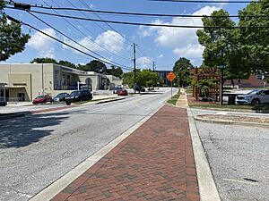
- Downtown: Downtown Chamblee looks like an old railroad town from the early 1900s. Many of its buildings are historic. This area has many antique shops, but it is changing. Since 2000, new shops, lofts, and townhomes have been built here. The Chamblee MARTA Station and City Hall are both downtown. This area is becoming a popular spot for food lovers, with new breweries and distilleries. The "Taste of Chamblee" event also shows off the local food.
- Buford Highway Corridor: The Buford Highway area is home to many people from other countries. You can find people from Mexico, Central America, China, Korea, and Vietnam here. Many Latino workers came to this area before the 1996 Olympic Games. Business owners from Asia were drawn to the highway because rents were low and many people passed by. Over 1,000 businesses here are owned by immigrants. People from many different backgrounds, like Korean, Mexican, Chinese, Vietnamese, Indian, Bangladeshi, Central American, Somali, and Ethiopian, shop here. The DeKalb County Chamber of Commerce calls this area the "International Corridor."
- DeKalb–Peachtree Airport: This airport, often called PDK, is very important to DeKalb County. It helps create about 7,300 jobs and brings in about $130 million for local residents. PDK is the second busiest airport in Georgia, after Hartsfield-Jackson. Many private and public planes fly in and out of PDK every day.
- Sexton Woods: This neighborhood is partly in Chamblee and partly in Brookhaven. It has both older ranch-style homes from the 1950s and newer craftsman-style houses. Chamblee Middle School used to be located here until 2006.
- Keswick Village: Next to Sexton Woods, Keswick Village was built in 1950. It has renovated old homes and new craftsman-style houses. It is also next to Keswick Park, which is the second largest park in Chamblee.
- Clairmont Park: These are residential areas along Clairmont Road, south of Peachtree Boulevard, close to the Peachtree Dekalb Airport.
- Huntley Hills: Huntley Hills is a neighborhood that started in the early 1960s. Huntley Hills Elementary School is in the middle of the neighborhood. This school has a special Montessori program and programs for children with different needs.
- Beverly Hills/Beverly Woods: This neighborhood was established in the early 1950s. Many houses here were built for workers at the Doraville GM plant nearby. Most homes are ranch-style or split-level houses from the mid-century.
Atlanta Chinatown
The Atlanta area has many Chinese-Americans. Chamblee is home to a Chinatown (called "亚特兰大唐人街" in Chinese) that was built in 1988. It is one of the first "New Chinatowns" in the country. Even though the city of Atlanta doesn't have its own Chinatown, this mall in Chamblee is known as "Atlanta Chinatown."
This area is part of the Buford Highway international market. It is located near the Chamblee MARTA station and New Peachtree Road. The "Atlanta Chinatown Mall" is known as the place for Chinese culture in Atlanta. It is located at 5379 New Peachtree Road. This Chinatown is an example of a "modern Chinatown" because it is in a strip mall, not an old city area. An annual Chinese New Year event is held here to celebrate the festival.
The Atlanta Chinatown market opened on August 8, 1988. It grew even more in 1996 when new immigrants from Beijing arrived. Atlanta's Chinatown has bakeries, restaurants, cosmetic stores, bookstores, a newspaper office, and many other Chinese-themed shops.
In 2000, a developer named Peter Chang completely redid the "Chinatown Square Mall." The new plans included a Chinese food court with 7 different food stalls, two sit-down restaurants, offices, a supermarket, gift shops, a bookstore, jewelers, a video rental store, and a beauty salon. The goal was to make Atlanta Chinatown a place for tourists, not just a shopping mall.
Chamblee's Population
| Historical population | |||
|---|---|---|---|
| Census | Pop. | %± | |
| 1910 | 129 | — | |
| 1920 | 253 | 96.1% | |
| 1930 | 893 | 253.0% | |
| 1940 | 1,081 | 21.1% | |
| 1950 | 3,445 | 218.7% | |
| 1960 | 6,635 | 92.6% | |
| 1970 | 9,127 | 37.6% | |
| 1980 | 7,137 | −21.8% | |
| 1990 | 7,668 | 7.4% | |
| 2000 | 9,552 | 24.6% | |
| 2010 | 9,892 | 3.6% | |
| 2020 | 30,164 | 204.9% | |
| U.S. Decennial Census | |||
| Race | Num. | Perc. |
|---|---|---|
| White (non-Hispanic) | 9,421 | 31.23% |
| Black or African American (non-Hispanic) | 4,029 | 13.36% |
| Native American | 57 | 0.19% |
| Asian | 2,590 | 8.59% |
| Pacific Islander | 10 | 0.03% |
| Other/Mixed | 943 | 3.13% |
| Hispanic or Latino | 13,114 | 43.48% |
In 2020, Chamblee had 30,164 people living in 11,526 households. The city's population grew a lot between 2010 and 2020, tripling in size. This growth included more Asian and African-American residents moving to Chamblee. The city is known for its diverse population, with many different ethnic groups living there.
Education in Chamblee
Chamblee has several schools for students of all ages.
Public Schools
The DeKalb County School System manages the public schools in Chamblee.
Elementary Schools
- Huntley Hills Elementary School (a public Montessori school)
- Dresden Elementary School
- Ashford Park Elementary School (in Brookhaven)
- Montclair Elementary School (in Brookhaven)
- Montgomery Elementary School (in Brookhaven)
- Kittredge Magnet School for High Achievers (in Brookhaven)
Middle Schools
- Chamblee Middle School
- Sequoyah Middle School (in Doraville, serves parts of southern Chamblee)
High Schools
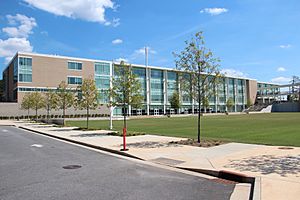
- Chamblee Charter High School
- Cross Keys High School (in Brookhaven, serves parts of southern Chamblee)
Private Schools
- St. Pius X High School
Colleges and Higher Education
- Interactive College of Technology
Public Libraries
The DeKalb County Public Library system has two branches in Chamblee:
- Chamblee Branch
- Embry Hills Library
Transportation in Chamblee
Chamblee has several ways for people to get around.
Major Roads
Important roads and highways that pass through or near Chamblee include:
 US 23
US 23 I-85
I-85 SR 141
Public Transportation
Commuter buses (GRTA Xpress / RTA) and the MARTA train and bus system serve Chamblee.
- Chamblee (MARTA station) is a train station that connects Chamblee to Atlanta and other areas.
Walking and Biking Paths
- Chamblee Rail Trail: This is a paved path in downtown Chamblee. It goes under Peachtree Boulevard and is a nice place to walk or bike. The city's largest park, Keswick Park, is at its northern end. Many shops and restaurants are close by. There are plans to make the trail longer and connect it to other paths.
- Peachtree Creek Greenway: This is a planned multi-use trail for walking and biking. It aims to give residents easy access to trails for fun and transportation. It will connect the cities of Atlanta, Brookhaven, Chamblee, and Doraville.
Sister Cities
Chamblee has a "sister city" relationship with another city in the world. This helps build friendships and understanding between different cultures.
See also
 In Spanish: Chamblee (Georgia) para niños
 | Bayard Rustin |
 | Jeannette Carter |
 | Jeremiah A. Brown |


