DeKalb County, Georgia facts for kids
Quick facts for kids
DeKalb County
|
|||||
|---|---|---|---|---|---|

|
|||||
|
|||||

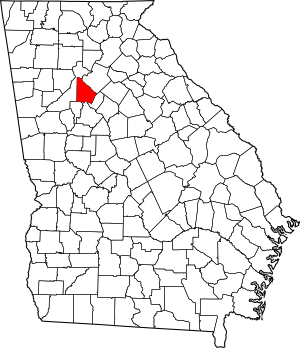
Location within the U.S. state of Georgia
|
|||||
 Georgia's location within the U.S. |
|||||
| Country | |||||
| State | |||||
| Founded | December 9, 1822 | ||||
| Named for | Johann de Kalb | ||||
| Seat | Decatur | ||||
| Largest city | Stonecrest | ||||
| Other cities | Atlanta (Mainly in Fulton County) | ||||
| Area | |||||
| • Total | 271 sq mi (700 km2) | ||||
| • Land | 268 sq mi (690 km2) | ||||
| • Water | 3.6 sq mi (9 km2) 1.3%% | ||||
| Population
(2020)
|
|||||
| • Total | 764,382 | ||||
| • Estimate
(2023)
|
762,992 |
||||
| • Density | 2,821/sq mi (1,089.0/km2) | ||||
| Time zone | UTC−5 (Eastern) | ||||
| • Summer (DST) | UTC−4 (EDT) | ||||
| Congressional districts | 4th, 5th | ||||
DeKalb County is located in the north central part of the U.S. state of Georgia. In 2020, about 764,382 people lived here. This makes it Georgia's fourth-largest county by population. The main city, or county seat, is Decatur.
DeKalb County is part of the larger Atlanta–Sandy Springs–Roswell metropolitan area. About 10% of the city of Atlanta is in DeKalb County, while most of Atlanta is in Fulton County. Stonecrest is the biggest city that is completely inside DeKalb County. DeKalb is mostly a suburban area, meaning it has many towns and neighborhoods outside a big city.
Recently, some communities in North DeKalb have become their own cities. This is a trend seen in other suburban areas around Atlanta. Stonecrest, Dunwoody, and Brookhaven are now the largest cities fully within the county.
Contents
History of DeKalb County
How DeKalb County Started
The land that is now DeKalb County was gained by Georgia in 1821. This happened after a special agreement, called the Treaty of Indian Springs, with a group of the Muscogee (Creek) people. DeKalb County was officially created in 1822. It was formed from parts of Henry, Gwinnett, and Fayette counties.
The county was named after Baron Johann de Kalb (1721–1780). He was born in Bavaria and was a former officer in the French Army. He bravely fought for the Continental Army during the American Revolutionary War. The oldest house still standing in the county is the 1831 Goodwin House. It is located along Peachtree Road in Brookhaven. Much of the area was once covered in forests. A special part of an old-growth forest (meaning trees have grown there for a very long time without being cut down) is saved at Fernbank Forest.
Changes Over Time
In 1853, Fulton County was created from the western half of DeKalb. The line between them is very straight, running north to south. This is where Moreland Avenue is today. Before this, the growing city of Atlanta was actually part of DeKalb. Atlanta grew because the city of Decatur did not want to be the main railroad stop in the 1830s. So, a different spot in western DeKalb was chosen. This spot was first called Terminus, then Marthasville, and later became Atlanta.
For a long time, DeKalb was mainly a farming county. But by the 1960s, as the Atlanta area grew, DeKalb became more and more urban. In 1969, the eastern part of Interstate 285, known as "the Perimeter," was finished. This highway circles the county, putting most of DeKalb "inside the Perimeter" along with Atlanta. Only Interstate 20 and Interstate 85 were built through the county. DeKalb also became one of the first counties to approve the MARTA public transportation system in the 1970s. Today, the county has important east and northeast train lines.
Geography of DeKalb County
Land and Water
DeKalb County covers about 271 square miles. Most of this (268 square miles) is land, and a small part (3.6 square miles) is water. The county is located in the upper Piedmont region of Georgia.
Several rivers and creeks flow through the county. These include the South River and many creeks like Nancy Creek and Snapfinger Creek. Peachtree Creek and Nancy Creek flow into the Chattahoochee River, which eventually reaches the Gulf of Mexico. The South River flows into the Ocmulgee River, which then goes to the Atlantic Ocean.
Natural Landmarks
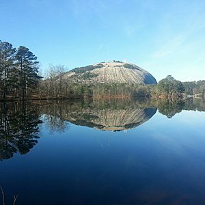
Stone Mountain is a famous natural landmark located near the eastern edge of the county. Another interesting area is Soapstone Ridge, which runs along the southern border. This area was used a lot between 1400 and 100 BC for quarrying soapstone. Objects made from this soapstone have been found far away, even near the Great Lakes.
Neighboring Counties
DeKalb County shares borders with these counties:
- Gwinnett County – North/Northeast
- Rockdale County – East
- Henry County – South
- Clayton County – Southwest
- Fulton County – West
Communities in DeKalb County
Cities in DeKalb County
- Atlanta (mostly in Fulton County)
- Avondale Estates
- Brookhaven
- Chamblee
- Clarkston
- Decatur
- Doraville
- Dunwoody
- Lithonia
- Pine Lake
- Stonecrest
- Stone Mountain
- Tucker
Census-Designated Places
These are areas that are like towns but are not officially incorporated as cities.
- Belvedere Park
- Candler-McAfee
- Druid Hills
- Gresham Park
- North Decatur
- North Druid Hills (also known as Briarcliff or Toco Hills)
- Panthersville
- Redan
- Scottdale
Unincorporated Communities
These are smaller areas that are not part of any city.
- Buford Highway
- Collinsville
- Conley (partly)
- Ellenwood
- Embry Hills
- Flair Forest
- Lenox Park (neighborhood in Brookhaven)
- Northlake
- Pittsburg
- Smoke Rise
- Snapfinger
Ghost Town
Population of DeKalb County
| Historical population | |||
|---|---|---|---|
| Census | Pop. | %± | |
| 1830 | 10,042 | — | |
| 1840 | 10,467 | 4.2% | |
| 1850 | 14,328 | 36.9% | |
| 1860 | 7,806 | −45.5% | |
| 1870 | 10,014 | 28.3% | |
| 1880 | 14,497 | 44.8% | |
| 1890 | 17,189 | 18.6% | |
| 1900 | 21,112 | 22.8% | |
| 1910 | 27,881 | 32.1% | |
| 1920 | 44,051 | 58.0% | |
| 1930 | 70,278 | 59.5% | |
| 1940 | 86,942 | 23.7% | |
| 1950 | 136,395 | 56.9% | |
| 1960 | 256,782 | 88.3% | |
| 1970 | 415,387 | 61.8% | |
| 1980 | 483,024 | 16.3% | |
| 1990 | 545,837 | 13.0% | |
| 2000 | 665,865 | 22.0% | |
| 2010 | 691,893 | 3.9% | |
| 2020 | 764,382 | 10.5% | |
| 2023 (est.) | 762,992 | 10.3% | |
| U.S. Decennial Census 1790-1880 1890-1910 1920-1930 1930-1940 1940-1950 1960-1980 1980-2000 2010 2020 |
|||
The population of DeKalb County has grown a lot over the years. In 2020, there were 764,382 people living here. This is a big increase from 665,865 people in 2000. Even though Fulton County has more people, DeKalb County has more people living per square mile than any other county in the Atlanta area.
| Race / Ethnicity (NH = Non-Hispanic) | Pop 2000 | Pop 2010 | Pop 2020 | % 2000 | % 2010 | % 2020 |
|---|---|---|---|---|---|---|
| White alone (NH) | 214,685 | 203,395 | 215,895 | 32.24% | 29.40% | 28.24% |
| Black or African American alone (NH) | 358,381 | 370,963 | 384,438 | 53.82% | 53.62% | 50.29% |
| Native American or Alaska Native alone (NH) | 964 | 1,239 | 1,161 | 0.14% | 0.18% | 0.15% |
| Asian alone (NH) | 26,483 | 35,173 | 50,076 | 3.98% | 5.08% | 6.55% |
| Pacific Islander alone (NH) | 256 | 245 | 202 | 0.04% | 0.04% | 0.03% |
| Other race alone (NH) | 1,674 | 1,644 | 4,719 | 0.25% | 0.24% | 0.62% |
| Mixed race or Multiracial (NH) | 10,880 | 11,410 | 26,420 | 1.63% | 1.65% | 3.46% |
| Hispanic or Latino (any race) | 52,542 | 67,824 | 81,471 | 7.89% | 9.80% | 10.66% |
| Total | 665,865 | 691,893 | 764,382 | 100.00% | 100.00% | 100.00% |
Economy of DeKalb County
Many people work in DeKalb County. Some of the largest employers include:
- AT&T Mobility, which has its main offices in the Lenox Park area of Brookhaven.
- Emory Healthcare, a large healthcare system.
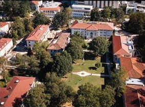
- Emory University, a well-known university.
- Kroger, a grocery store chain, has its Atlanta-area offices in Northlake.
- DeKalb County School District, the county's public school system.
Culture and Attractions
Fun Places to Visit
DeKalb County has many interesting places to visit:
- Davidson-Arabia Mountain Nature Preserve: A beautiful natural area with unique rock formations.
- Stone Mountain Park: A large park centered around the famous Stone Mountain.
- Fernbank Museum of Natural History: A museum where you can learn about natural history.
- Fernbank Science Center: A place for science education and exploration.
- Michael C. Carlos Museum: An art museum at Emory University.
- Callanwolde Fine Arts Center: A historic mansion that hosts arts programs.
- DeKalb History Center: Learn about the history of DeKalb County.
DeKalb County 9/11 Memorial
The DeKalb County 9/11 Memorial was opened on September 11, 2011. It is located in front of the DeKalb County Fire and Police Headquarters.
U.S. Marine and sculptor Curtis James Miller designed this memorial. It honors the firefighters, police officers, and many other people who lost their lives in the terrorist attacks on September 11, 2001. These attacks happened in New York City, Washington D.C., and Shanksville, Pennsylvania. A piece of steel from one of the World Trade Center Towers in New York City is the main part of this special monument.
Education in DeKalb County
Public Schools
Most of DeKalb County's public schools are managed by the DeKalb County School District. However, if you live in the city of Atlanta part of DeKalb County, you would go to Atlanta Public Schools (APS). If you live in the city of Decatur, you would go to schools in the Decatur City School District.
Private Schools
There are also many private schools in DeKalb County, including:
- Atlanta Jewish Academy Upper School (in Doraville)
- Benjamin Franklin Academy
- Howard Scholars Academy (Decatur)
- Marist School (Brookhaven)
- Mohammed Schools
- Paideia School (Atlanta)
- Saint Thomas More Catholic Elementary & Middle School (Decatur)
- St. Pius X Catholic High School (Chamblee)
- Friends School of Atlanta (Decatur)
- Waldorf School of Atlanta (Decatur)
- Academe of the Oaks (Decatur)
Colleges and Universities
DeKalb County is home to several colleges and universities:
- Agnes Scott College: A private college for women in Decatur.
- Emory University: A private university known for its research. It has many different schools, like arts and science, business, law, and nursing.
- Mercer University: A private university with a campus in DeKalb County. It has programs in nursing, pharmacy, and theology.
- Oglethorpe University: A private college in Brookhaven, named after James Oglethorpe, who founded the Georgia Colony.
- Perimeter College at Georgia State University: This college has three campuses in DeKalb County and offers two-year degrees.
- Georgia Military College (GMC): Has a campus in Stone Mountain Village.
- Georgia Piedmont Technical College: A large school that trains students for different jobs in areas like business, health, and technology.
- DeVry University: Offers bachelor's and master's degrees in healthcare, business, and technology.
- Columbia Theological Seminary: A school in Decatur for people studying to become religious leaders.
- Luther Rice College and Seminary: A private Christian college in Lithonia that offers degrees in ministry.
Public Libraries
The DeKalb County Public Library system has 22 branches. These libraries are located all over the county.
Transportation in DeKalb County
Major Roads and Highways
Many important roads and highways run through DeKalb County, helping people travel around.
 I-20
I-20 I-85
I-85 I-285
I-285 I-675
I-675 US 23
US 23 US 29
US 29 US 78
US 78 US 278
 SR 8
SR 8 SR 10
SR 10 SR 12
SR 12 SR 13
SR 13 SR 13 Conn.
 SR 14
SR 14 SR 42
SR 42 SR 124
 SR 141
 SR 154
 SR 155
 SR 212
 SR 236
 SR 260
 SR 410
Public Transportation
Commuter buses from Xpress GA / RTA and the MARTA train and bus system serve DeKalb County. This helps people get around without needing a car.
Walking and Biking Paths
There are plans to build more multi-use trails for walking and cycling. One big project is the Peachtree Creek Greenway. This path will connect the cities of Atlanta, Brookhaven, Chamblee, and Doraville. It aims to give people easy access to trails for exercise and transportation.
- Arabia Mountain Path
- Chamblee Rail Trail
- Hill Loop Trail
- Nancy Creek Trail
- Peachtree Creek Greenway (under construction)
- South Peachtree Creek Trail
- Stone Mountain Trail (under construction)
Images for kids
See also
 In Spanish: Condado de DeKalb (Georgia) para niños
 | Delilah Pierce |
 | Gordon Parks |
 | Augusta Savage |
 | Charles Ethan Porter |


