Georgia State Route 13 facts for kids
Quick facts for kids
State Route 13 |
||||
|---|---|---|---|---|
|
Georgia State Route 13 highlighted in red
|
||||
| Route information | ||||
| Maintained by GDOT | ||||
| Length | 49.5 mi (79.7 km) | |||
| Major junctions | ||||
| South end | ||||
|
||||
| North end | ||||
| Location | ||||
| Counties: | Fulton, DeKalb, Gwinnett, Hall | |||
| Highway system | ||||
| Georgia State Routes Former SR
|
||||
State Route 13 (SR 13) is a state highway in Georgia, USA. It is about 49.5 miles (79.7 km) long. This road goes through parts of Fulton, DeKalb, Gwinnett, and Hall counties.
SR 13 starts in Midtown Atlanta, where West Peachtree Street meets Spring Street. This area is near US 19 and SR 9. The southern part of SR 13 is a fast-moving freeway. It was built in 1953 as an extension of the Downtown Connector. This section was once part of Interstate 85 (I-85) until 1985. Then, new lanes were added next to it.
SR 13 ends in Gainesville at Jesse Jewell Parkway (SR 369). The road's name changes from Buford Highway to Atlanta Highway when it leaves Buford. SR 13 used to go further north past Gainesville, following what is now SR 365, all the way to the South Carolina state line.
Contents
Exploring State Route 13
Starting the Journey: Atlanta's Connector
SR 13 begins in Atlanta where it connects with US 19 and SR 9. These roads are on one-way streets: Spring Street (southbound) and Peachtree Street (northbound). SR 13 starts by heading west, then curves northeast. It runs next to I-85. There's a special exit that helps drivers go from SR 13 north to Peachtree Street, saving them time.
A big part of SR 13, from I-85 in Atlanta to I-285 in Doraville, is part of the National Highway System. This system includes roads that are very important for the country's economy, travel, and defense.
The International Corridor: Buford Highway
In the Atlanta area, Buford Highway is a lively community. It has many different neighborhoods and shopping centers. Many immigrants have moved to Atlanta's suburbs, including this area. They found affordable homes and businesses here.
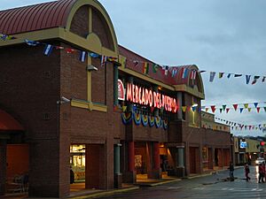
Along Buford Highway, you can find over 1,000 businesses owned by immigrants. People from many different backgrounds visit these shops and restaurants. You'll find Korean, Mexican, Chinese, and Vietnamese businesses, along with Indian, Central American, Somali, and Ethiopian ones. The local Chamber of Commerce even calls this area the "International Corridor."
This community has one of the highest numbers of foreign-born residents in the country. Many Latino workers came here for construction jobs before the 1996 Summer Olympics. Asian business owners liked the area because rents were low and there was a lot of traffic.
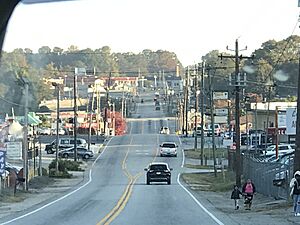
Most of Buford Highway has seven lanes and few sidewalks. This can be tricky because many people walk along and across the road. In recent years, new medians (raised areas in the middle of the road) and crosswalks have been added to make it safer for pedestrians.
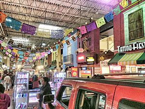
You'll see many strip malls and large apartment buildings along the highway. Some of the biggest strip malls are Northeast Plaza, Plaza Fiesta, and the Buford Highway Farmers Market.
This international community stretches across Fulton, DeKalb, and Gwinnett counties. It goes through towns like Brookhaven, Chamblee, and Doraville.
The Atlanta Highway: Heading to Gainesville

North of Buford, the road's name changes from "Buford Highway" to "Atlanta Highway." It continues to SR 369 in Gainesville. This part of the road also has a smaller Hispanic community between Chicopee and SR 369.
The Story of SR 13
Early Days: 1920s and 1930s
SR 13 was first created around 1919. It went from Lawrenceville north to Buford, then northeast to Gainesville and Cornelia, and finally east to Toccoa. By 1921, it was extended south from Lawrenceville to Loganville and east to the South Carolina border.
Over the years, different US routes shared parts of SR 13. For example, US 270 was on the Lawrenceville–Gainesville section. Later, US 19 and US 23 also used parts of SR 13. By the 1930s, more of the road had a "hard surface," meaning it was paved. In 1932, SR 13 was officially designated from Buckhead to Buford. By 1937, SR 13's southern end was in Midtown Atlanta.
Later Changes: 1940s to 1990s
In the 1940s, US 123 was added to SR 13 from Cornelia to the South Carolina line. In the 1960s and 70s, US 23 moved off parts of SR 13 as new freeways like SR 365 were built.
In the 1980s, SR 13's southern end was changed several times. It was shortened to the I-85 interchange, then extended to its current starting point in Atlanta. In 1986, this extension was built as a freeway. By the 1990s, the northern end of SR 13 was also shortened to its current spot in Gainesville.
Buford Highway started as a regular state road connecting Atlanta to towns like Chamblee and Doraville. These towns were home to many working-class families. In the 1960s and 70s, apartment complexes and strip malls grew along the highway. The first ethnic restaurant, Havana Sandwich Shop, opened in 1976.
In the 1980s, immigrants began to settle in the area. They found affordable housing, public transportation, and jobs in nearby Gwinnett County. Many Latino workers came for construction jobs before the 1996 Olympics. Asian business owners were drawn to the area by low rents and busy traffic.
During the 1996 Olympics, Chamblee welcomed the diverse nature of Buford Highway. However, Doraville was less open to the changes.
Road Safety and Improvements
Buford Highway has been known as a high-pedestrian area. This means many people walk along and across the road. In the ten years before 2010, 30 people died and 250 were injured trying to cross Buford Highway. This was a much higher rate than other roads in Georgia. Since then, improvements have been made to make the road safer for walkers.
In 2017, a part of the I-85 bridge collapsed. This temporarily closed the connector at Piedmont Road. The connector itself was not damaged and was used by firefighters to put out the blaze. It helped a lot with traffic while the main freeway was being repaired.
Getting Around: Public Transportation
Buford Highway is served by MARTA buses (route 39). You can also find privately run minibuses, sometimes called "jitneys." The Doraville MARTA metro rail station is also very close to Buford Highway. It's the end of the Gold Line train.
In Books and Culture
The city of Chamblee, where part of Buford Highway is located, is sometimes called "Chambodia." This nickname comes from the large Asian population and the many Asian restaurants there. A chapter in the famous book A Man in Full by Tom Wolfe is even titled "Chambodia."
Major Intersections
| County | Location | Mile | Roads intersected | Notes | |
|---|---|---|---|---|---|
| Fulton | Atlanta | 0.00 | 0.00 | Southern terminus; freeway section begins. | |
| 0.42 | 0.68 | Southbound exit and northbound entrance | |||
| 1.38 | 2.22 | Southbound exit and northbound entrance; I-85 exit 86 | |||
| 2.01 | 3.23 | Armour Drive / Monroe Drive to Piedmont Road south | |||
| 2.18 | 3.51 | Northbound exit and southbound entrance | |||
| 2.87 | 4.62 | Northbound exit and southbound entrance; I-85 exit 86 | |||
| 3.17 | 5.10 | Northern end of freeway | |||
| DeKalb | Brookhaven | 4.35 | 7.00 | Northern terminus of SR 42 | |
| Brookhaven–Chamblee line | 6.69 | 10.77 | Southern end of US 23 concurrency; northern terminus of SR 155 | ||
| Doraville | 10.54 | 16.96 | Eastern terminus of SR 13 Conn. | ||
| 10.55 | 16.98 | I-285 exit 32 | |||
| Gwinnett | Norcross | 14.27 | 22.97 | ||
| 15.70 | 25.27 | Western terminus of SR 378 | |||
| Duluth | 18.37 | 29.56 | Interchange | ||
| 21.04 | 33.86 | ||||
| Suwanee | 27.18 | 43.74 | Northern terminus of SR 317 | ||
| Sugar Hill–Buford line | 31.29 | 50.36 | Northern end of US 23 concurrency | ||
| Hall | Buford | 35.78 | 57.58 | ||
| | 42.08 | 67.72 | Eastern terminus of HF Reed Industrial Parkway; western terminus of Martin Road | ||
| Oakwood | 44.33 | 71.34 | |||
| 44.58 | 71.74 | Northern terminus of SR 332 | |||
| 45.19 | 72.73 | I-985 exit 17 | |||
| Gainesville | 49.53 | 79.71 | Northern terminus; no left turn onto SR 369 west from SR 13 | ||
| 1.000 mi = 1.609 km; 1.000 km = 0.621 mi | |||||
Special Routes
Doraville Connector Route
| Location: | Doraville |
|---|---|
| Length: | 1.1 mi (1.8 km) |
| Existed: | 1971–present |
State Route 13 Connector (SR 13 Conn.) is a short road, about 1.1 miles (1.8 km) long. It connects US 23/SR 13 (Buford Highway NE) to SR 141 (Peachtree Industrial Boulevard) in Doraville. This road is called Motors Industrial Way. It has four lanes and a grassy area in the middle. It runs next to Interstate 285 (I-285).
SR 13 Conn. is not part of the National Highway System. This road was first created between 1948 and 1949 as part of SR 13W. In 1971, it was renamed SR 13 Conn.
The entire route is in Doraville, DeKalb County.
| Mile | Roads intersected | Notes | ||
|---|---|---|---|---|
| 0.0 | 0.0 | Southern terminus | ||
| 1.0 | 1.6 | No access to I-285 west from SR 13 Conn. and no access from I-285 to SR 13 Conn. | ||
| 1.1 | 1.8 | Northern terminus | ||
| 1.000 mi = 1.609 km; 1.000 km = 0.621 mi | ||||
 | Dorothy Vaughan |
 | Charles Henry Turner |
 | Hildrus Poindexter |
 | Henry Cecil McBay |


