Dunwoody, Georgia facts for kids
Quick facts for kids
Dunwoody, Georgia
|
||
|---|---|---|
| City of Dunwoody | ||
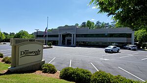
City hall
|
||
|
||
| Country | ||
| State | Georgia | |
| County | DeKalb | |
| Incorporated | December 1, 2008 | |
| Government | ||
| • Type | Council–manager | |
| Area | ||
| • Total | 13.25 sq mi (34.31 km2) | |
| • Land | 13.03 sq mi (33.74 km2) | |
| • Water | 0.22 sq mi (0.57 km2) | |
| Elevation | 1,129 ft (344 m) | |
| Population
(2020)
|
||
| • Total | 51,683 | |
| • Density | 3,967.68/sq mi (1,531.93/km2) | |
| Time zone | UTC-5 (Eastern (EST)) | |
| • Summer (DST) | UTC-4 (EDT) | |
| ZIP Codes |
30338, 30346, 30360
|
|
| Area code(s) | 770, 678, 470 | |
| FIPS code | 13-24768 | |
| GNIS feature ID | 0325929 | |
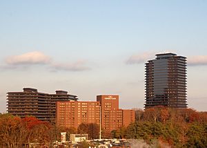
Dunwoody is a city in DeKalb County, Georgia, United States. It's a northern suburb of Atlanta and part of the larger Atlanta metropolitan area. Dunwoody officially became a city on December 1, 2008. However, people have lived in this area since the early 1830s. In 2020, about 51,683 people called Dunwoody home.
Contents
History of Dunwoody
How Dunwoody Got Its Name
The Dunwoody area was settled in the early 1830s. It is named after Major Charles Dunwody (1828–1905). An interesting fact is that an extra "o" was added to his name by mistake on a banking note, and the spelling stuck! Charles Dunwody returned to Roswell, Georgia after fighting in the American Civil War.
Early Buildings and Railroads
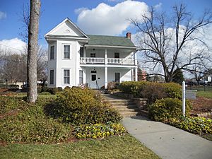
One of Dunwoody's oldest buildings is the Ebenezer Primitive Baptist Church, built in 1829. It's still used today and has one of the city's oldest cemeteries. Many of the people who helped start Dunwoody are buried there.
The first public school, Dunwoody Elementary, opened in 1911. It was located near the center of the city. A fire damaged the school's cafeteria in 1966. Today, the Dunwoody branch of the Dekalb County Public Library and the North Dekalb Cultural Arts Center are on that spot.
In 1881, the Roswell Railroad started running through the area. It helped Dunwoody grow into a small community. Even after the railroad closed in 1921, the community kept growing. In 1905, President Theodore Roosevelt even stopped in Dunwoody during a campaign trip!
Dunwoody Becomes a City
Dunwoody stayed mostly rural until the 1960s, when more homes and businesses started to be built. In 1971, a big shopping center called Perimeter Mall was built. The Dunwoody Village shopping area was also completed that same year.
In 2006, people started studying if Dunwoody should become its own city. Some people worried that this would take away tax money from the rest of the county. However, a group called Citizens for Dunwoody worked to make it happen.
In 2008, a bill was passed that allowed people in Dunwoody to vote on becoming a city. On July 15, most voters said yes! So, on December 1, 2008, Dunwoody officially became a city.
Geography and Location
Dunwoody is located at 33°56′34″N 84°19′4″W / 33.94278°N 84.31778°W. It covers about 34.1 square kilometers (13.2 square miles). Most of this area is land, with a small amount of water.
Dunwoody is at the very northern part of DeKalb County. It shares borders with Fulton County, Georgia to the north and west, and Gwinnett County, Georgia to the northeast. Interstate 285 runs along its southern border.
What happened during the 1998 Dunwoody tornado?
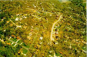
On April 8, 1998, a large tornado hit parts of Dunwoody. It caused a lot of damage to thousands of homes. Many trees were also knocked down. This tornado is often called the "Dunwoody tornado" because most of its damage happened here.
Dunwoody's Main Areas and Neighborhoods
Dunwoody has several unique districts and neighborhoods:
Dunwoody Village
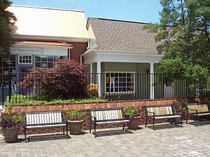
This is the historic center of the community. It's known for its special American colonial architecture style, which started when the Dunwoody Village Shopping Center was built in the 1970s. This style gives the area a unique look and feel.
Perimeter Center
Perimeter Center is a major business and shopping area that grew around Perimeter Mall. The mall opened in 1971, and since then, many offices, homes, and shops have been built. It's one of the biggest job centers in Metro Atlanta. The tallest building in Dunwoody, Ravinia 3, is 34 stories tall and located here. Perimeter Center is easy to reach because it's near two major highways, GA 400 and I-285. The Dunwoody Transit Station also provides public transportation to this area.
Georgetown
Georgetown was developed in the early 1960s. It's close to I-285 and borders the city of Chamblee, Georgia. This area has both single-family homes and its own shopping district. It's one of the most walkable parts of the city.
Williamsburg Commercial District
This area is on the eastern side of Dunwoody. It has several shopping centers like Orchard Park, Mt. Vernon, and Williamsburg at Dunwoody. It's a central spot for dining and shopping.
Winters Chapel
Winters Chapel is located where Dunwoody meets Peachtree Corners, Georgia. It's named after Winters Chapel Methodist Church, which has been there since the 1870s. This area is good for new businesses and shops. It also has two parks connected by sidewalks: a long park along the Twin Lakes water reservoir and Windwood Hollow Park, which has tennis courts, a playground, and picnic areas.
Tilly Mill
This area is named after the Tilly family, who had a farm and mill here in the late 1800s. Tilly Mill Road connects Dunwoody to other areas. Important places in Tilly Mill include the Dunwoody campus of Georgia State University's Perimeter College and Brook Run, Dunwoody's main park. Brook Run is a large park with walking trails, a playground, a dog park, and a community garden. The Marcus Jewish Community Center is also in this area.
People of Dunwoody (Demographics)
| Historical population | |||
|---|---|---|---|
| Census | Pop. | %± | |
| 1980 | 17,768 | — | |
| 1990 | 26,302 | 48.0% | |
| 2000 | 32,808 | 24.7% | |
| 2010 | 46,267 | 41.0% | |
| 2020 | 51,683 | 11.7% | |
| U.S. Decennial Census | |||
As of the 2020 United States census, there were 51,683 people living in Dunwoody. There were 20,482 households and 12,620 families.
| Race | Num. | Perc. |
|---|---|---|
| White (non-Hispanic) | 27,824 | 53.84% |
| Black or African American (non-Hispanic) | 6,036 | 11.68% |
| Native American | 36 | 0.07% |
| Asian | 8,839 | 17.1% |
| Pacific Islander | 17 | 0.03% |
| Other/Mixed | 2,321 | 4.49% |
| Hispanic or Latino | 6,610 | 12.79% |
Economy and Jobs
The main office for the Atlanta Journal-Constitution newspaper is in Dunwoody. InterContinental Hotels Group, a big hotel company, also has its American offices here. The restaurant chain Krystal has its main office in the city too.
Top Employers in Dunwoody
Here are some of the biggest employers in Dunwoody:
| # | Employer | # of Employees |
|---|---|---|
| 1 | InterContinental Hotels Group | 1765 |
| 2 | Dekalb County School District | 772 |
| 3 | Convergent Outsourcing | 423 |
| 4 | Peachford Hospital | 410 |
| 5 | T Mobile | 396 |
| 6 | Nordstrom | 366 |
| 7 | Southeastern Data | 366 |
| 8 | Maggiano's | 322 |
| 9 | Macy's | 298 |
| 10 | Walmart | 298 |
Education in Dunwoody
Public Schools
The DeKalb County School System (DCSS) runs the public schools in Dunwoody.
Elementary Schools
- Austin Elementary School
- Chesnut Charter Elementary School
- Kingsley Elementary School
- Vanderlyn Elementary School
- Dunwoody Elementary School
- Hightower Elementary School (serves parts of Doraville)
Middle and High Schools
- Peachtree Charter Middle School
- Dunwoody High School
Private Schools
- Dunwoody Christian School
Colleges and Universities
- Georgia State University, Dunwoody Campus
- American InterContinental University (AIU Dunwoody)
- Troy University, Atlanta site
Public Libraries
The DeKalb County Public Library has a branch in Dunwoody.
Transportation
Major Roads
- Interstate 285, also known as The Perimeter, runs along the city's southern edge.
- A part of Georgia State Route 141 is on the southeastern border.
- Georgia State Route 400 is very close to Dunwoody's western border.
Public Transportation (MARTA)
The Metropolitan Atlanta Rapid Transit Authority (MARTA) offers subway and bus services.
The Dunwoody station is the only subway station within the city limits. Other nearby stations include Medical Center, Sandy Springs, and North Springs. All these stations are on the Red Line.
There are also three main bus routes that serve Dunwoody:
- Route 103 - Peeler Rd./N. Shallowford Rd.
- Route 132 - Tilly Mill Road
- Route 150 - Perimeter Center/Dunwoody Village
Walking and Biking Paths
Dunwoody has several paths for walking and cycling:
- Dunwoody Trailway
- Georgetown Gateway (Planned)
- Perimeter Multi-Modal Trails (Planned)
- PATH400 (Under construction)
- Winters Chapel Corridor Multiuse Trail (Planned)
Notable People from Dunwoody
Many well-known people have lived in Dunwoody, including:
- Ryan Seacrest, a famous TV host
- Erin Andrews, a sports reporter
- Bret Baier, a news anchor
- Harris Barton, a former professional football player
- Black Lips, a music band
- Alex Caskey, a professional soccer player
- Emily Jacobson, an Olympic fencer
- Sada Jacobson, an Olympic fencer
- Charles London, a football coach
- Robert Duncan McNeill, an actor and director
- Robin Meade, a news anchor
- Kip Pardue, an actor
- Jeff Williams, a poker player
- Cindy Wilson, a singer from the band The B-52s
- Sally Yates, a former U.S. Attorney General
- Matt Porwoll, an award-winning filmmaker
Parks
- Brook Run Skate Park
- Donaldson-Bannister Farm
See also
 In Spanish: Dunwoody para niños
 | John T. Biggers |
 | Thomas Blackshear |
 | Mark Bradford |
 | Beverly Buchanan |


