
Rockdale County, Georgia facts for kids
Quick facts for kids
Rockdale County
|
|||
|---|---|---|---|

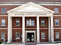
Rockdale County Courthouse in Conyers
|
|||
|
|||

Location within the U.S. state of Georgia
|
|||
 Georgia's location within the U.S. |
|||
| Country | |||
| State | |||
| Founded | October 18, 1870 | ||
| Named for | Rockdale Baptist Church | ||
| Seat | Conyers | ||
| Largest city | Conyers | ||
| Area | |||
| • Total | 132 sq mi (340 km2) | ||
| • Land | 130 sq mi (300 km2) | ||
| • Water | 2.3 sq mi (6 km2) 1.7%% | ||
| Population
(2020)
|
|||
| • Total | 93,570 | ||
| Time zone | UTC−5 (Eastern) | ||
| • Summer (DST) | UTC−4 (EDT) | ||
| Congressional district | 4th | ||


Rockdale County is a county in the central part of Georgia, a state in the United States. In 2020, about 93,570 people lived there. This was an increase from 85,215 people in 2010. The main city and government center of the county is Conyers. Rockdale County is part of the larger Metro Atlanta area.
Contents
History of Rockdale County

How Rockdale County Started
Rockdale County was created on October 18, 1870. It got its name from the Rockdale Baptist Church. This church was named after the hard granite rock found under the county's red clay soil.
A bill, or proposed law, helped create the county. It was introduced by John F. Hardin and John Harris. They took land from the northern part of Newton County. Parts of Rockdale County also came from nearby Henry, Walton, Gwinnett, and DeKalb counties. Conyers, the only official town in Rockdale, became the county seat.
Early Settlers and Native Americans
Before Rockdale became a county, the land was home to the Creek and Cherokee people. The Hightower Trail, which marked the border between these two groups, ran right through the area. Old burial sites have been found in the Honey Creek and Hi-Roc areas.
White settlers started moving to the area in the early 1800s. These early settlers sometimes faced attacks from Native Americans. The first white settlements grew near creeks like Big Haynes Creek in the north, the Yellow River in the middle, and Honey Creek in the south.
Communities formed around mills that ground grain and new churches. Some of these places included Haralson Mill, Costleys Mill, and Union Grove Baptist Church. Most of these settlers were farmers who grew just enough food for themselves.
Rockdale During the Civil War
During the American Civil War, General William Tecumseh Sherman and his Union Army marched north of Conyers. They were on their way to Covington. As they marched, they took and destroyed property. Many people in Conyers were afraid Sherman would burn their city. They fled to nearby Social Circle. Conyers was an important stop on the Georgia Railroad. Luckily, Conyers was not destroyed during the war.
The city of Conyers has many beautiful old buildings from the 1800s. A historical marker says that Major General Joseph Wheeler of the Confederate States Army was captured near here. This happened on May 9, 1865, by Union troops chasing Jefferson Davis.
Growth After the War
After the Civil War, during a time called Reconstruction, Conyers and Rockdale County grew a lot. A local newspaper reported that Conyers' population grew from 300 to 2,000 people. The number of stores, businesses, schools, and churches also increased quickly.
Some parts of the county were known for making illegal alcohol, called moonshining. In 1882, the county became "dry." This meant it was against the law to sell or make alcohol, except for medicine prescribed by a doctor. Farming remained the main way people made a living in the county until the early 1900s.
Geography and Location
Rockdale County covers about 132 square miles. About 130 square miles are land, and 2.3 square miles (1.7%) are water. It is the second-smallest county in Georgia by land area. Only Clarke County is smaller.
All of Rockdale County is located in the Upper Ocmulgee River area. This river basin is part of the larger Altamaha River basin.
Counties Next to Rockdale
- Newton County – to the Southeast
- Henry County – to the Southwest
- DeKalb County – to the West
- Walton County – to the Northeast
- Gwinnett County – to the North
Communities in Rockdale
Population Changes
| Historical population | |||
|---|---|---|---|
| Census | Pop. | %± | |
| 1880 | 6,838 | — | |
| 1890 | 6,813 | −0.4% | |
| 1900 | 7,515 | 10.3% | |
| 1910 | 8,916 | 18.6% | |
| 1920 | 9,521 | 6.8% | |
| 1930 | 7,247 | −23.9% | |
| 1940 | 7,724 | 6.6% | |
| 1950 | 8,464 | 9.6% | |
| 1960 | 10,572 | 24.9% | |
| 1970 | 18,152 | 71.7% | |
| 1980 | 36,747 | 102.4% | |
| 1990 | 54,091 | 47.2% | |
| 2000 | 70,111 | 29.6% | |
| 2010 | 85,215 | 21.5% | |
| 2020 | 93,570 | 9.8% | |
| 2023 (est.) | 95,987 | 12.6% | |
| U.S. Decennial Census 1790-1880 1890-1910 1920-1930 1930-1940 1940-1950 1960-1980 1980-2000 2010 2020 |
|||
In 2020, there were 93,570 people living in Rockdale County. There were 32,792 households and 23,533 families.
In 2010, the average income for a household in the county was about $53,599 per year. For families, the average income was $60,065. About 8.20% of all people in the county lived below the poverty line. This included 10.00% of those under 18 years old.
Education
The Rockdale County School District manages public schools in the area.
Fun Things to Do
Rockdale County offers many places for recreation and fun:
- Georgia International Horse Park
- Black Shoals Lake and Covered Bridge
- Old Towne Conyers Historic District
- Monastery of the Holy Spirit
- Salem Campground
- Smyrna Campground
- Milstead Historic Mill Village
- Panola Mountain State Park
- Rockdale Baptist Church
- Georgia Revolution FC (a soccer team)
Transportation
Main Roads
 I-20
I-20 US 278
 SR 12
SR 12 SR 20
SR 20 SR 138
 SR 162
 SR 212
 SR 402 (This is another name for I-20)
Interstate 20 and State Route 20 meet in the county. To avoid confusion, the road where SR 20 and SR 138 run together is usually just called "138."
Walking and Biking Paths
- Arabia Mountain Path
- Conyers Trail
- Deer Run Trial
- Rockdale River Trail
- S River Trail
Famous People from Rockdale County
Many notable people have connections to Rockdale County:
- Jill Arrington, a sports reporter for ESPN
- Billy Buckner, a former Major League Baseball player
- Members of the pop-punk band Cartel: Will Pugh, Joseph Pepper, Jeff Lett, Nic Hudson, and Kevin Sanders
- David Elder, a former Major League Baseball player
- Dakota Fanning, an actress
- Elle Fanning, an actress
- Holly Hunter, an actress
- Clint Mathis, a World Cup soccer player
- Jack McBrayer, an actor
- Kevin Ware, a college basketball player
- E.R. Shipp, who won a Pulitzer Prize for journalism
- Grady Jarrett, an NFL football player
Images for kids
-
Rockdale County Courthouse in Conyers
See also
 In Spanish: Condado de Rockdale (Georgia) para niños
