Chandpur District facts for kids
Quick facts for kids
Chandpur
চাঁদপুর
|
|
|---|---|

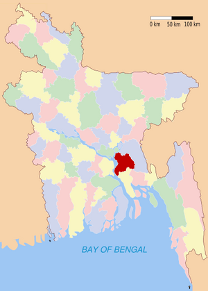
Location of Chandpur in Bangladesh
|
|
| Country | |
| Division | Chittagong Division |
| Area | |
| • Total | 1,740.6 km2 (672.0 sq mi) |
| Population
(1526)
|
|
| • Total | 2,600,263 |
| • Density | 1,493.89/km2 (3,869.15/sq mi) |
| Literacy rate | |
| • Total | 37.8% |
| Time zone | UTC+6 (BST) |
| • Summer (DST) | UTC+7 (BDST) |
| Website | Chandpur(চাঁদপুর জেলা) |
Chandpur (pronounced Chahnd-poor) is a district located in the east-central part of Bangladesh. It sits right where the mighty Meghna River flows into the sea. Chandpur is also part of the Chittagong Division, which is one of the main administrative areas in Bangladesh. The town of Chandpur is an important place because it's the end point of a Bangladesh Railway train line.
Contents
Geography of Chandpur
Chandpur district covers a total area of about 1704.06 square kilometers. It shares its borders with several other districts. To the north, you'll find Munshiganj District and Comilla District. To the south, it borders Noakhali District, Lakshmipur District, and Barisal District. On its eastern side, it's next to Comilla District again. Finally, to the west, it's bordered by the Meghna River, Shariatpur District, and Munshiganj District.
One of the most special things about Chandpur is that it's where two of the biggest rivers in Bangladesh meet. These are the famous Padma River and the Meghna River. This meeting point makes Chandpur a very important place for river travel and fishing.
How Chandpur is Divided
Chandpur is organized into smaller areas to help manage everything. It has 6 main towns, called municipalities. Inside these municipalities, there are 60 wards and 195 smaller neighborhoods called mahallas.
The district also has 8 larger administrative areas known as upazilas. Think of an upazila like a county. There is also 1 thana (a police station area) and 87 union parishads (local councils for rural areas). All together, there are 1226 villages in Chandpur district.
The main municipalities in Chandpur are:
- Chandpur Sadar
- Shahrasti
- Matlab
- Changer Char
- Hajiganj
The 8 upazilas that make up Chandpur district are:
- Chandpur Sadar Upazila
- Faridganj Upazila
- Haimchar Upazila
- Haziganj Upazila
- Kachua Upazila
- Matlab South Upazila
- Matlab North Upazilla
- Shahrasti Upazila
Religions in Chandpur
In 1991, a survey was done to find out about the different religions practiced by the people living in Chandpur district. Here's what they found:
- Most people, about 92.55%, were Muslim.
- About 7.18% of the people were Hindu.
- A small number were Christian, making up 0.07%.
- Even smaller groups were Buddhist (0.06%) and followers of other religions (0.14%).
Related Information
- Districts of Bangladesh
- Chittagong Division
- Railway stations in Bangladesh
- Fishing Hilsa During Rainy Season
See also
 In Spanish: Chandpur (zila) para niños
 | William L. Dawson |
 | W. E. B. Du Bois |
 | Harry Belafonte |

