Chautauqua Creek facts for kids
Quick facts for kids Chautauqua Creek |
|
|---|---|

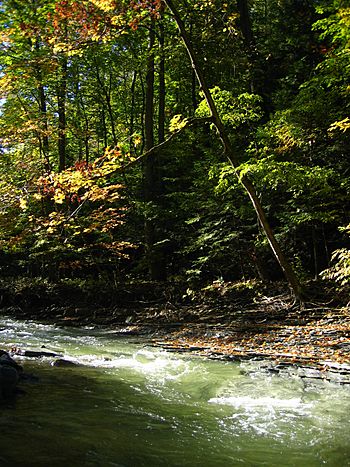
Early Autumn on Chautauqua Creek
|
|
|
Location of the mouth of Chautauqua Creek in New York State.
|
|
| Country | United States |
| State | New York |
| Region | Chautauqua County |
| Physical characteristics | |
| Main source | Sherman, New York 42°10′54″N 79°35′58″W / 42.18167°N 79.59944°W |
| River mouth | Lake Erie 571 ft (174 m) 42°20′16″N 79°36′24″W / 42.33778°N 79.60667°W |
| Length | 15 mi (24 km) |
Chautauqua Creek is a small river, about 15 kilometers (9 miles) long. It flows into Lake Erie in the southwestern part of New York State, United States. The creek starts in the town of Sherman in Chautauqua County. It then flows north through the town and village of Westfield. For much of its path, the creek forms the border between the towns of Westfield and Chautauqua.
Contents
History of Chautauqua Creek
How Chautauqua Creek Got Its Name
The Seneca people, who are Native Americans, have a story about how Chautauqua Creek got its name. They say that some Seneca fishers caught fish in Chautauqua Lake. They carried these fish to Chautauqua Creek. They were surprised that the fish were still alive without water. So, they released them into the creek. Later, they found that this type of fish, which wasn't there before, was now common in the creek and Lake Erie. Because of this, both the creek and the lake were named "fish taken out" in the local Erie language. There are other old stories about the name too.
French Explorers and the Portage Road
French explorers likely found the creek as early as 1615. One of them might have been Etienne Brule, who was a scout. He learned, just like Native Americans had known for a long time, that you could easily move boats and goods between Lake Erie and Chautauqua Lake. This short path, called a "portage," connected the Great Lakes to the Mississippi River system. It used the Allegheny and Ohio Rivers.
In 1753, the French built a road to Chautauqua Lake. This road is now known as the French Portage Road. It helped them move people and supplies between the two river systems. The road started where Chautauqua Creek meets Lake Erie. It followed the creek for about two miles. Then, it went up a steep hill and continued to what is now Mayville, New York. This path is similar to today's New York State Route 394.
Early Settlers and Mills
In 1804, a man named James McMahan was the first settler in Westfield. He built a grist mill near the mouth of the creek. A grist mill is a place where grain is ground into flour. Other mills were built after that. For the next 100 years, the creek's flowing water powered these mills. They included grist mills, saw mills (for cutting wood), and carding mills (for preparing wool).
Fun Activities on Chautauqua Creek
Chautauqua Creek is a popular spot for fishing. It has some brown trout. But it is best known for its "steelhead" fishing. Steelhead are a type of rainbow trout that live in the lake but swim up the creek to lay their eggs. People catch more steelhead here than in any other river in New York.
 | Precious Adams |
 | Lauren Anderson |
 | Janet Collins |


