Chester Creek (Alaska) facts for kids
Quick facts for kids Chester Creek |
|
|---|---|

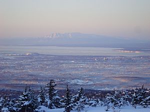
Overview of Anchorage, Chester Creek is on the right hand side
|
|

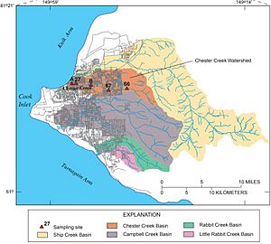
Drainage basin of Chester Creek and other Anchorage waterways
|
|
|
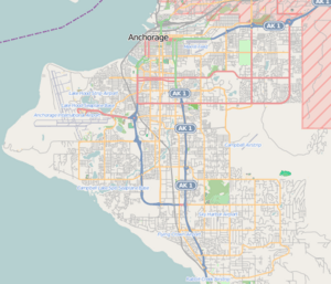
Location of the mouth of the Chester Creek in Alaska
|
|
| Country | United States |
| State | Alaska |
| Municipality | Anchorage |
| Physical characteristics | |
| Main source | Chugach Mountains |
| River mouth | Knik Arm, Cook Inlet 61°12′30″N 149°55′29″W / 61.20833°N 149.92475°W |
| Length | 21 mi (34 km) |
| Basin features | |
| Basin size | 30.5 sq mi (79 km2) |
Chester Creek is one of many streams that flow through Anchorage, Alaska. It travels about 21 miles (34 km) from the Chugach Mountains to the Knik Arm of Cook Inlet.
The creek connects several parks, open spaces, and lakes. Together, they form a "green corridor" that runs across the city from east to west. A paved trail follows the creek for part of its journey. This trail goes through areas from Goose Lake to Westchester Lagoon.
The area that Chester Creek drains, called its drainage basin, includes most of the older parts of Anchorage.
Contents
History of Chester Creek
Long ago, the Denaʼina people lived in this area. They called the creek Chanshtnu, which means "Grass Creek." They used it as a camp for fishing salmon. Later, the name Chanshtnu became "Chester."
As Anchorage grew in the early 1900s, areas around the creek were built up. However, some parts were kept as green spaces. After the big 1964 Alaska earthquake, many parks were joined together in 1971. This created one of the oldest urban greenbelts in the United States.
This greenbelt included the area where the creek flowed into the ocean. The earthquake caused this area to sink, so it was partly underwater at high tide. A new wall was built, which flooded this area to create Westchester Lagoon. The rest of the land was turned into parkland.
Chester Creek's Watershed
A drainage basin is the area of land where all the water drains into a specific river or creek. Chester Creek's drainage basin includes many smaller streams, called tributaries. It also has seven areas with their own starting points.
Important places in the watershed are Westchester Lagoon, Hilstrand Pond, Baxter Bog, and several lakes. These lakes include Mosquito Lake, University Lake, Reflection Lake, and Cheney Lake. Chester Creek has three main branches, called forks. The largest one is the South Fork.
- The South Fork starts in the Chugach Mountains. It flows through Fort Richardson and a neighborhood. It passes University Lake, the Providence Hospital campus, and the University of Alaska Anchorage campus. It then joins the Middle Fork near Goose Lake.
- The Middle Fork begins at Russian Jack Springs Park. Its area includes Goose Lake and homes in Northeast Anchorage.
- The North Fork is short and its path has changed due to buildings. It now comes out of the ground near Merrill Field. Its area includes Alaska Regional Hospital, the Northway Mall, and parts of Mountain View.
The Lower Chester Creek forms where the North and South Forks meet. It then flows into Westchester Lagoon and finally into Knik Arm. Chester Creek's watershed is next to the watersheds of Ship Creek to the north. It is also next to Fish Creek and Campbell Creek to the south.
The Chester Creek Trail
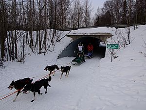
Citizens worked hard to create the Chester Creek Trail. They wanted it to be a path for exercise and travel. In 1972, Lanie Fleischer started the Anchorage Bike Committee with other people. After a successful "bike in" event with 300 riders, city planners began to build the trail in 1973. This was the first of many multi-use trails in Anchorage.
In 1994, the trail was renamed the Lanie Fleischer Chester Creek Trail. It is four miles long and very popular. People enjoy cycling on it in the summer. In winter, many people go skiing there. A big project to improve the trail started in 2012. It was expected to cost about $3.2 million.
In the summer of 2015, a group of artists worked on a project called Seeking the Source. They talked to people using the trail. They wanted to learn about their experiences and memories of the trail. They also explored how the trail helps shape people's ideas about local nature and wildlife.
Wildlife in Chester Creek
The creek is home to many different plants and animals. You can find migrating fish, large animals like moose and bears, and wild birds. The birds are often seen around the various lakes.
In the 1970s, a dam was built at the creek's outlet. This changed how the water flowed into Westchester Lagoon. It made it harder for Coho salmon and Dolly Varden trout to enter the creek.
In 2009, changes were made to the dam to help fish pass through easily. After these changes, the number of Coho and Pink salmon entering the creek grew a lot. For example, over 2000 fish were counted in 2013, compared to fewer than 500 in 2008. There are also efforts to make the creek a better home for these salmon. The United States Fish and Wildlife Service and the Anchorage Office of Fish and Game are working together on this.
A large area around the creek is a habitat for moose. To help these animals, people are trying to remove Mayday trees. These trees look nice, but they are not a good food source for moose.
How Chester Creek Flows
The United States Geological Survey (USGS) has been measuring the streamflow of Chester Creek since 1966. A special measuring site near the Arctic Boulevard bridge checks 90% of the watershed. This covers about 27.4 square miles (71 km2) of the total 30.5 square miles (79 km2).
From 1966 to 2013, the average flow was 21.2 cubic feet per second. The lowest flow recorded was 1.6 cubic feet per second in February 1975. The highest water level was in September 2012. The creek reached a height of 5.9 feet (1.8 m) at the gauge. This meant the water was flowing at 454 cubic feet per second.
 | Mary Eliza Mahoney |
 | Susie King Taylor |
 | Ida Gray |
 | Eliza Ann Grier |


