Chinook Pass facts for kids
Quick facts for kids Chinook Pass |
|
|---|---|

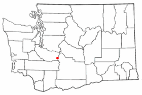
Location of Chinook Pass
|
|
| Elevation | 5,430 ft (1,655 m) |
| Traversed by | State Route 410 |
| Location | Pierce / Yakima counties, Washington, United States |
| Range | Cascades |
| Coordinates | 46°52′18″N 121°30′56″W / 46.8717°N 121.515483°W |
Chinook Pass is a mountain pass in the Cascade Range in Washington. It sits at an elevation of 5,430 feet (1,656 meters) above sea level.
This pass is located right on top of the Cascade Mountains. It's found along a ridge between Yakima Peak and Naches Peak. The border between Pierce County (to the west) and Yakima County (to the east) runs along this ridge. Water on the west side flows into the Cowlitz River, while water on the east side goes to the Yakima River.
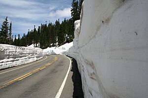
Chinook Pass is the eastern entrance to Mount Rainier National Park. It carries State Route 410, connecting the towns of Enumclaw and Naches. Because it's so high up, the pass usually closes in November. This is due to heavy snow and a high risk of avalanches. It typically reopens in mid-May. Sometimes, the snow at the summit can be as deep as 15 feet!
Route 410 through Chinook Pass is part of the All-American Road program. The U.S. government has named it the Chinook Scenic Byway. Many people think it's one of the most beautiful roads in the United States. Since the top of the pass is above the tree line, there are many spots to stop and enjoy the views. Large commercial trucks are not allowed through the National Park section of State Route 410. This makes it a favorite route for summer tourists.
Building the Road: A Look Back
Chinook Pass was chosen as a route across the Cascade Mountains after a lot of discussion. One big problem was that the road would be very high up. This meant it probably couldn't stay open all year. Another option was Naches Pass. With a short tunnel, Naches Pass would be much lower. This would make it easier to keep open in winter. The plan for Naches Pass is still around as SR 168, but it was never built.
The main reason Chinook Pass was chosen was the cost of building that tunnel. It was simply too expensive.
Work on the Yakima side of the road started in 1914. But then, construction stopped for several years. This part was called the 'Normile Grade'. In 1921, work began again on the Yakima side, near the American River. At first, horse teams did the work. In 1924, an army tractor was brought in to speed things up. Building the west side of the road started later and took more time. The two sides of the road finally met in 1931 at Tipsoo Lake, close to the summit.
Fun Activities at Chinook Pass
From 1940 to 1959, Chinook Pass was one of the best ski areas in Washington. The ski season lasted from December to June! There were many temporary rope tows from Cayuse Pass to the Tipsoo Lake area. Mount Rainier National Park made sure these lifts were temporary. This way, they could be removed when the snow melted in the summer.
Lift skiing ended when the state decided not to keep Chinook Pass open in winter. Also, the White Pass Ski Area opened nearby. Today, Chinook Pass is still very popular for backcountry telemark skiing and snowboarding. People enjoy these sports from May to July.
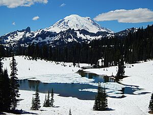
Tipsoo Lake
Tipsoo Lake is just a short walk from the summit. It has a picnic area and a trail that goes around the lake. This spot is one of the most photographed places in the United States because of its amazing views.
Hiking Trails
Chinook Pass is also a starting point for the Pacific Crest Trail. From here, you can reach places like Dewey Lake and Cougar Lake in the William O. Douglas Wilderness. You can also get to Crystal Mountain Ski Resort and the Norse Peak Wilderness.
The Naches Peak Loop is a popular trail that goes around Naches Peak. Part of this trail is actually a section of the famous Pacific Crest Trail.
 | Misty Copeland |
 | Raven Wilkinson |
 | Debra Austin |
 | Aesha Ash |


