Yakima Peak facts for kids
Quick facts for kids Yakima Peak |
|
|---|---|

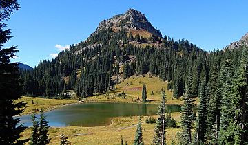
Yakima Peak seen from Tipsoo Lake
|
|
| Highest point | |
| Elevation | 6,226 ft (1,898 m) |
| Prominence | 426 ft (130 m) |
| Isolation | 0.57 mi (0.92 km) |
| Parent peak | Deadwood Peak (6,280 ft) |
| Geography | |
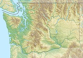
| Location | Mount Rainier National Park Pierce County, Washington, U.S. |
| Parent range | Cascades |
| Topo map | USGS Chinook Pass |
| Climbing | |
| Easiest route | Scrambling class 3 north gully |
Yakima Peak is a mountain that stands 6,226 feet (1,898 meters) tall. It's found right on the eastern edge of Mount Rainier National Park. This peak also sits on the border between Pierce County and Yakima County in Washington state. You can find Yakima Peak northwest of Tipsoo Lake and west of Chinook Pass. It's part of the Cascade Range, a long chain of mountains.
The mountain's name, Yakima Peak, is a tribute to the Yakima Tribe from eastern Washington. Its closest taller neighbor is Deadwood Peak, which is about 0.59 miles (0.95 km) to the north. If you start from Chinook Pass, a short climb up a rocky path on the north side leads to a flat top. From there, you get clear views of Mount Rainier and Naches Peak.
Climate at Yakima Peak
Yakima Peak is located in a special weather area called the marine west coast climate zone. This type of climate is found in western North America. It means the weather is often influenced by the nearby ocean.
How Weather Works Here
Most of the weather systems, like big air masses, start over the Pacific Ocean. They then travel northeast towards the Cascade Mountains. When these weather systems hit the tall Cascade Mountains, they are forced to rise. This process is called Orographic lift. As the air rises, it cools down and drops its moisture. This moisture falls as rain or snow onto the mountains.
Because of this, the western side of the Cascades gets a lot of rain and snow. This is especially true during the winter months. In winter, the sky is often cloudy. However, in summer, high-pressure systems over the Pacific Ocean become stronger. This often leads to clear skies with little to no clouds. The ocean's influence also makes the snow wet and heavy. This kind of snow can increase the risk of avalanches, which are dangerous slides of snow down a mountain.
Water's Journey
Yakima Peak is a very important spot for water. It's a "triple divide point." This means that the precipitation (rain and snow) that falls on the peak can flow in three different directions. The water runs off into streams that become part of the White River, the Cowlitz River, and the Yakima River. Each of these rivers eventually flows to different places.
 | Jewel Prestage |
 | Ella Baker |
 | Fannie Lou Hamer |


