Christmas 1994 nor'easter facts for kids
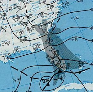
The Christmas 1994 nor'easter was a powerful storm that hit the East Coast of the United States and Atlantic Canada around Christmas in 1994. It started as an area of low pressure (where air pressure is lower than its surroundings) in the southeastern Gulf of Mexico, near the Florida Keys. The storm then moved across the state of Florida.
How the Storm Formed and Grew
A weather system first moved from the central Great Plains towards the southern United States. When it reached the Gulf of Mexico, it turned into a cyclone (a large system of winds rotating around a center of low atmospheric pressure). A weather feature called a trough then pushed this system across Florida.
A weather expert, Jack Beven, from the National Hurricane Center noticed something unusual. He said that as the storm moved into the Bahamas, it started to look like a tropical storm. However, because it wasn't exactly like a typical tropical storm, they didn't officially call it one.
A "Hybrid" Storm
This cyclone was called a "hybrid" storm. This means it had features of both a tropical storm and a regular winter storm (called an extratropical cyclone). It grew very strong quickly because it moved over the warm waters of the Gulf Stream. It also got stronger due to cold air over the United States.
The storm even developed a clear center of atmospheric convection (rising warm air). This is unusual for a regular winter storm. It also formed an eye, which is usually only seen in tropical cyclones like hurricanes.
Even with these tropical features, it wasn't a true tropical storm. Its strongest winds were spread out over a very large area. This was different from how tropical storms usually behave.
The Storm's Path and Strength
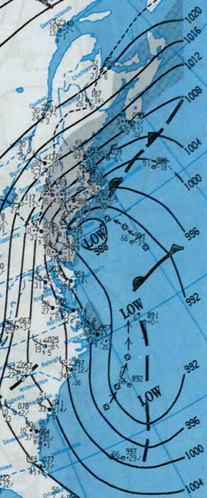
On December 23 and 24, the nor'easter became very powerful. Its lowest air pressure reached 970 mb. Another low pressure system formed behind it and grew even larger.
Because of something called the Fujiwhara effect (where two nearby cyclones interact and orbit each other), the larger second storm pulled the original nor'easter. This caused the nor'easter to move towards the northwest.
The storm passed along the south shore of Long Island in New York. It then made landfall near New York City on December 24. After that, it moved over southeastern New York State.
On Christmas Day, December 25, the storm began to lose strength. It moved towards Nova Scotia in Canada. By early December 26, both low pressure systems had moved out to sea.
Other pages


