Clallam Bay, Washington facts for kids
Quick facts for kids
Clallam Bay, Washington
|
|
|---|---|

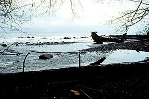
The mouth of the Clallam River, located in Clallam Bay County Park.
|
|
| Country | United States |
| State | Washington |
| County | Clallam |
| Area | |
| • Total | 0.56 sq mi (1.46 km2) |
| • Land | 0.56 sq mi (1.46 km2) |
| • Water | 0 sq mi (0.0 km2) |
| Elevation | 31 ft (9 m) |
| Population
(2020)
|
|
| • Total | 386 |
| • Density | 685/sq mi (264.4/km2) |
| Time zone | UTC-8 (Pacific (PST)) |
| • Summer (DST) | UTC-7 (PDT) |
| ZIP code |
98326
|
| FIPS code | 53-12525 |
| GNIS feature ID | 1517797 |
Clallam Bay is a small community in Clallam County, Washington, United States. It is a census-designated place (CDP), which means it's a special area defined by the government for counting people. Clallam Bay sits right where the Clallam River flows into Clallam Bay, which is a part of the larger Strait of Juan de Fuca.
This area is known for its beautiful natural environment and is a popular spot for hunting. Many visitors come here, making tourism important for the community. Clallam Bay is often called the "twin city" of nearby Sekiu. In 2020, about 386 people lived in Clallam Bay. This was a small increase from 363 people in 2010.
Contents
History of Clallam Bay
Clallam Bay started as a busy stop for steamboats in the 1880s. By 1890, it became a "mill town," meaning it had a large factory that cut wood. Two years later, the mill burned down. After that, making barrels for a special leather-making liquid became the main business. In 1905, the lighthouse at Slip Point began shining its light on April Fool's Day.
Sekiu's Early Days
Sekiu Point, which is pronounced "See'-kew," is the western edge of Clallam Bay. Captain Henry Kellett first mapped this area in 1847. The town of Sekiu was first called "West Clallam." It was founded in 1870 by A.J. Martin. He built a salmon cannery, a factory that prepares and cans fish, to be closer to the fishing areas.
The area grew quickly before the year 1900. This was because a company called Pacific Tanning Extract Company started making a liquid used for tanning leather in 1887. But in 1893, the demand for this liquid stopped, and hundreds of workers lost their jobs. People then turned to fishing and later to cutting down trees (logging). From 1902 to 1907, a person named D.A. Robinson did a lot of logging here. He even built a railroad with what was then the longest railroad bridge in the world. This bridge was 808 feet (246 meters) long and 202 feet (62 meters) high. It crossed over Charlie Creek.
Geography and Climate
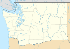
Clallam Bay is located in the northwestern part of Clallam County. The Clallam River flows into the southeastern side of Clallam Bay. Clallam Bay itself is a small part of the Strait of Juan de Fuca, which is a large body of water between Washington state and Vancouver Island, Canada.
Washington State Route 112 is the main road that goes through Clallam Bay. If you go south on Route 112, you can connect to Washington State Route 113. This route will take you about 16 miles (26 km) to Sappho on US 101. If you go west on Route 112, it's about 2 miles (3 km) to Sekiu. Going further west, it's about 20 miles (32 km) to Neah Bay.
Weather in Clallam Bay
Clallam Bay has a mild climate, meaning it doesn't get too hot or too cold. It gets a lot of rain, especially in the winter months. Summers are usually cool and pleasant.
| Climate data for Clallam Bay, Washington | |||||||||||||
|---|---|---|---|---|---|---|---|---|---|---|---|---|---|
| Month | Jan | Feb | Mar | Apr | May | Jun | Jul | Aug | Sep | Oct | Nov | Dec | Year |
| Record high °F (°C) | 65 (18) |
68 (20) |
75 (24) |
79 (26) |
92 (33) |
96 (36) |
102 (39) |
99 (37) |
97 (36) |
83 (28) |
67 (19) |
66 (19) |
102 (39) |
| Mean daily maximum °F (°C) | 45.8 (7.7) |
48.8 (9.3) |
52.0 (11.1) |
56.6 (13.7) |
61.9 (16.6) |
66.0 (18.9) |
71.1 (21.7) |
72.5 (22.5) |
69.2 (20.7) |
58.7 (14.8) |
49.2 (9.6) |
44.2 (6.8) |
58.0 (14.4) |
| Mean daily minimum °F (°C) | 35.4 (1.9) |
34.8 (1.6) |
36.3 (2.4) |
38.4 (3.6) |
43.0 (6.1) |
47.3 (8.5) |
50.4 (10.2) |
50.6 (10.3) |
47.3 (8.5) |
42.3 (5.7) |
37.9 (3.3) |
34.1 (1.2) |
41.5 (5.3) |
| Record low °F (°C) | 3 (−16) |
4 (−16) |
8 (−13) |
26 (−3) |
28 (−2) |
30 (−1) |
34 (1) |
34 (1) |
27 (−3) |
26 (−3) |
8 (−13) |
6 (−14) |
3 (−16) |
| Average precipitation inches (mm) | 14.41 (366) |
10.71 (272) |
8.72 (221) |
5.49 (139) |
2.80 (71) |
2.07 (53) |
1.60 (41) |
1.82 (46) |
2.68 (68) |
7.96 (202) |
13.44 (341) |
13.94 (354) |
85.64 (2,175) |
| Average snowfall inches (cm) | 1.9 (4.8) |
2.0 (5.1) |
0.7 (1.8) |
0.1 (0.25) |
0 (0) |
0 (0) |
0 (0) |
0 (0) |
0 (0) |
0 (0) |
1.4 (3.6) |
1.6 (4.1) |
7.7 (20) |
See also
 In Spanish: Clallam Bay (Washington) para niños
 | Bessie Coleman |
 | Spann Watson |
 | Jill E. Brown |
 | Sherman W. White |


