
Clare, Michigan facts for kids
Quick facts for kids
Clare, Michigan
|
|
|---|---|
| City of Clare | |

Downtown Clare along Bus. US 10 / 127
|
|
| Nickname(s):
"The Crossroads of Michigan"
|
|
,_MI_location.png)
Location within Clare County (top) and Isabella County (bottom)
|
|

Clare, Michigan
Location in Michigan

Clare, Michigan
Location in the United States
|
|
| Country | United States |
| State | Michigan |
| Counties | Clare and Isabella |
| Founded | 1870 |
| Incorporated | 1885 (village) 1891 (city) |
| Government | |
| • Type | City commission |
| Area | |
| • Total | 3.83 sq mi (9.92 km2) |
| • Land | 3.72 sq mi (9.63 km2) |
| • Water | 0.11 sq mi (0.28 km2) |
| Elevation | 837 ft (255 m) |
| Population
(2020)
|
|
| • Total | 3,254 |
| • Density | 874.26/sq mi (337.53/km2) |
| Time zone | UTC-5 (Eastern (EST)) |
| • Summer (DST) | UTC-4 (EDT) |
| ZIP code(s) |
48617
|
| Area code(s) | 989 |
| FIPS code | 26-15920 |
| GNIS feature ID | 0623335 |
Clare is a small city located in the state of Michigan, in the United States. It's found near the middle of Michigan's lower part. Most of Clare is in Clare County, but a small piece stretches into Isabella County. In 2020, about 3,254 people lived there.
Clare started as a settlement around 1870. It has two places listed on the National Register of Historic Places, which means they are important historical sites. These are the Clare Downtown Historic District and the Clare Congregational Church.
The city is a busy spot for travel because several major roads meet there. These include U.S. Route 10 and U.S. Route 127. There are also special "business routes" (Bus. 10 and Bus. US 127) that go right through downtown. Another highway, M-115, also passes through Clare.
Because so many roads and old train lines (like the Ann Arbor and Pere Marquette railroads) meet here, Clare is often called the "Crossroads of Michigan."
Contents
History of Clare, Michigan
Clare began when the Pere Marquette railroad arrived in 1870. The city was named after Clare County, which itself was named after County Clare in Ireland. The first post office in Clare opened on January 20, 1871.
Clare officially became a village in 1879. Later, in 1891, it became a full city. A famous local bakery, Cops & Doughnuts, opened in 2009. It's located in a building that has been a bakery since 1896!
Where is Clare? (Geography)
The U.S. Census Bureau says that Clare covers about 3.83 square miles (9.92 square kilometers). Most of this area, about 3.72 square miles (9.63 square kilometers), is land. The rest, about 0.11 square miles (0.28 square kilometers), is water.
The south branch of the Tobacco River flows through Clare. The city also has a lake called Lake Shamrock.
Clare's Climate
Clare has a humid continental climate. This means it experiences big changes in temperature throughout the year. Summers are warm to hot and can be humid. Winters are cold, sometimes very cold.
Getting Around Clare (Transportation)
Clare is a central point for travel due to its major highways and trails.
Major Roads and Highways
 US 10: This highway runs along the northeastern part of the city.
 US 127: This highway goes from south to north along the western edge of the city. It joins with US 10.
Bus. US 10: This is a special business route that goes through downtown Clare.

Bus. US 127: This is another business route. Parts of it run along with Bus. US 10 in downtown Clare. M-115 (Main Street): This road enters Clare from the west. It ends in downtown Clare where it meets Bus. US 127 and Bus. US 10.
Airport and Bus Service
- Clare Municipal Airport: This is a public airport located in the northeast part of the city.
- Indian Trails: You can catch a bus here for longer trips. This service connects Clare to places like St. Ignace and East Lansing.
Trails for Fun and Travel
- Pere Marquette Rail-Trail: This is a trail built on an old railroad line. It starts in Clare and is great for biking or walking.
- Pere Marquette State Trail: This trail also runs through the city and is used for biking and other activities.
Clare's Population (Demographics)
| Historical population | |||
|---|---|---|---|
| Census | Pop. | %± | |
| 1880 | 502 | — | |
| 1890 | 1,174 | 133.9% | |
| 1900 | 1,326 | 12.9% | |
| 1910 | 1,350 | 1.8% | |
| 1920 | 1,462 | 8.3% | |
| 1930 | 1,491 | 2.0% | |
| 1940 | 1,844 | 23.7% | |
| 1950 | 2,440 | 32.3% | |
| 1960 | 2,442 | 0.1% | |
| 1970 | 2,639 | 8.1% | |
| 1980 | 3,300 | 25.0% | |
| 1990 | 3,021 | −8.5% | |
| 2000 | 3,173 | 5.0% | |
| 2010 | 3,118 | −1.7% | |
| 2020 | 3,254 | 4.4% | |
| U.S. Decennial Census | |||
In 2010, there were 3,118 people living in Clare. These people lived in 1,354 households. About 31.7% of these households had children under 18 living with them. The average household had about 2.22 people.
The average age of people in Clare was 36.1 years. About 23.9% of residents were under 18 years old. About 16.9% were 65 years or older.
Education in Clare
The city of Clare has its own school system called Clare Public Schools. The schools are located in the city center. They serve students from the southeastern part of Clare County and the northeastern part of Isabella County.
Clare's Sister Cities
Clare has "sister city" relationships with several cities around the world. These partnerships help promote cultural understanding and friendship.
- Ennis, Ireland (since 1986)
- Nakhodka, Russia (since 1997)
- Nantong, China (since 2005)
- Surulere, Nigeria (since 2009)
- Ipoh, Malaysia (since 2010)
- Dharavi, India (since 2011)
Famous People from Clare
- Fred C. Reger: A politician from Wisconsin who was born in Clare.
- Debbie Stabenow: A politician who grew up in Clare and now serves in the U.S. Senate.
- Wayne Terwilliger: A World War II veteran and a professional baseball player, born in Clare.
- Cody Vance: A professional wrestler, known as Cody Preston, who graduated from Clare High School in 2010.
Images for kids
-
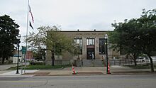
U.S. Post Office in Clare -
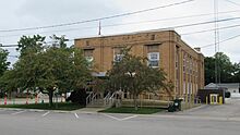
Clare City Hall -
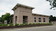
Pere Marquette District Library


.jpg)
See also
 In Spanish: Clare (Míchigan) para niños
