Clarkson, New York facts for kids
Quick facts for kids
Clarkson
|
|
|---|---|

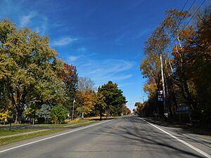
New York State Route 19 northbound entering Clarkson Corners.
|
|

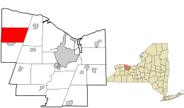
Location in Monroe County and the state of New York.
|
|

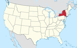
Location of New York in the United States
|
|
| Country | United States |
| State | New York |
| County | Monroe |
| Established | April 2, 1819 |
| Area | |
| • Total | 33.18 sq mi (85.95 km2) |
| • Land | 33.18 sq mi (85.93 km2) |
| • Water | 0.01 sq mi (0.01 km2) |
| Elevation | 368 ft (112 m) |
| Population
(2020)
|
|
| • Total | 6,904 |
| • Density | 208.08/sq mi (80.34/km2) |
| Time zone | UTC-5 (EST) |
| • Summer (DST) | UTC-4 (EDT) |
| ZIP code |
14430
|
| Area code(s) | 585 |
| FIPS code | 36-055-15957 |
| Website | http://www.clarksonny.org/ |
Clarkson is a town in Monroe County, New York. It's located on the western edge of the county, just west of the city of Rochester. In 2020, about 6,904 people lived here. The town gets its name from General Matthew Clarkson.
Contents
Exploring Clarkson's Past
Clarkson was officially formed on April 2, 1819. It was created from a larger area called the Town of Murray. Later, in 1852, a part of Clarkson was used to create the Town of Union, which is now known as Hamlin.
Early Settlers and Important People
It's believed that Moddy Freeman was the very first person to settle in Clarkson. James Sayres bought land in Clarkson Corners in 1804 and was the first settler along the important Ridge Road. Another early settler was Eli Blodgett, who also arrived in 1804. Many more people moved to the area before 1809, and the town grew quickly around 1819.
Clarkson was once home to Henry R. Seldon. He was a judge and later became the lieutenant governor of New York State. The first boy born in Clarkson was a son to Mrs. Clarkson. The first girl born was Betsey Palmer in 1812.
First Businesses and Services
The first school in Clarkson was taught by Charlotte Cummings in 1812. Around 1810, Henry McCall opened the first store. Isaac Williams built the first wooden house and was also the town's first blacksmith.
The first physician in town was Dr. Noah Owen, followed by Dr. Rowe. John Bowman was the first lawyer. A newspaper called the Jeffersonian was published in Clarkson in 1835, but it only lasted for about a year. The first sawmill was built by James Sayres before 1811, located east of the main corners. A post office was set up in 1816, with Dr. Baldwin as the first postmaster.
Clarkson's Role in History
The Ridge Road was a very important route during the War of 1812. Clarkson was a meeting point for soldiers and a place to store military supplies. The village of Clarkson, then called "Murray Corners," was a busy spot because Ridge Road was the main path between Canandaigua and Lewiston. It was a place where travelers could rest and change horses.
However, after the Erie Canal was finished and later the New York Central railroad was built, nearby towns like Sweden grew more important for trade. Clarkson's commercial importance decreased over time.
Clarkson's Geography
Clarkson covers a total area of about 33.2 square miles (86 km2). Almost all of this area is land, with only a tiny amount of water.
The western border of the town is also the border of Orleans County. This border is marked by New York State Route 272. Another important road is New York State Route 104, also known as Ridge Road, which runs from east to west through the town.
Clarkson's Population
| Historical population | |||
|---|---|---|---|
| Census | Pop. | %± | |
| 1820 | 1,612 | — | |
| 1830 | 3,251 | 101.7% | |
| 1840 | 3,486 | 7.2% | |
| 1850 | 4,555 | 30.7% | |
| 1860 | 2,093 | −54.1% | |
| 1870 | 1,884 | −10.0% | |
| 1880 | 2,160 | 14.6% | |
| 1890 | 1,741 | −19.4% | |
| 1900 | 1,581 | −9.2% | |
| 1910 | 1,549 | −2.0% | |
| 1920 | 1,403 | −9.4% | |
| 1930 | 1,456 | 3.8% | |
| 1940 | 1,449 | −0.5% | |
| 1950 | 1,912 | 32.0% | |
| 1960 | 2,339 | 22.3% | |
| 1970 | 3,642 | 55.7% | |
| 1980 | 4,016 | 10.3% | |
| 1990 | 4,517 | 12.5% | |
| 2000 | 6,072 | 34.4% | |
| 2010 | 6,736 | 10.9% | |
| 2020 | 6,904 | 2.5% | |
| U.S. Decennial Census | |||
In 2000, there were 6,072 people living in Clarkson. This included 2,034 households and 1,582 families. The population density was about 182.8 inhabitants per square mile (70.6/km2).
About 41.3% of households had children under 18 living with them. Most households (64.7%) were married couples living together. The average household had 2.86 people, and the average family had 3.26 people.
The population was spread out by age:
- 29.4% were under 18 years old.
- 6.0% were between 18 and 24.
- 30.7% were between 25 and 44.
- 21.9% were between 45 and 64.
- 11.9% were 65 years or older.
The average age in Clarkson was 36 years.
Communities and Places in Clarkson
- Brockport – A small part of the Village of Brockport is located within the town of Clarkson.
- Clarkson Corners – This is a small community that was once very important. It used to be called "Murray Corners." The Clarkson Corners Historic District is a special area listed on the National Register of Historic Places since 1994.
- Garland – A community in the southeast part of town, also located on Ridge Road (NY-104).
- Morton – A community right on the western town line, along NY-272.
- Otis – A location found in the northeast part of the town.
- Redman Corners – Another community located on Ridge Road, on the west side of Clarkson.
- Ridge Road – This is NYS-104. It was once the main highway connecting Rochester and Niagara Falls.
See also
 In Spanish: Clarkson (Nueva York) para niños
 | Valerie Thomas |
 | Frederick McKinley Jones |
 | George Edward Alcorn Jr. |
 | Thomas Mensah |

