Clay County, Alabama facts for kids
Quick facts for kids
Clay County
|
|
|---|---|
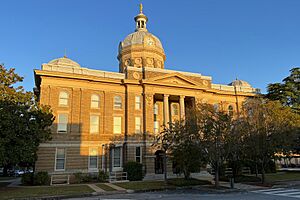
Clay County Courthouse in Ashland
|
|
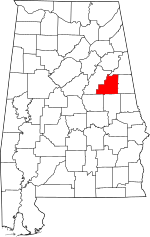
Location within the U.S. state of Alabama
|
|
 Alabama's location within the U.S. |
|
| Country | |
| State | |
| Founded | December 7, 1866 |
| Named for | Henry Clay |
| Seat | Ashland |
| Largest city | Lineville |
| Area | |
| • Total | 606 sq mi (1,570 km2) |
| • Land | 604 sq mi (1,560 km2) |
| • Water | 2.0 sq mi (5 km2) 0.3% |
| Population
(2020)
|
|
| • Total | 14,236 |
| • Estimate
(2023)
|
14,111 |
| • Density | 23.492/sq mi (9.070/km2) |
| Time zone | UTC−6 (Central) |
| • Summer (DST) | UTC−5 (CDT) |
| Congressional district | 3rd |
|
|
Clay County is a county located in the east-central part of Alabama, a state in the United States. In 2020, about 14,236 people lived here. The main town and county seat is Ashland.
The county is named after Henry Clay, a very important American statesman from the 1800s. He was a senator for Kentucky and served as the U.S. Secretary of State. For a long time, Clay County was known as the last "dry county" in Alabama. This meant that alcohol could not be sold there. However, in 2016, people voted to allow alcohol sales in the towns of Lineville and Ashland.
Contents
History of Clay County
Clay County was officially created on December 7, 1866. It was formed from parts of Randolph and Talladega counties. Like the county, its county seat, Ashland, was also named after Henry Clay's home in Kentucky, which was called "Ashland."
When the county was first formed, it was covered with many trees. Some of the land was home to the Creek Native American people. Early settlers bought land from the government or from the Native Americans. Many families came from Fayette County, Georgia.
Clay County was created because it was hard for people in the area to reach the county seats of nearby counties. Rivers and mountains made travel difficult. Even today, Clay County is one of only three counties in Alabama that does not have any major U.S. highways passing through it. Ashland was once a mining town, especially known for digging up graphite.
During a conflict called Desert Shield/Storm, Clay County had more soldiers serving per person than any other county in the United States. This shows the strong spirit of its people.
Geography and Nature
Clay County covers about 606 square miles. Most of this area, about 604 square miles, is land. The rest, about 2 square miles, is water.
Neighboring Counties
Clay County shares borders with these other counties:
- Cleburne County – to the north
- Randolph County – to the east
- Tallapoosa County – to the south
- Coosa County – to the southwest
- Talladega County – to the west
Protected Natural Areas
A part of the Talladega National Forest is located within Clay County. This forest is a large protected area where nature can thrive.
Transportation
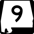
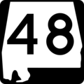
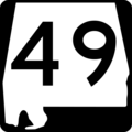
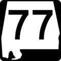
Even though Clay County doesn't have U.S. highways, it has several state routes that help people travel.
Main Roads
Railroads
- CSX Transportation
- Norfolk Southern Railway
Population Over Time
| Historical population | |||
|---|---|---|---|
| Census | Pop. | %± | |
| 1870 | 9,560 | — | |
| 1880 | 12,938 | 35.3% | |
| 1890 | 15,765 | 21.9% | |
| 1900 | 17,099 | 8.5% | |
| 1910 | 21,006 | 22.8% | |
| 1920 | 22,645 | 7.8% | |
| 1930 | 17,768 | −21.5% | |
| 1940 | 16,907 | −4.8% | |
| 1950 | 13,929 | −17.6% | |
| 1960 | 12,400 | −11.0% | |
| 1970 | 12,636 | 1.9% | |
| 1980 | 13,703 | 8.4% | |
| 1990 | 13,252 | −3.3% | |
| 2000 | 14,254 | 7.6% | |
| 2010 | 13,932 | −2.3% | |
| 2020 | 14,236 | 2.2% | |
| 2023 (est.) | 14,111 | 1.3% | |
| U.S. Decennial Census 1790–1960 1900–1990 1990–2000 2010–2020 |
|||
In 2020, the population of Clay County was 14,236 people. There were 5,198 households and 3,704 families living in the county.
Education
Clay County has one public school district. About 1,800 students attend public schools from kindergarten through 12th grade in Clay County.
School Districts
- Clay County School District
Communities
Clay County has several towns and communities where people live.
City
Town
- Ashland (This is the county seat)
Census-Designated Places
These are areas that are like towns but are not officially incorporated as cities or towns.
Unincorporated Communities
These are smaller communities that are not officially part of a city or town.
- Brownsville
- Cleveland Crossroads
- Corinth
- Cragford
- Pinckneyville
- Springhill
Famous People from Clay County
Many notable people have come from Clay County:
- Hugo Black (1886–1971) was born in Harlan. He became a very important judge on the U.S. Supreme Court.
- LaFayette L. Patterson (1888–1987) was born near Delta. He served in the U.S. Congress for three terms.
- Byron Lavoy Cockrell (1935–2007) was born in Lineville. He was a rocket scientist and engineer.
- Bob Riley (born 1944) is from Ashland. He was a U.S. Congressman and later became Alabama's 52nd governor.
- Flem Walker (born 1964) is from Lineville. He was a high-ranking officer in the United States Army.
Places to Visit
Clay County is a great place for outdoor adventures and exploring history.
Parts of Cheaha State Park are in Clay County, within the Talladega National Forest. Lake Wedowee is also nearby, on the eastern border.
The Pinhoti Trail system winds through the Talladega National Forest and goes up to Mount Cheaha. Mount Cheaha is the highest point in Alabama. Hikers on the trail might see local wildlife like deer, wild turkeys, and even rare bald eagles.
Clay County is also home to Doc Hilt Trails, a special place for off-highway vehicles. In 2010, it was named a National Recreation Trail. This is a big honor, as it was one of only two private motorized parks in the whole country to get this award.
There are two historic sites in Clay County listed on the National Register of Historic Places: the Hugo Black House (even though it was destroyed, it's still listed) and the Clay County Courthouse.
Images for kids
See also
 In Spanish: Condado de Clay (Alabama) para niños
 | Stephanie Wilson |
 | Charles Bolden |
 | Ronald McNair |
 | Frederick D. Gregory |


