Clear Island Waters, Queensland facts for kids
Quick facts for kids Clear Island WatersGold Coast, Queensland |
|||||||||||||||
|---|---|---|---|---|---|---|---|---|---|---|---|---|---|---|---|

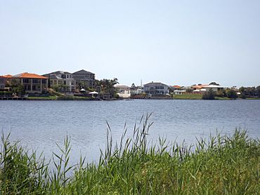
Canal homes, 2015
|
|||||||||||||||
| Population | 4,395 (2021 census) | ||||||||||||||
| • Density | 1,022/km2 (2,650/sq mi) | ||||||||||||||
| Established | 1989 | ||||||||||||||
| Postcode(s) | 4226 | ||||||||||||||
| Elevation | 3 m (10 ft) | ||||||||||||||
| Area | 4.3 km2 (1.7 sq mi) | ||||||||||||||
| Time zone | AEST (UTC+10:00) | ||||||||||||||
| Location |
|
||||||||||||||
| LGA(s) | City of Gold Coast | ||||||||||||||
| State electorate(s) | Surfers Paradise | ||||||||||||||
| Federal Division(s) | McPherson | ||||||||||||||
|
|||||||||||||||
Clear Island Waters is a suburb located on the Gold Coast in Queensland, Australia. It's a place where about 4,395 people live, according to the 2021 census.
Contents
What is Clear Island Waters Like?
Clear Island Waters is a residential area, meaning it's mostly homes. It's built around man-made waterways called canals. These canals connect to Clear Island Lake and Boobegan Creek. Imagine living right by the water!
How Did Clear Island Waters Begin?
Long ago, in the early 1900s, the land where Clear Island Waters now stands was very different. It was a dairy farming area in the south. The northern part was covered in wetlands, which are like swampy areas.
The Golf Club's Story
- In 1967, a property developer named Bruce Small bought a large piece of land.
- He later became the Gold Coast Mayor.
- Bruce Small convinced a group of golfers to buy his land.
- They wanted to build the Surfers Paradise Golf Club there.
Italian Community and Schools
- In 1976, some Italian families on the Gold Coast started the Italo-Australian Club.
- This club was built next to the Surfers Paradise Golf Club.
- Because of the club, many Italian families moved to the area.
- In 1986, St Vincent's Primary School moved to Clear Island Waters.
- The Sacred Heart Parish Church also opened next to the school.
Becoming an Official Suburb
- Clear Island Waters officially became a suburb on February 25, 1989.
- In the early 1990s, plans were approved to build many canal estates.
- These new areas were called Island Quay, Rhode Island, and Santa Cruz.
Who Lives in Clear Island Waters?
In 2021, about 4,395 people called Clear Island Waters home. Here are some interesting facts about the people living there:
- In 2011, there were more females (52.6%) than males (47.4%).
- The average age was 49 years old. This was a bit older than the national average of 37.
- Most people (56.7%) were born in Australia.
- Other common birthplaces included England (6.9%) and New Zealand (6.8%).
- Most people (75.7%) spoke only English at home.
- Other languages spoken included Mandarin, Cantonese, Japanese, and Italian.
Schools in Clear Island Waters
Clear Island Waters has one school:
- St Vincent's Primary School is a Catholic school for kids from Prep to Year 6.
- It's located on Fairway Drive.
- In 2017, the school had 764 students.
There are no government schools directly in Clear Island Waters. Students usually go to nearby schools like:
- Broadbeach State School (for primary)
- Robina State School (for primary)
- Merrimac State School (for primary)
- Merrimac State High School (for secondary)
Sports and Clubs
Clear Island Waters is a great place for sports!
- The Surfers Paradise Golf Club is located here.
- The Surfers Paradise Tennis Club is also on Fairway Drive.
- The soccer club Merrimac F.C. is in the suburb.
- This soccer club is run by the Italo-Australian club.
 | Aurelia Browder |
 | Nannie Helen Burroughs |
 | Michelle Alexander |


