Clinton (CDP), Maine facts for kids
Quick facts for kids
Clinton, Maine
|
|
|---|---|

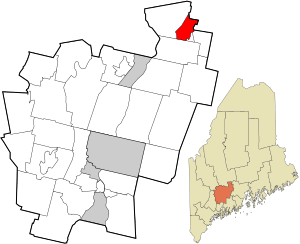
Location in Kennebec County and the state of Maine
|
|
| Country | United States |
| State | Maine |
| County | Kennebec |
| Town | Clinton |
| Area | |
| • Total | 9.17 sq mi (23.74 km2) |
| • Land | 8.86 sq mi (22.94 km2) |
| • Water | 0.31 sq mi (0.80 km2) |
| Elevation | 131 ft (40 m) |
| Population
(2020)
|
|
| • Total | 1,386 |
| • Density | 156.49/sq mi (60.42/km2) |
| Time zone | UTC-5 (Eastern (EST)) |
| • Summer (DST) | UTC-4 (EDT) |
| ZIP code |
04927
|
| Area code(s) | 207 |
| FIPS code | 23-13435 |
| GNIS feature ID | 0564107 |
Clinton is a special kind of community called a census-designated place (CDP). It's the main village in the larger town of Clinton. You can find it in Kennebec County, in the state of Maine, United States.
In 2020, about 1,386 people lived in the Clinton CDP. The entire town of Clinton had a population of 3,486 people in 2010.
Contents
Where is Clinton Located?
Clinton is in the northeastern part of Kennebec County. It sits on the north side of the Sebasticook River. This river flows into the larger Kennebec River.
Nearby Areas and Roads
The Clinton CDP includes the main village and some rural land around it. To the south, it borders the town of Benton. The Sebasticook River forms its eastern border. To the northeast, it touches the Waldo County line near the town of Burnham.
Interstate 95 runs along the north and west sides of Clinton. You can get onto I-95 from Exit 138, which is west of the village. I-95 can take you to Pittsfield (about 12 miles northeast) or Bangor (about 47 miles northeast). If you head southwest on I-95, you'll reach Waterville (about 9 miles away) and Augusta (about 28 miles away), which is Maine's capital city.
Maine State Routes 11 and 100 pass through Clinton village. They are known as Main Street. These routes lead northeast to Burnham village (about 5 miles) and southwest to Fairfield (about 7 miles).
Size of Clinton
The United States Census Bureau says that the Clinton CDP covers a total area of about 9.17 square miles (23.7 square kilometers). Most of this area, about 8.86 square miles (22.9 square kilometers), is land. The rest, about 0.31 square miles (0.8 square kilometers), is water.
Who Lives in Clinton?
| Historical population | |||
|---|---|---|---|
| Census | Pop. | %± | |
| 2020 | 1,386 | — | |
| U.S. Decennial Census | |||
Let's look at the people who live in Clinton, based on information from the 2000 census.
Population Details
In 2000, there were 1,305 people living in the Clinton CDP. These people lived in 510 households, and 363 of these were families. The population density was about 147 people per square mile.
Most of the people in Clinton were White (about 98.85%). A small number were Black (0.08%), Native American (0.38%), or from other backgrounds. About 0.77% of the population identified as Hispanic or Latino.
Households and Families
Out of the 510 households, about 34.9% had children under 18 living there. More than half (52.7%) were married couples living together. About 13.1% were led by a female with no husband present.
About 21.6% of all households were made up of people living alone. Of these, 9.6% were people aged 65 or older living by themselves. On average, there were about 2.56 people in each household and 2.95 people in each family.
Age Groups
The population in Clinton was spread across different age groups:
- About 27.4% were under 18 years old.
- About 8.3% were between 18 and 24 years old.
- About 30.3% were between 25 and 44 years old.
- About 23.7% were between 45 and 64 years old.
- About 10.3% were 65 years old or older.
The average age of people in Clinton was 36 years old. For every 100 females, there were about 97.4 males.
See also
 In Spanish: Clinton (condado de Kennebec) para niños
 | Aurelia Browder |
 | Nannie Helen Burroughs |
 | Michelle Alexander |

