
Coaldale, Schuylkill County, Pennsylvania facts for kids
Quick facts for kids
Coaldale, Pennsylvania
|
|
|---|---|
|
Borough
|
|

Coaldale Town Hall in July 2015
|
|

Location of Coaldale in Schuylkill County, Pennsylvania
|
|

Coaldale, Schuylkill County, Pennsylvania
Location in Pennsylvania

Coaldale, Schuylkill County, Pennsylvania
Location in the United States
|
|
| Country | United States |
| State | Pennsylvania |
| County | Schuylkill |
| Incorporated | 1906 |
| Government | |
| • Type | Borough Council |
| Area | |
| • Total | 2.17 sq mi (5.63 km2) |
| • Land | 2.17 sq mi (5.63 km2) |
| • Water | 0.00 sq mi (0.00 km2) |
| Elevation | 968 ft (295 m) |
| Population
(2020)
|
|
| • Total | 2,426 |
| • Density | 1,115.40/sq mi (430.58/km2) |
| Time zone | UTC-5 (Eastern (EST)) |
| • Summer (DST) | UTC-4 (EDT) |
| ZIP Code |
18218
|
| Area code(s) | 570 and 272 |
| FIPS code | 42-14600 |
| GNIS feature ID | 1215545 |
Coaldale is a small town, also called a borough, in Schuylkill County, Pennsylvania. It was first settled in 1827 and became an official borough in 1906. The town got its name from the important coal industry that once thrived there. Coaldale was one of the first major coal mining areas.
Coaldale is located in the southern part of the Anthracite Coal region. It sits in the Panther Creek Valley, which is a valley along a small river. U.S. Route 209 runs through this valley. The town is very close to Lansford, almost like they are one town. Both were started as "company towns." This means they were built by a company, the Lehigh Coal & Navigation Company (LC&N). This company owned the land and mined the coal.
The history of Coaldale, Lansford, and nearby Summit Hill are all connected. The LC&N company built the second railroad in the country. It was called the Summit Hill and Mauch Chunk Gravity Railway. This railroad helped ship coal out of the area. The company opened many mines in Coaldale and Lansford. You can see a bus stop in town with a mural that says, "Everybody's Goal Is Mine More Coal" on one side. The other side says, "A Car More a Day Means More Pay."
A historical marker in Coaldale honors Mother Jones. She was a famous organizer who fought for better pay and safer conditions for coal miners. She also worked to end child labor. She even organized a march for child workers that started in Coaldale.
Herbert Whildin became the mayor of Coaldale in 2017.
Contents
History of Coaldale
The story of Coaldale began in the areas known as West Penn and Rahn. Rahn Township was created in 1860. At first, people came to the land for its timber (wood from trees). Only a few farms were there.
The first steps toward today's Coaldale happened in 1827. That's when John Moser and his wife settled there. John Moser was born in 1805 in Tamaqua. His parents were the first settlers of Tamaqua. John Moser built a log cabin in what is now Coaldale. This cabin was on the north side of a place called Manila Grove Park. Today, the St. Luke's Hospital stands on that spot.
Coaldale grew from several small villages. The first houses, besides Moser's cabin, were built in 1846. This area was called Bugtown. More houses were built in 1848 in "old Coal Dale."
Gearytown was started in 1866. It was named after John W. Geary, who was the governor of Pennsylvania at the time. Houses in Bull Run were built in 1864 by the Greenwood Coal Co. As the mines started working, more people moved in. Many new homes were built, mostly by the mining company. New Wales, also called New Coal Dale, began around 1868 or 1869. Houses were built along the border of Schuylkill and Carbon counties starting in 1870. Another area, Centerville, was on the south side of Coaldale. It was later left empty because of mines underneath it.
Coaldale got its own post office in 1871. This made the name "Coaldale" official. The Greenwood coal breaker (a building where coal was processed) burned down in 1874. In 1878, the Lehigh Navigation and Coal Co. bought this property. Coaldale was surrounded by many LC&N mines.
Coaldale was a town built around coal mining. The entire area was owned by the Lehigh Coal & Navigation Company. The main jobs in Coaldale were in the mines, on the railroads, and in a small shirt factory. Because the land was very hilly, it took the LC&N company many years to build a railroad. This railroad helped move coal from Mauch Chunk through the valleys to Tamaqua.
Coaldale also became home to a State Hospital. This hospital was built to care for injured coal miners. Before the hospital, badly hurt miners had to travel far for help. In 1909, the miners in the valley gave up a day's pay to help build a hospital. The LC&N company gave the land for the hospital and matched every dollar donated. The hospital was built in Manila Grove, where John Moser first lived. It opened on July 11, 1910. Today, it is known as St. Luke's Miners Memorial Medical Center.
Notable People from Coaldale
Many interesting people have come from Coaldale, including:
- Johnny Gildea, a former professional football player.
- George Welsh, who was a great quarterback at the US Naval Academy. He also became a very successful college football coach.
- Albert B. Morgan, a miner and musician. He wrote and recorded his song "Union Man" in 1946. This song was part of a collection of miner songs for the Library of Congress.
Geography of Coaldale

Coaldale is located at 40°49′20″N 75°54′36″W / 40.82222°N 75.91000°W. It is about one mile southwest of Lansford. Both towns are on the border of Carbon and Schuylkill Counties. Coaldale is also five miles northeast of Tamaqua. It is 27 miles northwest of Allentown and nine miles south of Hazleton.
Coaldale is on the edge of the Lehigh Valley. It is also close to the Poconos. Water from Coaldale flows into Panther Creek, then the Little Schuylkill River, and finally the Schuylkill River to the Delaware River. Coaldale sits on top of some of the richest coal deposits in the eastern part of the southern Coal Region. A company that took over from the LC&N still mines coal there today. Coaldale is about 1050 feet (320 meters) above sea level.
The United States Census Bureau says that Coaldale covers about 2.2 square miles (5.6 square kilometers) of land. There is no water area. U.S. Route 209 runs through Lansford's main area and serves as the main road for both towns. Coaldale's land is mostly hilly. Many of these hills are old piles of mine waste, called culm piles. When the land is not built on, it is mostly covered by forests.
Population and People
| Historical population | |||
|---|---|---|---|
| Census | Pop. | %± | |
| 1910 | 5,154 | — | |
| 1920 | 6,336 | 22.9% | |
| 1930 | 6,921 | 9.2% | |
| 1940 | 6,163 | −11.0% | |
| 1950 | 5,318 | −13.7% | |
| 1960 | 3,949 | −25.7% | |
| 1970 | 3,023 | −23.4% | |
| 1980 | 2,762 | −8.6% | |
| 1990 | 2,531 | −8.4% | |
| 2000 | 2,295 | −9.3% | |
| 2010 | 2,281 | −0.6% | |
| 2020 | 2,432 | 6.6% | |
| 2021 (est.) | 2,431 | 6.6% | |
| Sources: | |||
In 2000, there were 2,295 people living in Coaldale. There were 1,046 households, and 606 families. The population density was about 1,055 people per square mile. Most of the people living in Coaldale were White (98.34%).
About 19.2% of the people were under 18 years old. About 28.5% were 65 years or older. The average age in Coaldale was 44 years. The average income for a household was $23,362. For a family, it was $31,905. About 13.2% of the population lived below the poverty line. This included 23.7% of those under 18.
Buildings and Architecture
Coaldale's town hall and fire department building were built in 1907. They were designed by an architect named Owen McGlynn from Wilkes-Barre.
Gallery
-
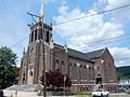
Church on Ruddle St.
-
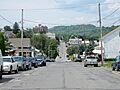
Ruddle St.
-
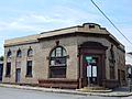
Former bank, 1910
-
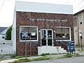
Post Office
-
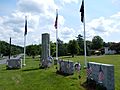
War Memorial


See also
 In Spanish: Coaldale (condado de Schuylkill, Pensilvania) para niños
