
Coffeyville, Kansas facts for kids
Quick facts for kids
Coffeyville, Kansas
|
|||
|---|---|---|---|

Sign at the west entrance (2016)
|
|||
|
|||

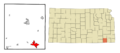
Location within Montgomery County and Kansas
|
|||

|
|||
| Country | United States | ||
| State | Kansas | ||
| County | Montgomery | ||
| Founded | 1869 | ||
| Incorporated | 1873 | ||
| Named for | James A. Coffey | ||
| Area | |||
| • Total | 9.47 sq mi (24.52 km2) | ||
| • Land | 9.47 sq mi (24.52 km2) | ||
| • Water | 0.00 sq mi (0.00 km2) | ||
| Elevation | 735 ft (224 m) | ||
| Population
(2020)
|
|||
| • Total | 8,826 | ||
| • Density | 932.0/sq mi (359.95/km2) | ||
| Time zone | UTC-6 (CST) | ||
| • Summer (DST) | UTC-5 (CDT) | ||
| ZIP code |
67337
|
||
| Area code | 620 | ||
| FIPS code | 20-14600 | ||
| GNIS ID | 485556 | ||

Coffeyville is a city in southeastern Montgomery County, Kansas, United States. It is located along the Verdigris River in the southeastern part of the state. In 2020, about 8,826 people lived there. Coffeyville is the biggest city in Montgomery County and is home to Coffeyville Community College. The town of South Coffeyville, Oklahoma is only about 1 mile (1.6 km) south of the city.
Contents
History of Coffeyville

Coffeyville was started in 1869 by Colonel James A. Coffey. It began as a trading post for Native Americans living nearby. In 1871, the city grew when the Leavenworth, Lawrence & Galveston Railroad came through. This connected Coffeyville to other towns and markets.
A surveyor named Napoleon B. Blanton helped plan the town. Colonel Coffey won a coin toss against Captain Blanton, and the town was officially named Coffeyville. The city became an official town in 1873.
The Dalton Gang Shootout
As a frontier town, Coffeyville had some exciting moments. On October 5, 1892, a famous group of outlaws called the Dalton Gang tried to rob two banks at the same time. The banks were located across the street from each other.
However, the town's people recognized the gang members, even though they wore fake beards. As the gang tried to escape, citizens fought back. Four members of the Dalton Gang were killed in the shootout. Four brave citizens also died defending their town, including a U.S. marshal. The city remembers this event every October with a special celebration.
Growth and Industry

Coffeyville grew quickly between 1890 and 1910. This was because natural gas and clay were found in the area. The city became a major center for making glass and bricks.
Later, oil was discovered, which brought more factories that made equipment for oil fields. During World War II, a local businessman named Douglas Brown helped make parts for the Norden bombsight. This important device helped planes drop bombs very accurately.
The 2007 Flood
On July 1, 2007, Coffeyville had a big flood. The Verdigris River rose very high, and about one-third of the city was flooded. A local oil refinery's protective walls were topped by the water. This caused some crude oil to mix with the floodwaters.
The EPA worked hard to clean up the oil and stop it from spreading. Many people had to leave their homes. The Federal Emergency Management Agency (FEMA) and the Red Cross came to help. The Governor of Kansas and the U.S. President declared Coffeyville a disaster area.
The community worked together to recover. The annual Inter-State Fair & Rodeo was canceled that year so everyone could focus on cleaning up. Many damaged homes were bought by the oil company to help the residents.
Geography of Coffeyville

Coffeyville is in the very southeast corner of Kansas. It is about 75 miles (121 km) north of Tulsa, Oklahoma, and 60 miles (97 km) west of Joplin, Missouri. The city is located along the west bank of the Verdigris River.
An interesting fact is that Coffeyville is the lowest point in Kansas, at 679 feet (207 m) above sea level. The Coffeyville Municipal Airport is a few miles northeast of the city. Even though Coffeyville is the biggest city in Montgomery County, the county seat (main government town) is Independence, which is about 16 miles (26 km) northwest.
Some people say that a spot just north of the Coffeyville Country Club is the default center point of Google Maps. This is because it's in the middle of the map that shows the 48 connected United States.
Climate
| Climate data for Coffeyville, Kansas | |||||||||||||
|---|---|---|---|---|---|---|---|---|---|---|---|---|---|
| Month | Jan | Feb | Mar | Apr | May | Jun | Jul | Aug | Sep | Oct | Nov | Dec | Year |
| Record high °F (°C) | 74 (23) |
86 (30) |
90 (32) |
100 (38) |
95 (35) |
104 (40) |
116 (47) |
112 (44) |
108 (42) |
98 (37) |
86 (30) |
78 (26) |
116 (47) |
| Mean daily maximum °F (°C) | 42 (6) |
48 (9) |
58 (14) |
68 (20) |
76 (24) |
85 (29) |
90 (32) |
91 (33) |
82 (28) |
70 (21) |
57 (14) |
45 (7) |
68 (20) |
| Mean daily minimum °F (°C) | 20 (−7) |
25 (−4) |
34 (1) |
43 (6) |
55 (13) |
64 (18) |
68 (20) |
66 (19) |
57 (14) |
45 (7) |
34 (1) |
23 (−5) |
45 (7) |
| Record low °F (°C) | −20 (−29) |
−16 (−27) |
−6 (−21) |
14 (−10) |
28 (−2) |
40 (4) |
47 (8) |
45 (7) |
27 (−3) |
15 (−9) |
2 (−17) |
−18 (−28) |
−20 (−29) |
| Average precipitation inches (mm) | 1.65 (42) |
2.04 (52) |
3.47 (88) |
4.32 (110) |
6.60 (168) |
5.98 (152) |
3.83 (97) |
3.54 (90) |
4.87 (124) |
4.14 (105) |
2.98 (76) |
2.28 (58) |
45.7 (1,162) |
| Average snowfall inches (cm) | 7.7 (20) |
6 (15) |
3.8 (9.7) |
1 (2.5) |
0 (0) |
0 (0) |
0 (0) |
0 (0) |
0 (0) |
0.1 (0.25) |
1.6 (4.1) |
6 (15) |
26.2 (66.55) |
| Source: http://www.weather.com/weather/wxclimatology/monthly/graph/USKS0119 | |||||||||||||
Population and Demographics
| Historical population | |||
|---|---|---|---|
| Census | Pop. | %± | |
| 1880 | 753 | — | |
| 1890 | 2,282 | 203.1% | |
| 1900 | 4,953 | 117.0% | |
| 1910 | 12,687 | 156.1% | |
| 1920 | 13,452 | 6.0% | |
| 1930 | 16,198 | 20.4% | |
| 1940 | 17,355 | 7.1% | |
| 1950 | 17,113 | −1.4% | |
| 1960 | 17,382 | 1.6% | |
| 1970 | 15,116 | −13.0% | |
| 1980 | 15,185 | 0.5% | |
| 1990 | 12,917 | −14.9% | |
| 2000 | 11,021 | −14.7% | |
| 2010 | 10,295 | −6.6% | |
| 2020 | 8,826 | −14.3% | |
| U.S. Decennial Census 2010-2020 |
|||
Coffeyville's population has slowly decreased since the 1960s. This is mainly because some industries changed, leading to fewer jobs. People moved to other places to find work.
2020 Census Information
In 2020, there were 8,826 people living in Coffeyville. The city had 3,587 households. About 27.5% of these households had children under 18 years old.
The population included people from many different backgrounds. About 64.66% were white, 11.18% were African American, and 4.2% were Native American. About 12.62% of the population identified as Hispanic or Latino.
The average age in Coffeyville was 37.7 years. About 23.6% of the people were under 18.
Economy and Industries
Coffeyville has a long history of important industries and factories.
- Coffeyville Resources runs a large oil refinery and a plant that makes nitrogen fertilizer.
- Sherwin-Williams Chemical Co. has been operating a metal-smelting factory in the city since 1909.
- John Deere Corporation has a factory in Coffeyville. It makes parts for big machines used in construction, farming, and mining.
- Acme Foundry is a metal casting company that has been open since 1905. It employs more than 300 people.
- Taylor Crane & Rigging is a company that moves heavy industrial equipment and offers crane services.
Education in Coffeyville

Coffeyville has good schools for its students.
Public Schools
The public school district, Coffeyville USD 445, teaches about 2,000 students. It has several schools:
- Field Kindley High School (grades 9–12), named after a famous aviator.
- Roosevelt Middle School (grades 7–8).
- Community Elementary School (grades K–6).
- Dr. Jerry Hamm Early Learning Center (preschool).
Private Schools
- Holy Name School is a private Catholic school for students in grades PK-6.
Colleges and Higher Education
Coffeyville Community College offers advanced education. It has a main campus and a technical trades campus in Coffeyville. You can also earn four-year college degrees through other universities like Oklahoma Wesleyan University at the community college campus. Coffeyville Community College is known for its strong academic and sports programs.
Transportation
Coffeyville has several ways to get around.
- Bus Service: Jefferson Lines provides bus service to cities like Kansas City, Missouri (north) and Tulsa, Oklahoma (south). Connections Transportation also serves Coffeyville and nearby towns.
- Railroads: Two railroads serve the community: the Union Pacific Railroad and the South Kansas and Oklahoma Railroad.
- Highways: Two U.S. highways pass through Coffeyville: US 166 (east-west) and US 169 (north-south).
- Airport: The Coffeyville Municipal Airport (KCFV) is a few miles northeast of the city. For bigger flights, people use Tulsa International Airport, which is about 66 miles (106 km) south.
Media
- Newspaper: The local newspaper is the Coffeyville Journal, published twice a week.
- Radio Stations: Coffeyville has several radio stations. KGGF (690 AM) plays news and talk shows. KUSN (98.1 FM) plays country music. KGGF-FM (104.1 FM) plays oldies. KQQF (98.9 FM) also broadcasts from Coffeyville.
- Television: Coffeyville is part of the Tulsa, Oklahoma television market.
Notable People from Coffeyville
Many interesting people have come from or lived in Coffeyville:
- Mildred "Micky" Axton, aviator and educator
- Terry Beeson, NFL football player
- Mildred Burke, famous professional wrestler
- Phil Ehart, drummer for the rock band Kansas
- Walter Johnson, a legendary baseball player in the Hall of Fame
- Field Eugene Kindley, a brave aviator and World War I hero
- Omar Knedlik, inventor of the ICEE frozen drink
- Rudy May, former Major League baseball pitcher
- Johnny Rutherford, race car driver and 3-time Indy 500 winner
- Cynthia Sikes, actress
- Wendell Willkie, a politician who ran for President in 1940
Images for kids
-

Sign at the west entrance (2016)
-

Flag of Coffeyville, Kansas
-

Logo of Coffeyville, Kansas
-
Location within Montgomery County and Kansas
-
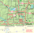
KDOT map of Montgomery County
See also
 In Spanish: Coffeyville para niños
