Coffey County, Kansas facts for kids
Quick facts for kids
Coffey County
|
|
|---|---|

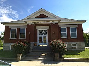
Burlington Carnegie Free Library (2016)
|
|

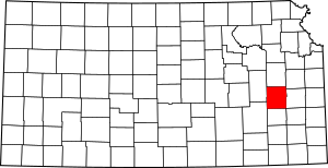
Location within the U.S. state of Kansas
|
|
 Kansas's location within the U.S. |
|
| Country | |
| State | |
| Founded | August 25, 1855 |
| Named for | Asbury M. Coffey |
| Seat | Burlington |
| Largest city | Burlington |
| Area | |
| • Total | 654 sq mi (1,690 km2) |
| • Land | 627 sq mi (1,620 km2) |
| • Water | 27 sq mi (70 km2) 4.2%% |
| Population
(2020)
|
|
| • Total | 8,360 |
| • Density | 13.3/sq mi (5.1/km2) |
| Time zone | UTC−6 (Central) |
| • Summer (DST) | UTC−5 (CDT) |
| Area code | 620 |
| Congressional district | 2nd |
Coffey County is a county in Eastern Kansas. Its main city and county seat is Burlington. In 2020, about 8,360 people lived here. The county was named after A.M. Coffey. He was a lawmaker who supported Kansas becoming a free state. This was during a tough time called the "Bleeding Kansas" era.
Contents
History of Coffey County
Early Times
For thousands of years, Native American groups lived on the Great Plains of North America. They often moved around to hunt and gather food. From the 1500s to the 1700s, France claimed much of North America. In 1762, France secretly gave this land to Spain. This happened after a big war called the French and Indian War.
The 1800s
In 1802, Spain gave most of the land back to France. Then, in 1803, the United States bought a huge area from France. This was part of the Louisiana Purchase. It included most of what is now Kansas. In 1854, the Kansas Territory was set up. Kansas officially became the 34th U.S. state in 1861. Coffey County was created in 1855.
Where is Coffey County?
Coffey County covers about 654 square miles. Most of this area is land, about 627 square miles. The rest, about 27 square miles, is water.
Neighboring Counties
Coffey County shares its borders with several other counties:
- Osage County (to the north)
- Franklin County (to the northeast)
- Anderson County (to the east)
- Allen County (to the southeast)
- Woodson County (to the south)
- Greenwood County (to the southwest)
- Lyon County (to the northwest)
Main Roads
Several important roads pass through Coffey County:
- Interstate 35
- U.S. Route 50
- U.S. Route 75
- K-31
- K-58
Special Nature Areas
Part of the Flint Hills National Wildlife Refuge is located in Coffey County. This is a protected area for wildlife.
People of Coffey County
| Historical population | |||
|---|---|---|---|
| Census | Pop. | %± | |
| 1860 | 2,842 | — | |
| 1870 | 6,201 | 118.2% | |
| 1880 | 11,438 | 84.5% | |
| 1890 | 15,856 | 38.6% | |
| 1900 | 16,643 | 5.0% | |
| 1910 | 15,205 | −8.6% | |
| 1920 | 14,254 | −6.3% | |
| 1930 | 13,653 | −4.2% | |
| 1940 | 12,278 | −10.1% | |
| 1950 | 10,408 | −15.2% | |
| 1960 | 8,403 | −19.3% | |
| 1970 | 7,397 | −12.0% | |
| 1980 | 9,370 | 26.7% | |
| 1990 | 8,404 | −10.3% | |
| 2000 | 8,865 | 5.5% | |
| 2010 | 8,601 | −3.0% | |
| 2020 | 8,360 | −2.8% | |
| 2023 (est.) | 8,251 | −4.1% | |
| U.S. Decennial Census 1790-1960 1900-1990 1990-2000 2010-2020 |
|||
In 2000, there were 8,865 people living in Coffey County. Most people were White (about 97%). About 1.5% of the population was Hispanic or Latino. The average age of people in the county was 39 years old. About 27% of the population was under 18 years old.
Learning and Schools
School Districts
Coffey County has several school districts:
- Lebo–Waverly USD 243
- Burlington USD 244
- LeRoy–Gridley USD 245 (Southern Coffey County)
Some school district offices are in neighboring counties:
- Southern Lyon County USD 252
- Garnett USD 365
Towns and Communities
Coffey County has several cities and smaller communities. The county is also divided into fourteen areas called townships.
Cities in Coffey County
- Burlington (This is the main city and county seat)
- Gridley
- Lebo
- LeRoy
- New Strawn
- Waverly
Small Towns and Areas
Famous People
- Alan L. Hart (1890–1962), a doctor, researcher, and writer. He was also a transgender man.
See also
 In Spanish: Condado de Coffey para niños
 | Selma Burke |
 | Pauline Powell Burns |
 | Frederick J. Brown |
 | Robert Blackburn |


