
Anderson County, Kansas facts for kids
Quick facts for kids
Anderson County
|
|
|---|---|

Anderson County Courthouse in Garnett (2016)
|
|

Location within the U.S. state of Kansas
|
|
 Kansas's location within the U.S. |
|
| Country | |
| State | |
| Founded | August 25, 1855 |
| Named for | Joseph C. Anderson |
| Seat | Garnett |
| Largest city | Garnett |
| Area | |
| • Total | 584 sq mi (1,510 km2) |
| • Land | 580 sq mi (1,500 km2) |
| • Water | 7.1 sq mi (18 km2) 0.7%% |
| Population
(2020)
|
|
| • Total | 7,836 |
| • Density | 13.5/sq mi (5.2/km2) |
| Time zone | UTC−6 (Central) |
| • Summer (DST) | UTC−5 (CDT) |
| Area code | 785 |
| Congressional district | 3rd |
Anderson County is a county in East Central Kansas. It is located in the Central United States. The main city and county seat is Garnett. This is also the city with the most people.
In 2020, about 7,836 people lived in Anderson County. The county is named after Joseph C. Anderson. He was a lawmaker in the Kansas Territory. He was part of the "Bleeding Kansas" time, which was a period of conflict before the American Civil War.
Contents
History of Anderson County
How Anderson County Started
For thousands of years, Native Americans lived on the Great Plains. They often moved around to hunt and gather food.
Later, in the 16th to 18th centuries, France claimed much of North America. In 1762, France gave a large area, called New France, to Spain. This happened after a big war.
The 1800s
In 1803, the United States bought a huge amount of land from France. This was called the Louisiana Purchase. Most of what is now Kansas was part of this purchase. The U.S. paid a very small amount per acre.
In 1854, the Kansas Territory was created. Then, in 1861, Kansas became the 34th U.S. state. Anderson County was officially started in 1855. It was named after Joseph C. Anderson.
Something cool happened in Anderson County in 1884. The very first photograph of a tornado was taken there!
Geography of Anderson County
Anderson County covers about 584 square miles. Most of this area, about 580 square miles, is land. The rest, about 4.1 square miles, is water. This means about 0.7% of the county is water.
Counties Nearby
Anderson County shares borders with several other counties:
- Franklin County (to the north)
- Miami County (to the northeast)
- Linn County (to the east)
- Bourbon County (to the southeast)
- Allen County (to the south)
- Woodson County (to the southwest)
- Coffey County (to the west)
Main Roads
These are the major highways that go through Anderson County:
- U.S. Route 59
- U.S. Route 169
- Kansas Highway 31
- Kansas Highway 52
- Kansas Highway 58
People in Anderson County (Demographics)

| Historical population | |||
|---|---|---|---|
| Census | Pop. | %± | |
| 1860 | 2,400 | — | |
| 1870 | 5,220 | 117.5% | |
| 1880 | 9,057 | 73.5% | |
| 1890 | 14,203 | 56.8% | |
| 1900 | 13,938 | −1.9% | |
| 1910 | 13,829 | −0.8% | |
| 1920 | 12,986 | −6.1% | |
| 1930 | 13,355 | 2.8% | |
| 1940 | 11,658 | −12.7% | |
| 1950 | 10,267 | −11.9% | |
| 1960 | 9,035 | −12.0% | |
| 1970 | 8,501 | −5.9% | |
| 1980 | 8,749 | 2.9% | |
| 1990 | 7,803 | −10.8% | |
| 2000 | 8,110 | 3.9% | |
| 2010 | 8,102 | −0.1% | |
| 2020 | 7,836 | −3.3% | |
| 2023 (est.) | 7,838 | −3.3% | |
| U.S. Decennial Census 1790-1960 1900-1990 1990-2000 2010-2020 |
|||
In 2000, there were 8,110 people living in Anderson County. These people lived in 3,221 households. About 2,264 of these were families. The county had about 14 people per square mile.
Most people in the county were White (97.41%). A small number were Black (0.32%) or Native American (0.74%). People of Hispanic or Latino background made up about 1.09% of the population. Many people had German (35.0%), American (20.4%), English (10.4%), or Irish (9.9%) roots.
About 31% of households had children under 18 living there. Most households (59.9%) were married couples. The average household had 2.48 people.
The population's age spread out. About 26.2% were under 18 years old. About 20% were 65 years or older. The average age in the county was 40 years.
Education in Anderson County
School Districts
Anderson County has a few school districts:
- Garnett USD 365
- Crest USD 479
Communities in Anderson County

Anderson County has several cities, towns, and even some places that used to be towns.
Cities
Unincorporated Communities
These are smaller communities that are not officially cities. Some are called "Census-Designated Places" (CDP) by the U.S. Census Bureau.
Ghost Towns
Townships
Anderson County is divided into fourteen areas called townships. The city of Garnett is separate from these township figures.
- Indian Creek
- Jackson
- Lincoln
- Lone Elm
- Monroe
- North Rich
- Ozark
- Putnam
- Reeder
- Rich
- Walker
- Washington
- Welda
- Westphalia
Media
The Anderson County Review is a newspaper that comes out every week.
Images for kids
-
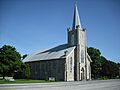
St. Boniface Catholic Church in Scipio.

See also
 In Spanish: Condado de Anderson (Kansas) para niños
