Collins, New York facts for kids
Quick facts for kids
Collins
|
|
|---|---|
| Town of Collins | |

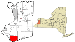
Location in Erie County and the state of New York.
|
|

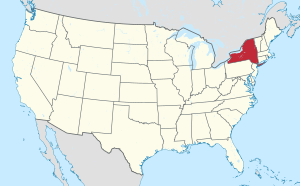
Location of New York in the United States
|
|
| Country | United States |
| State | New York |
| County | Erie |
| Incorporated | 1821 |
| Area | |
| • Total | 48.14 sq mi (124.68 km2) |
| • Land | 47.97 sq mi (124.23 km2) |
| • Water | 0.17 sq mi (0.45 km2) |
| Elevation | 1,079 ft (329 m) |
| Population
(2020)
|
|
| • Total | 5,894 |
| • Density | 137.16/sq mi (52.96/km2) |
| Time zone | UTC-5 |
| • Summer (DST) | UTC-4 (EDT) |
| ZIP code |
14034
|
| Area code(s) | 716 |
| FIPS code | 36-029-17200 |
Collins is a town located in Erie County, New York, United States. It's on the southern edge of the county. Collins is known as one of the "Southtowns" of Erie County. In 2010, about 6,601 people lived there.
Contents
What is the History of Collins?
People from Europe first settled in the Collins area in 1811. Many of these early settlers were Quakers. They came with the goal of helping the local Native Americans.
The town of Collins was officially created on March 6, 1821. It was formed from a part of the town of Concord. The town got its name from the Collins family, who were well-known dairy farming family in the area.
Over time, Collins gave up some of its land to create new towns. This happened when Brant was formed in 1839 and North Collins in 1852. Because so many dairy farms were in the area, Collins once had ten different factories that made cheese and milk!
Where is Collins Located?
Collins covers a total area of about 124.7 square kilometers (48.14 square miles). Most of this area is land, with only a small part being water.
The southern border of Collins is formed by Cattaraugus Creek. This creek also marks the line between Erie County and Cattaraugus County.
Several important roads run through Collins. U.S. Route 62 goes from north to south. New York State Route 39 runs east to west and crosses with New York State Route 75.
What is the Population of Collins?
| Historical population | |||
|---|---|---|---|
| Census | Pop. | %± | |
| 1830 | 2,120 | — | |
| 1840 | 4,257 | 100.8% | |
| 1850 | 4,001 | −6.0% | |
| 1860 | 2,119 | −47.0% | |
| 1870 | 2,100 | −0.9% | |
| 1880 | 2,371 | 12.9% | |
| 1890 | 2,362 | −0.4% | |
| 1900 | 2,875 | 21.7% | |
| 1910 | 3,742 | 30.2% | |
| 1920 | 4,061 | 8.5% | |
| 1930 | 4,424 | 8.9% | |
| 1940 | 5,819 | 31.5% | |
| 1950 | 6,862 | 17.9% | |
| 1960 | 6,984 | 1.8% | |
| 1970 | 6,400 | −8.4% | |
| 1980 | 5,037 | −21.3% | |
| 1990 | 6,020 | 19.5% | |
| 2000 | 8,307 | 38.0% | |
| 2010 | 6,601 | −20.5% | |
| 2020 | 5,894 | −10.7% | |
| U.S. Decennial Census | |||
In the year 2000, there were 8,307 people living in Collins. These people lived in 1,754 households, with 1,187 of them being families. The population density was about 172.6 people per square mile.
Most of the people living in Collins in 2000 were White (66.85%). There were also African American (22.62%), Native American (3.47%), and Asian (0.22%) residents. Some people identified as being from other races or two or more races. About 11.94% of the population was Hispanic or Latino.
About 30% of the households had children under 18 living with them. The average household had 2.50 people, and the average family had 3.04 people. The median age in Collins was 36 years old.
What Communities and Places are in Collins?
Collins is home to several smaller communities and interesting locations:
- Babbitch Corners – A small community in the western part of town. It's at the crossing of NY-39 and Quaker Street.
- Bagdad – A community located northeast of Gowanda.
- Black Hills – This community is named for its unusually dark soil.
- Collins Center – This community is right in the middle of the town. It's where NY-39 and NY-75 meet.
- Collins Correctional Facility – This is a state prison. It's a medium-security facility located next to Gowanda Correctional Facility.
- Gowanda – A village that is partly located in the southwest part of Collins. You can find it on NY-62.
- Gowanda Correctional Facility – Another state prison, also medium-security. It's right next to Collins Correctional Facility. Both prisons used to be a mental health hospital.
- Hutzenlaub Hill – A large hill where several German immigrant families have lived for many generations.
- McIntosh Woods – These woods are between Collins and Gowanda. They are named for the wild McIntosh apple trees that grow there. These trees were planted for patients at the former mental health hospital.
- Seneca Heights – A neighborhood found where Richardson Road and NY-62 (Taylor Hollow Road) meet. The Gernatt Family of Companies is located here.
- Taylor Hollow – A neighborhood in the northeast corner of the town, on NY-62. It's named after the Taylor Family, who owned a large dairy farm there long ago.
- Tubtown – Located near the intersection of Route 62 and Route 39. A company called Waltz Watermann Tubs made tubs here from 1899 to 1933. A bar was named Tubtown in its honor in the 1970s.
- Whites Corners – A place in the northeast corner of the town on NY-75. It was named after Ezekiel White's big farm that was at this intersection.
- Zoar – A community in the southeast corner of the town.
- Zoar Valley – A beautiful valley created by Cattaraugus Creek.
Who are Some Famous People from Collins?
- Elon Howard Eaton – A person who studied birds, was a scholar, and wrote books.
- Daniel R. Gernatt, Sr. and Flavia C. (Schmitz) Gernatt – They were the people who started the Gernatt Family of Companies.
- Frank Manly Thorn (1836–1907) – He was a lawyer, politician, government official, writer, journalist, and inventor. He was the sixth superintendent of the United States Coast and Geodetic Survey. He was born in the part of Collins that later became North Collins.
See also
 In Spanish: Collins (Nueva York) para niños
 | Dorothy Vaughan |
 | Charles Henry Turner |
 | Hildrus Poindexter |
 | Henry Cecil McBay |


