Colter Butte facts for kids
Quick facts for kids Colter Butte |
|
|---|---|

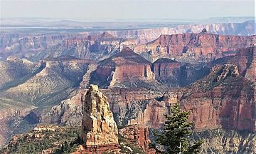
Colter Butte centered.
Northwest aspect as seen from Point Imperial. (summit spire of Mount Hayden in foreground) |
|
| Highest point | |
| Elevation | 7,254 ft (2,211 m) |
| Prominence | 994 ft (303 m) |
| Isolation | 1.94 mi (3.12 km) |
| Parent peak | Alsap Butte (7,500 ft) |
| Geography | |
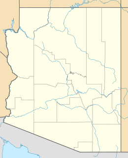
| Location | Grand Canyon National Park Coconino County, Arizona, US |
| Parent range | Kaibab Plateau Colorado Plateau |
| Topo map | USGS Walhalla Plateau |
| Type of rock | sandstone, limestone, shale |
Colter Butte is a tall, flat-topped mountain located in the amazing Grand Canyon in Arizona, USA. It stands 7,254 feet (about 2,211 meters) high. This impressive landform is part of the Grand Canyon National Park, a famous natural wonder.
Contents
What is Colter Butte?
Colter Butte is a type of mountain called a butte. A butte is a tall, isolated hill with steep sides and a small, flat top. Colter Butte rises dramatically, about 3,600 feet (1,100 meters) above Nankoweap Canyon. It's located about four miles southeast of a spot called Point Imperial.
Where is it Located?
You can find Colter Butte in Coconino County, Arizona. It's part of the Kaibab Plateau and the larger Colorado Plateau. Nearby peaks include Brady Peak to the west-northwest and Alsap Butte to the northwest. Swilling Butte is also close by, about half a mile to the east.
Who was Colter Butte Named After?
Colter Butte is named after James G. H. Colter (1844–1922). He was born in Nova Scotia, Canada. James Colter moved to the Arizona Territory in 1872. He was a pioneer, farmer, and cattleman. He was also the father of Fred Colter, who became an Arizona state senator. The name "Colter Butte" was officially recognized in 1932 by the United States Board on Geographic Names.
Rocks and Climate
Colter Butte is made up of different types of rocks. These include sandstone, limestone, and shale. These rocks were formed during the Pennsylvanian and Permian periods of Earth's history. The top layers are part of the Supai Group. Below that is the cliff-forming Redwall Limestone. Underneath that are the older rocks of the Tonto Group.
The area around Colter Butte has a cold semi-arid climate. This means it's generally dry, but it gets some rain and snow. Water from the butte drains into the Colorado River. On the north side, water flows into Nankoweap Creek. From the south side, it flows into Kwagunt Creek.
 | Valerie Thomas |
 | Frederick McKinley Jones |
 | George Edward Alcorn Jr. |
 | Thomas Mensah |


