
Columbia, Virginia facts for kids
Quick facts for kids
Columbia, Virginia
|
|
|---|---|

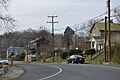
St. James Street
|
|
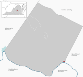 Location of the Columbia CDP within the Fluvanna County
|
|

Columbia, Virginia
Location in Virginia

Columbia, Virginia
Location in the United States
|
|
| Country | United States |
| State | Virginia |
| County | Fluvanna |
| Incorporated | 1788 |
| Disincorporated | 2016 |
| Named for | Columbia (poetic name for the United States) |
| Area | |
| • Total | 0.20 sq mi (0.53 km2) |
| • Land | 0.19 sq mi (0.50 km2) |
| • Water | 0.01 sq mi (0.03 km2) |
| Elevation | 203 ft (62 m) |
| Population
(2010)
|
|
| • Total | 83 |
| • Density | 428/sq mi (165.2/km2) |
| Time zone | UTC−5 (Eastern (EST)) |
| • Summer (DST) | UTC−4 (EDT) |
| ZIP code |
23038
|
| FIPS code | 51-18624 |
| GNIS feature ID | 1492796 |
Columbia, once known as Point of Fork, is a small community in Fluvanna County, Virginia, United States. It's located where the James and Rivanna rivers meet. Until recently, Columbia was the smallest official town in Virginia. However, after a vote by its residents, it stopped being an official town on July 1, 2016.
In 2010, the community had a population of 83 people. This was a jump from 49 people in 2000. Columbia is part of the larger Charlottesville area.
Contents
History
Early Beginnings: Rassawek and Point of Fork
Long before European settlers arrived, the area where Columbia now stands was home to the Monacan Indian Nation. Their main village, called Rassawek, was located here. This was a very important place for the Monacan people.
Later, English settlers came and named the spot "Point of Fork." This name came from the way the James and Rivanna rivers meet, like a fork in the road.
Revolutionary War and the Arsenal
During the American Revolutionary War, a special storage place for weapons and supplies, called an arsenal, was built near Point of Fork. This arsenal was led by a general named Friedrich Wilhelm von Steuben.
In 1781, a group of American Loyalists (people who supported the British) led by Colonel John Graves Simcoe tried to capture the arsenal. General von Steuben quickly ordered his soldiers to move the supplies across the James River. They even threw heavy cannons into the river to hide them, planning to get them back later.
Simcoe did capture the arsenal on June 5, 1781. He thought he had taken a lot of Patriot supplies. However, von Steuben and General Lafayette said that not much was actually lost.
The arsenal was rebuilt and used to supply weapons for other conflicts, like the Whiskey Rebellion and the Battle of Fallen Timbers. It stayed open until 1801. Then, a new, bigger arsenal was built in Richmond.
Columbia's Growth and Decline
After the Revolutionary War, the community changed its name to "Columbia" in 1788. It became an important place for shipping tobacco on the James River. They even had their own special boats called bateaux to carry goods.
Because the James and Rivanna rivers met here, Columbia connected cities like Richmond and Lynchburg (through the James River) and Charlottesville (through the Rivanna River). In the mid-1800s, Columbia was also a stop for stagecoaches traveling between Richmond and Staunton.
However, Columbia began to face tough times. When passenger train service ended in 1958, fewer people came through the town. Then, in 1969 and 1972, big floods from Hurricanes Camille and Agnes destroyed many homes and businesses.
Over the next few decades, the town continued to struggle. Many buildings on its main street were either abandoned or burned down. In 2014, the town's leaders suggested that Columbia stop being an official town and instead be governed by Fluvanna County. This would allow the county to provide financial help.
Even though some people tried to raise money to keep Columbia an independent town, the residents voted in 2015 to give up its town status. The Virginia General Assembly officially removed Columbia's town charter on March 3, 2016. The change became official on July 1, 2016.
Shrine of St. Katharine Drexel: A Special Place
Columbia is home to St. Joseph's Church and Shrine of St. Katharine Drexel. This church is part of the Roman Catholic Diocese of Richmond. It was built by William and Catherine Wakeham, who were English Catholics who moved to Columbia in 1833. They were also abolitionists, meaning they were against slavery. Because of their beliefs, the hill where their house was built became known as Free Hill.
After Catherine Wakeham passed away in 1891, her sons, who were priests, moved away from Columbia. But an elderly African-American man named Zack Kimbro continued to take care of the church's small chapel. He kept it clean and put fresh flowers on the altar.
St. Katharine Drexel, a very special nun, visited the church in 1901. She noticed the sunlight reflecting off the chapel's cross. She met Zack Kimbro, who told her he had prayed for over ten years for Mass to be celebrated in the chapel again.
St. Katharine Drexel then contacted the priests and arranged for Mass to be held regularly at the church. She also started a small school next to the chapel. This school was one of the only places where black children in Fluvanna County could get an education. St. Joseph's Church and its school became a center for one of Virginia's few historically African-American Catholic communities.
Because St. Joseph's Church is on high ground, it was saved from the big floods in the 1900s that damaged other buildings in Columbia. The church is still active today and shares a pastor with another church in Palmyra. It also serves Catholic students from the nearby Fork Union Military Academy.
Geography
Where is Columbia Located?
Columbia is in the southeastern part of Fluvanna County. It sits on the north side of the James River. You can find it at these coordinates: 37°45′8″N 78°9′44″W / 37.75222°N 78.16222°W.
Virginia State Route 6 runs through the community. This road can take you about 4.5 miles northwest to U.S. Route 15 at Dixie. If you head east on Route 6, you'll reach Goochland in about 16 miles.
Charlottesville is about 31 miles to the northwest, and Richmond is about 47 miles to the east.
Land and Water
According to the United States Census Bureau, the area that used to be the town of Columbia covers about 0.5 square kilometers (or 0.19 square miles). A small part of this area, about 0.02 square kilometers (or 4.90%), is water.
Climate: What's the Weather Like?
Columbia has a "Humid Subtropical Climate." This means it has relatively high temperatures and rain spread out fairly evenly throughout the year.
| Climate data for Columbia, Virginia | |||||||||||||
|---|---|---|---|---|---|---|---|---|---|---|---|---|---|
| Month | Jan | Feb | Mar | Apr | May | Jun | Jul | Aug | Sep | Oct | Nov | Dec | Year |
| Mean daily maximum °C (°F) | 8 (46) |
9 (48) |
14 (57) |
20 (68) |
25 (77) |
29 (84) |
31 (87) |
30 (86) |
27 (80) |
21 (69) |
15 (59) |
9 (48) |
19 (66) |
| Mean daily minimum °C (°F) | −4 (24) |
−3 (26) |
0 (32) |
5 (41) |
10 (50) |
15 (59) |
18 (64) |
17 (62) |
13 (55) |
6 (42) |
1 (33) |
−3 (26) |
6 (42) |
| Average precipitation mm (inches) | 81 (3.2) |
71 (2.8) |
91 (3.6) |
84 (3.3) |
94 (3.7) |
91 (3.6) |
110 (4.3) |
110 (4.2) |
84 (3.3) |
84 (3.3) |
71 (2.8) |
79 (3.1) |
1,050 (41.2) |
| Source: Weatherbase | |||||||||||||
Demographics
Population Changes Over Time
| Historical population | |||
|---|---|---|---|
| Census | Pop. | %± | |
| 1860 | 263 | — | |
| 1870 | 311 | 18.3% | |
| 1880 | 239 | −23.2% | |
| 1890 | 239 | 0.0% | |
| 1900 | 216 | −9.6% | |
| 1910 | 157 | −27.3% | |
| 1920 | 185 | 17.8% | |
| 1930 | 154 | −16.8% | |
| 1940 | 144 | −6.5% | |
| 1950 | 119 | −17.4% | |
| 1960 | 86 | −27.7% | |
| 1970 | 125 | 45.3% | |
| 1980 | 111 | −11.2% | |
| 1990 | 58 | −47.7% | |
| 2000 | 49 | −15.5% | |
| 2010 | 83 | 69.4% | |
| 2016 (est.) | 80 | −3.6% | |
| U.S. Decennial Census | |||
The table above shows how Columbia's population has changed over many years, from 1860 to 2010. You can see that the number of people living there has gone up and down over time.
Life in Columbia in 2010
Based on the 2010 census, about 55.6% of the people aged 16 and older in Columbia had jobs. The average income for a household (a group of people living together) was $90,000 per year. For families, the average income was $43,750 per year. The average income per person was $14,956.
About 45.5% of all families were living below the poverty line. This means they had very low incomes compared to what is needed to live comfortably.
Images for kids
-
St. James Street
-

Location of the Columbia CDP within the Fluvanna County

See also
 In Spanish: Columbia (Virginia) para niños
