Columbia Plateau Trail facts for kids
Quick facts for kids Columbia Plateau Trail |
|
|---|---|
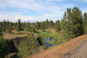
The trail between the Martin Road
and Amber Lake trailheads |
|
| Length | 130 miles (210 km) |
| Location | Eastern Washington |
| Established | 1991 |
| Designation | Washington state park |
| Trailheads | Fish Lake (47°31′19″N 117°30′57″W / 47.52193°N 117.51593°W) Ice Harbor Dam (46°15′12″N 118°52′40″W / 46.25323°N 118.87765°W) |
| Use | Hiking, biking, horseback riding, in-line skating |
| Sights | Turnbull National Wildlife Refuge, Snake River, railroad tunnels and trestles |
| Surface | Various: asphalt, crushed rock |
| Maintained by | Washington State Parks and Recreation Commission |
| Website | Columbia Plateau Trail State Park |
The Columbia Plateau Trail is a very long path in Eastern Washington. It stretches for 130-mile-long (210 km) and is 20-foot-wide (6.1 m). This trail is part of the Washington State Park system.
The trail follows an old railroad line. This line used to belong to the Spokane, Portland and Seattle Railway. It goes from Cheney all the way to where the Snake River and Columbia River meet near Pasco, Washington. It passes through five different counties.
Most of the trail is made of gravel. However, a 3.75 miles (6.04 km) part near Cheney and Fish Lake is paved. You can do many fun activities on the trail. These include hiking, mountain biking, and horseback riding. You can also use in-line skates on the paved parts. It's also a great place to watch wildlife. Because the paved part is close to an active railroad, some people enjoy watching trains there. This is called railfanning.
History of the Trail
The railroad tracks for this line were built a long time ago. This was in the early 1900s by the Spokane, Portland, and Seattle Railway Company. Later, another company, the Burlington Northern Company, stopped using the line in 1987.
In 1991, the state of Washington bought this old railroad land. It was 130 miles (210 km) long. The state park system started managing the trail in 1992. You can still see parts of the old railroad today. One example is the historic Burr Canyon Trestle, which was built in 1908.
Nature and Wildlife Along the Trail
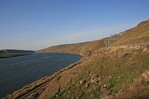
Animals and Plants
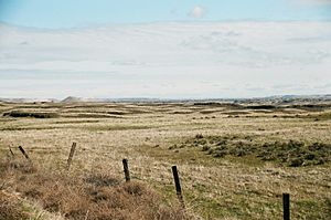
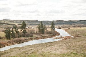
The northern part of the trail goes through different types of natural areas. You will see ponderosa pine trees and grasslands. There are also areas with exposed basalt cliffs. You might also find meadows and areas with shrubs and grasses.
The trail cuts through the Turnbull National Wildlife Refuge. This is a special area in northeastern Washington. It covers about 16,000 acres (6,500 ha). This refuge is part of the channeled scablands. These are unique landscapes formed by ancient floods.
The area has over 130 marshes, wetlands, and lakes. These watery spots attract many different kinds of waterfowl. More than 200 types of birds have been seen here. Other animals you might spot include elk, mule deer, and white-tailed deer. You could also see coyotes, badgers, porcupines, muskrats, and beavers.
Amazing Geology
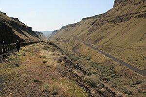
As the trail crosses the Columbia River Plateau, you will see unique landforms. These were created by huge floods long ago. These floods are called the Missoula Floods. They swept across eastern Washington many times during the Ice Age.
The trail follows one of the paths these floods took. The floods carved through the Columbia River Basalt rock. You can see many cool geological features along the trail. These include:
- The Cow Creek scabland.
- Washtucna Coulee, a wide, empty channel left by the floods.
- Devil's Canyon, a dry, straight, 4-mile-long (6.4 km) channel that goes down to the Snake River.
- Giant current ripples formed by the powerful flood currents.
- The Walker Bar, a large sand and gravel bar created by the floodwaters.
Where to Start Your Adventure
You can get onto the Columbia Plateau Trail at many different places. Here are some of the main access points, listed from northeast to southwest:
 | Charles R. Drew |
 | Benjamin Banneker |
 | Jane C. Wright |
 | Roger Arliner Young |


