Conception Bay facts for kids
Quick facts for kids Conception Bay |
|
|---|---|
| Location | Newfoundland |
| Coordinates | 47°45′N 53°00′W / 47.75°N 53.00°W |
| Ocean/sea sources | Labrador Sea, North Atlantic Ocean |
| Basin countries | Canada |
| Islands | Bell Island |
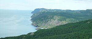
Conception Bay (often called CB) is a large bay on the southeast coast of Newfoundland, Canada. It's a very important area because many people live along its shores. In fact, it's one of the most populated parts of the province.
Many smaller towns in Newfoundland are often known by the bay they are located in. For example, you might hear 'Port de Grave, CB', which means Port de Grave in Conception Bay.
Contents
Exploring Conception Bay's Geography
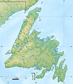
Conception Bay cuts into the Avalon Peninsula and opens up towards the Atlantic Ocean. It stretches from Cape St. Francis in the south to Split Point near Bay de Verde in the north.
How Big is Conception Bay?
This bay is quite deep, reaching up to 300 metres (about 980 feet) at its deepest point. It covers a large area of 1,295 square kilometres.
Islands of the Bay
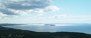
Conception Bay is home to several islands. The three biggest ones are Bell Island, Little Bell Island, and Kellys Island. Rivers flow into the bay from its east and west sides, eventually emptying into the Atlantic Ocean.

A Look Back: History of Conception Bay
The name Conception Bay comes from the Portuguese words Baía da Conceição. This name was likely given to honor the Feast of the Immaculate Conception, celebrated on December 8th. The name first appeared on an old map from around 1504–1505.
Early Settlements and Pirates
Conception Bay was an important place for early European settlements. The Britaniola Colony was set up here in 1610. Other settlements like Sea-Forest Plantation (1610) and Bristol's Hope Plantation (1619) also started here. In the 1610s, the bay was even a hiding spot for a famous Newfoundland pirate named Peter Easton. Old items like Spanish coins have been found, showing that people traded between Newfoundland and Spain a long time ago.
Mining and World War II
From the late 1890s to the 1960s, Bell Island was a busy place with an iron ore mine in Wabana. Iron ore is a rock that contains iron, which is used to make steel.
During World War II, the mine's loading pier and ships at Wabana became targets. In 1942, enemy submarines attacked the area. During one attack, a torpedo missed a ship and hit the pier! This made Bell Island one of the very few places in North America to be directly attacked during the war. Today, you can sometimes see the remains of the ships that were sunk during these attacks at low tide. There's also a memorial to remember the sailors who lost their lives.
Since 2011, Memorial University of Newfoundland has been doing archaeological digs at Carbonear, looking for more historical treasures.
Other Interesting Facts
A passenger and vehicle ferry service connects Bell Island to Portugal Cove. Locals often call this ferry route the "Bell Island Tickle."
During the summer, you might even spot Humpback whales swimming into Conception Bay as they migrate. Many people enjoy boating and taking tourist trips on the bay's waters. The area around Conception Bay has grown a lot recently, especially in Conception Bay South, leading to more people enjoying the bay for fun activities.
 | Calvin Brent |
 | Walter T. Bailey |
 | Martha Cassell Thompson |
 | Alberta Jeannette Cassell |


