
Conquest, New York facts for kids
Quick facts for kids
Conquest, New York
|
|
|---|---|

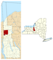
Location within Cayuga County and New York
|
|

Conquest, New York
Location in New York
|
|
| Country | United States |
| State | New York |
| County | Cayuga |
| Government | |
| • Type | Town Council |
| Area | |
| • Total | 36.32 sq mi (94.06 km2) |
| • Land | 35.22 sq mi (91.22 km2) |
| • Water | 1.10 sq mi (2.84 km2) |
| Elevation | 420 ft (128 m) |
| Population
(2020)
|
|
| • Total | 1,796 |
| • Estimate
(2021)
|
1,788 |
| • Density | 49.54/sq mi (19.13/km2) |
| Time zone | UTC-5 (Eastern (EST)) |
| • Summer (DST) | UTC-4 (EDT) |
| ZIP code |
13140
|
| Area code(s) | 315 |
| FIPS code | 36-011-17849 |
| GNIS feature ID | 0978862 |
Conquest is a small town in Cayuga County, New York, United States. In 2020, about 1,796 people lived there. The town got its name because it was formed after a big disagreement, and the name "Conquest" celebrated the winning side. Conquest is located on the western edge of Cayuga County, west of the city of Syracuse.
Contents
A Look Back: History of Conquest
The area where Conquest is now was first settled around 1800. The town of Conquest was officially created in 1821. It was formed from a part of the town of Cato. There was a lot of debate about whether to create this new town. At the same time, the town of Victory was also formed, and its name also celebrated the outcome of this debate.
Where is Conquest? Geography
Conquest covers a total area of about 94.1 square kilometers (or 36.3 square miles). Most of this area, about 91.2 square kilometers (35.2 square miles), is land. The rest, about 2.8 square kilometers (1.1 square miles), is water.
The western border of the town touches Wayne County. The Seneca River and the famous Erie Canal form the southern boundary of the town. New York State Route 38 is a main road that runs north to south through Conquest.
People of Conquest: Demographics
| Historical population | |||
|---|---|---|---|
| Census | Pop. | %± | |
| 1830 | 1,507 | — | |
| 1840 | 1,911 | 26.8% | |
| 1850 | 1,862 | −2.6% | |
| 1860 | 1,892 | 1.6% | |
| 1870 | 1,821 | −3.8% | |
| 1880 | 1,661 | −8.8% | |
| 1890 | 1,549 | −6.7% | |
| 1900 | 1,360 | −12.2% | |
| 1910 | 1,103 | −18.9% | |
| 1920 | 1,044 | −5.3% | |
| 1930 | 906 | −13.2% | |
| 1940 | 890 | −1.8% | |
| 1950 | 1,103 | 23.9% | |
| 1960 | 1,170 | 6.1% | |
| 1970 | 1,362 | 16.4% | |
| 1980 | 1,628 | 19.5% | |
| 1990 | 1,859 | 14.2% | |
| 2000 | 1,925 | 3.6% | |
| 2010 | 1,819 | −5.5% | |
| 2020 | 1,796 | −1.3% | |
| 2021 (est.) | 1,788 | −1.7% | |
| U.S. Decennial Census | |||
In 2000, there were 1,925 people living in Conquest. The population density was about 54.7 people per square mile. The average age of people in the town was 36 years old. About 29% of the population was under 18 years old. For every 100 females, there were about 101.8 males.
Places to Know in Conquest
Here are some of the communities and interesting spots you can find in the town of Conquest:
- Conquest (also known as "Conquest Center") – This is the main village, located near the middle of the town on NY-38. It was founded around 1802.
- Cottage Corners – You can find this spot on NY-38, just south of the Conquest village.
- Duck Lake – A beautiful lake located in the northwestern part of the town.
- Duloc – A community south of where NY-38 meets Conquest Victory Town Line Road. It was settled around 1869.
- Emerson (once called "The Pepper Mill") – This is a small community in the southeastern part of the town.
- Hard Point – A community in the southwestern part of the town, right by the Seneca River.
- Haiti Island – An island in the Seneca River, located west of NY-38.
- Howland – A community in the very southwestern corner of the town. It's part of a wildlife management area on Howland Island.
- Howland Island (formerly "Walnut Island" and "Hickory Island") – This island is part of a wildlife management area. It's found between the Seneca River and the Erie Canal.
- Montezuma Swamp Wildlife Management Area – A special area set aside for nature and wildlife. It's in the southwestern corner of the town and is partly bordered by the Seneca River and the Erie Canal.
- Mosquito Point – A location near the southern town line, on the eastern end of Haiti Island.
- Spring Lake (called "Pineville" until 1874) – A community located west of the Conquest village.
Images for kids
-
Location within Cayuga County and New York
See also
 In Spanish: Conquest (Nueva York) para niños
