Copiapó facts for kids
Quick facts for kids
Copiapó
|
||||||
|---|---|---|---|---|---|---|
|
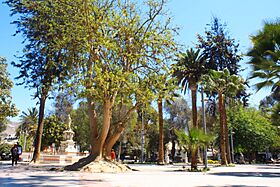
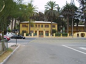
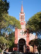
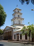
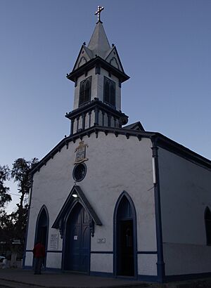
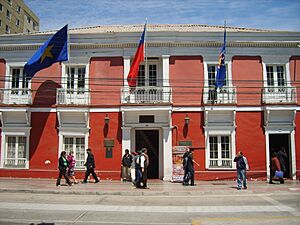
Main Square, Toro Lorca Palace, Atacama Museum, Viña de Cristo Palace, Atacama University, San Francisco Church and Copiapó Cathedral
|
||||||
|
||||||
| Country | ||||||
| Region | ||||||
| Province | Copiapó | |||||
| Founded | December 8, 1744 | |||||
| Founded by | José Antonio Manso de Velasco | |||||
| Government | ||||||
| • Type | Municipality | |||||
| Area | ||||||
| • Total | 16,681.3 km2 (6,440.7 sq mi) | |||||
| Elevation | 390 m (1,280 ft) | |||||
| Population | ||||||
| • Total | 158,438 | |||||
| • Density | 9.49794/km2 (24.59955/sq mi) | |||||
| Time zone | UTC−4 (CLT) | |||||
| • Summer (DST) | UTC−3 (CLST) | |||||
| Postal code |
1530000
|
|||||
| Area code(s) | (+56) 52 | |||||
| Climate | BWk | |||||
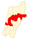
Copiapó is a city and commune located in northern Chile. It was founded on December 8, 1744. Today, it is the capital of the Copiapó Province and the Atacama Region.
The city is about 65 kilometers (40 miles) east of the coastal town of Caldera. It sits in a valley by the Copiapó River, which has mostly dried up due to climate change. Copiapó is surrounded by the Atacama Desert, one of the driest places on Earth. It gets very little rain, only about 12 millimeters (half an inch) each year. In 2012, the city had about 158,438 people living there.
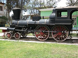
Copiapó is famous for its rich silver and copper mining history. The first railway in South America was built here in 1850. It connected Copiapó to Caldera. This railway was a big deal for moving minerals from the mines to the coast.
Contents
A Look Back in Time
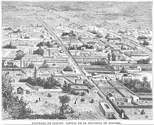
Spanish explorers first settled this area in 1742. They called it San Francisco de la Selva de Copiapó, which means "Saint Francis of the Jungle of Copiapó," because of all the green plants. Before the Spanish arrived, the Diaguita people lived here under the Inca Empire. Scientists have found old Diaguita fortresses and signs of human activity from about 10,000 years ago in the Copiapó Valley.
In 1832, Juan Godoy discovered rich silver deposits nearby. This made Copiapó a very important mining center. For a long time, it was Chile's main mining city in the north.
The city grew a lot during the 20th century because of mining and its role as a capital city.
On August 5, 2010, a big event happened near Copiapó: the San José Copper Mine collapsed. This trapped 33 miners deep underground. They were stuck 700 meters (about 2,300 feet) down for 69 days! People from all over the world worked together to rescue them. All 33 miners were brought to the surface safely on October 13, 2010. This was a record for how long miners survived underground. The San José mine is now closed, but copper and gold mining are still very important in the region.
Who Lives in Copiapó?
In 2002, Copiapó had 129,091 people. Most of them (97.6%) lived in the city, while a smaller number (2.4%) lived in rural areas nearby. The city's population grew by almost 28% between 1992 and 2002.
Weather in Copiapó
Copiapó has a desert climate, which means it's usually dry and sunny all year. Winters are mild, with cool days and nights. Summers are warm, and it almost never rains. The average yearly rainfall is very low, about 18.8 millimeters (0.74 inches). Some years, it doesn't rain at all! The coolest temperature ever recorded was -2.0°C (28.4°F) in June 1975, and the hottest was 34.0°C (93.2°F) in August 1972.
| Climate data for Copiapó (291m) | |||||||||||||
|---|---|---|---|---|---|---|---|---|---|---|---|---|---|
| Month | Jan | Feb | Mar | Apr | May | Jun | Jul | Aug | Sep | Oct | Nov | Dec | Year |
| Record high °C (°F) | 33.8 (92.8) |
31.6 (88.9) |
32.4 (90.3) |
31.8 (89.2) |
31.4 (88.5) |
33.4 (92.1) |
32.8 (91.0) |
34.0 (93.2) |
32.7 (90.9) |
32.4 (90.3) |
32.2 (90.0) |
31.4 (88.5) |
34.0 (93.2) |
| Mean daily maximum °C (°F) | 27.5 (81.5) |
27.5 (81.5) |
26.1 (79.0) |
23.5 (74.3) |
21.3 (70.3) |
19.6 (67.3) |
19.3 (66.7) |
20.3 (68.5) |
21.8 (71.2) |
23.3 (73.9) |
24.7 (76.5) |
26.4 (79.5) |
23.4 (74.1) |
| Daily mean °C (°F) | 22.2 (72.0) |
22.0 (71.6) |
20.6 (69.1) |
18.2 (64.8) |
16.1 (61.0) |
14.5 (58.1) |
14.0 (57.2) |
14.9 (58.8) |
16.3 (61.3) |
17.7 (63.9) |
19.1 (66.4) |
21.0 (69.8) |
18.0 (64.4) |
| Mean daily minimum °C (°F) | 15.5 (59.9) |
14.9 (58.8) |
14.0 (57.2) |
11.9 (53.4) |
9.6 (49.3) |
7.8 (46.0) |
7.3 (45.1) |
8.2 (46.8) |
9.5 (49.1) |
10.8 (51.4) |
12.5 (54.5) |
14.3 (57.7) |
11.3 (52.3) |
| Record low °C (°F) | 7.0 (44.6) |
2.5 (36.5) |
1.4 (34.5) |
3.4 (38.1) |
0.4 (32.7) |
−0.6 (30.9) |
−2.0 (28.4) |
−0.6 (30.9) |
0.8 (33.4) |
0.6 (33.1) |
1.5 (34.7) |
2.4 (36.3) |
−2.0 (28.4) |
| Average precipitation mm (inches) | 0.0 (0.0) |
0.1 (0.00) |
1.2 (0.05) |
1.0 (0.04) |
1.5 (0.06) |
5.6 (0.22) |
5.6 (0.22) |
3.4 (0.13) |
0.3 (0.01) |
0.1 (0.00) |
0.0 (0.0) |
0.0 (0.0) |
18.8 (0.74) |
| Average precipitation days | 0.0 | 0.0 | 0.2 | 0.2 | 0.5 | 0.8 | 0.6 | 0.4 | 0.3 | 0.1 | 0.1 | 0.0 | 3.2 |
| Average relative humidity (%) | 60 | 61 | 63 | 66 | 67 | 66 | 65 | 65 | 63 | 61 | 60 | 59 | 63 |
| Mean monthly sunshine hours | 294.5 | 259.9 | 263.5 | 201.0 | 198.4 | 192.0 | 217.0 | 220.1 | 237.0 | 269.7 | 276.0 | 291.4 | 2,920.5 |
| Mean daily sunshine hours | 9.5 | 9.2 | 8.5 | 6.7 | 6.4 | 6.4 | 7.0 | 7.1 | 7.9 | 8.7 | 9.2 | 9.4 | 8.0 |
| Source 1: Dirección Meteorológica de Chile | |||||||||||||
| Source 2: Universidad de Chile (sunshine hours only) | |||||||||||||
How People Make a Living
Copiapó has a varied economy, but mining is the biggest activity. The area has a lot of copper ore, which is dug up by companies like Minera Candelaria. This creates jobs in transportation, small factories, and services. Even small-scale miners, called pirquineros, contribute a lot of copper.
Agriculture is the second-largest source of money. Farmers mostly grow grapes, but also olives, tomatoes, avocados, and some citrus fruits.
The industry in Copiapó mainly involves light manufacturing. There are also some medium-sized industries, like the INACESA plant and the Paipote copper refinery.
Energy is a growing field here. Many important solar power plants have been built in the Atacama Region. This is because the area gets a lot of sunlight all year round.
Commerce (buying and selling goods) is also growing. Many small and medium-sized businesses are thriving. Big supermarkets have also opened in the city, showing how much it's growing.
Tourism is becoming more popular. People visit to see the desert and ancient monuments, like an Inca cemetery. A new casino and improved hotels are also attracting visitors.
Fun Things to See and Do
- The Copiapó steam locomotive from 1850, located at the University of Atacama.
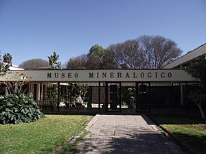
- The Mineralogic Museum, where you can see cool rocks and minerals.
- Plaza de Armas, the main square of the city.
- The Regional Museum of the Matta Family.
- The old Wooden Railway Station, which is now a National Monument.
- The San José Copper Mine (closed since 2010).
- The coastal areas of Totoralillo, Totoral, and "Travesía," where the "Desierto Florido" (Flowering Desert) appears after rare rains.
- In the Andes mountains, you can find the Ojos del Salado volcano and the beautiful Green and Negro Francisco lakes.
- Tres Cruces National Park in the Andes.
How the City is Run
Copiapó is run by a Municipality led by an Alcalde (Mayor). The current mayor is Marcos López.
Learning in Copiapó
Copiapó offers many educational options, from kindergarten to university. In 2007, over 35,000 students were enrolled in schools here.
Schools
There are 64 schools in Copiapó: 61 in urban areas and 3 in rural areas. These include public schools, state-subsidized private schools, and fully private schools.
Universities
- Universidad de Atacama: The only public university in the Atacama Region, founded in 1857.
- Universidad Santo Tomás (Copiapó)
- Universidad Tecnológica de Chile, INACAP (Copiapó)
There are also several professional institutes and technical centers for further education.
Sports and Fun
Football
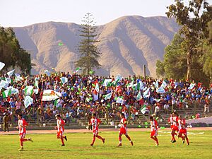
The city has a football (soccer) team called Club de Deportes Copiapó. They play in Chile's Primera A League. Their home games are played at the Luis Valenzuela Hermosilla Stadium.
Raid Atacama
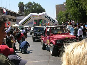
This is a huge event for 4x4 vehicles, bringing together hundreds of off-road enthusiasts. It started in 1992 and is known for being one of the largest 4x4 gatherings in the world. It has even won a National Award for Tourism!
Rally Dakar
Copiapó has been a part of the famous Rally Dakar race, which passes through Chile and Argentina. The city is also the hometown of Jaime Prohens, a well-known participant in the rally.
Getting Around
Copiapó is served by Desierto de Atacama Airport, which has flights from three of Chile's main airlines. As mentioned before, the city also has an important railway line.
Friends Around the World
Copiapó has "sister city" relationships with several cities around the world. This means they share cultural and educational ties.
 Catamarca, Argentina
 Córdoba, Argentina
 Felipe Varela, Argentina
 La Rioja, Argentina
 Santiago del Estero, Argentina
 Jiujiang, China
 Nanchang, China
 Panyu, China
 Pingxiang, China
 Ruichang, China
 Castellón de la Plana, Spain
See also
 In Spanish: Copiapó para niños
 | John T. Biggers |
 | Thomas Blackshear |
 | Mark Bradford |
 | Beverly Buchanan |


