Corcogemore facts for kids
Quick facts for kids Corcogemore |
|
|---|---|
| Corcóg | |

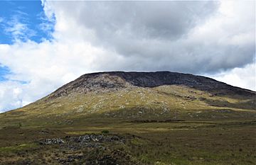
Corcogemore from the R336 road
|
|
| Highest point | |
| Elevation | 609 m (1,998 ft) |
| Prominence | 221 m (725 ft) |
| Listing | Marilyn, Hewitt, Arderin, Simm, Vandeleur-Lynam |
| Naming | |
| English translation | cone or beehive |
| Language of name | Irish |
| Geography | |
| Location | Galway, Ireland |
| Parent range | Maumturks |
| OSI/OSNI grid | L9526049144 |
| Topo map | OSi Discovery 45 |
| Geology | |
| Type of rock | Pale quartzites, grits, graphitic top bedrock |
| Climbing | |
| Easiest route | via R336 at Maam Cross |
Corcogemore is a mountain in Galway, Ireland. Its name comes from the Irish word Corcóg, which means "cone" or "beehive". This mountain stands at 609 metres (1,998 ft) (about 2,000 feet) tall.
Corcogemore is part of the Maumturks mountain range. This range is located in the beautiful Connemara National Park. Corcogemore is one of the highest peaks in the Maumturks, ranking as the 8th tallest. It's also the most southerly mountain in the range.
What's in a Name?
The name Corcóg means "beehive" in Irish. It can also mean "cone," which describes the shape of an old-fashioned beehive.
For a long time, maps incorrectly called this mountain "Leckavrea." However, Lackavrea (Leic Aimhréidh) is actually a different mountain. It is located to the east of Corcogemore.
Where is Corcogemore?
Corcogemore is found in the southeastern part of the Maumturks range. It sits on a small group of mountains called a massif. This massif is separated from the main mountain range. A deep valley called Máméan divides them. Máméan is a special place. People have visited it for religious reasons since the 400s.
On the same massif, to the west of Corcogemore, are two other peaks. These are Mullach Glas, which is 432 metres (1,417 ft) high, and Binn Mhór, which is 661 metres (2,169 ft) high.
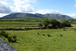
To the east of Corcogemore, across the R336 road, is the mountain of Lackavrea. This road goes through a pass called Mám Aodha.
Hiking Corcogemore
If you want to climb Corcogemore, the easiest way is a 5-kilometre (about 3 miles) trip. This hike takes about 2 to 3 hours to complete. You start from the R336 road, near Maam Cross, and then return the same way.
Another way to climb Corcogemore is part of a longer adventure. You can hike from Corcogemore, across Mullach Glas, and then to the top of Binn Mhór. This longer route is about 10 kilometres (6 miles) and takes 4 to 5 hours. It's a one-way trip, so you would need two cars. One car would be at the start and another at the end in Máméan.
Corcogemore is also a checkpoint for the Maamturks Challenge. This is a very tough 25-kilometre (15.5 miles) hike. It takes 10 to 12 hours to walk over the entire Maumturks range. The challenge starts at Maam Cross and finishes in Leenaun. It's known as one of Ireland's "great classic ridge-walks." It's considered "extreme" because you climb about 7,600 feet in total!
Since 1975, the University College Galway Mountaineering Club has organized the "Maamturks Challenge Walk" every year. They set up a checkpoint on Corcogemore. It's the first major checkpoint for hikers taking on the challenge.
 | Sharif Bey |
 | Hale Woodruff |
 | Richmond Barthé |
 | Purvis Young |


