Coulee Dam, Washington facts for kids
Quick facts for kids
Coulee Dam
|
|
|---|---|
|
Town
|
|
| Coulee Dam, Washington | |
 |
|

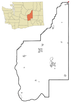
Location of Coulee Dam, Washington
|
|
| Country | United States |
| State | Washington |
| Counties | Okanogan, Douglas, Grant |
| Area | |
| • Total | 0.79 sq mi (2.05 km2) |
| • Land | 0.72 sq mi (1.85 km2) |
| • Water | 0.07 sq mi (0.19 km2) |
| Elevation | 1,145 ft (349 m) |
| Population
(2020)
|
|
| • Total | 1,211 |
| • Density | 1,508.38/sq mi (582.56/km2) |
| Time zone | UTC-8 (Pacific (PST)) |
| • Summer (DST) | UTC-7 (PDT) |
| ZIP code |
99116
|
| Area code(s) | 509 |
| FIPS code | 53-15115 |
| GNIS feature ID | 1504196 |
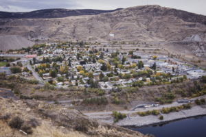
Coulee Dam is a small town in the state of Washington, USA. It is special because it sits across three different counties: Douglas, Grant, and Okanogan. In 2020, about 1,211 people lived there. The town is famous for being the home of the huge Grand Coulee Dam.
Contents
History of Coulee Dam
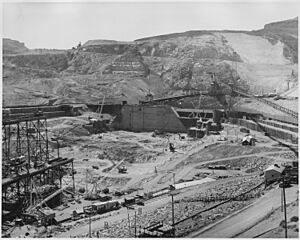
The town of Coulee Dam was started in 1933. It was built by the U.S. Bureau of Reclamation. This agency needed a place for workers and leaders during the construction of the Grand Coulee Dam.
At first, the town had two parts. The part in Okanogan County was called Mason City. This was where the main building company was located. The other parts, in Douglas and Grant Counties, were called Engineers Town. These areas were owned by the government.
In 1942, as the dam project was finishing, Mason City became part of the Columbia Basin Project. Later, in 1948, Mason City joined with Coulee Dam. The government started selling parts of the town to the public in 1957. This process finished in 1959. Coulee Dam officially became a town on February 26, 1959.
Today, Coulee Dam is the main office for the Lake Roosevelt National Recreation Area. It is also home to one of the world's largest man-made sand piles. This hill is about 230-foot (70 m) high. It is made from 12,000,000-cubic-yard (9,200,000 m3) of sand left over from building the dam.
Geography and Location
Coulee Dam is located at 47°58′6″N 118°58′41″W / 47.96833°N 118.97806°W. Part of the town is inside the Colville Indian Reservation in Okanogan County. This area also marks the southern edge of the Okanogan Highlands.
The town covers a total area of about 0.78 square miles (2.02 km2). Most of this area, about 0.72 square miles (1.86 km2), is land. The rest, about 0.06 square miles (0.16 km2), is water.
Coulee Dam's Climate
Coulee Dam has a climate with big changes between seasons. Summers are usually warm to hot, and sometimes humid. Winters are cold, and can be very cold. This type of weather is called a humid continental climate.
| Climate data for Coulee Dam, WA | |||||||||||||
|---|---|---|---|---|---|---|---|---|---|---|---|---|---|
| Month | Jan | Feb | Mar | Apr | May | Jun | Jul | Aug | Sep | Oct | Nov | Dec | Year |
| Record high °F (°C) | 57 (14) |
61 (16) |
74 (23) |
92 (33) |
100 (38) |
105 (41) |
113 (45) |
110 (43) |
104 (40) |
90 (32) |
69 (21) |
58 (14) |
113 (45) |
| Mean daily maximum °F (°C) | 32.2 (0.1) |
39.7 (4.3) |
50.7 (10.4) |
61.7 (16.5) |
71.0 (21.7) |
78.5 (25.8) |
87.6 (30.9) |
86.4 (30.2) |
77.2 (25.1) |
61.5 (16.4) |
43.6 (6.4) |
34.4 (1.3) |
60.4 (15.8) |
| Mean daily minimum °F (°C) | 21.6 (−5.8) |
25.7 (−3.5) |
31.5 (−0.3) |
38.2 (3.4) |
45.8 (7.7) |
52.5 (11.4) |
58.3 (14.6) |
57.5 (14.2) |
50.3 (10.2) |
40.6 (4.8) |
31.4 (−0.3) |
24.6 (−4.1) |
39.8 (4.3) |
| Record low °F (°C) | −17 (−27) |
−15 (−26) |
0 (−18) |
20 (−7) |
27 (−3) |
36 (2) |
32 (0) |
38 (3) |
30 (−1) |
10 (−12) |
−10 (−23) |
−16 (−27) |
−17 (−27) |
| Average precipitation inches (mm) | 1.07 (27) |
0.92 (23) |
0.88 (22) |
0.83 (21) |
1.10 (28) |
1.04 (26) |
0.47 (12) |
0.41 (10) |
0.49 (12) |
0.72 (18) |
1.24 (31) |
1.39 (35) |
10.55 (268) |
| Average snowfall inches (cm) | 6.1 (15) |
2.5 (6.4) |
0.8 (2.0) |
0.0 (0.0) |
0.0 (0.0) |
0.0 (0.0) |
0.0 (0.0) |
0.0 (0.0) |
0.0 (0.0) |
0.0 (0.0) |
1.5 (3.8) |
4.6 (12) |
15.5 (39) |
People of Coulee Dam
| Historical population | |||
|---|---|---|---|
| Census | Pop. | %± | |
| 1960 | 1,344 | — | |
| 1970 | 1,425 | 6.0% | |
| 1980 | 1,412 | −0.9% | |
| 1990 | 1,087 | −23.0% | |
| 2000 | 1,044 | −4.0% | |
| 2010 | 1,098 | 5.2% | |
| 2020 | 1,211 | 10.3% | |
| U.S. Decennial Census 2020 Census |
|||
In 2010, there were 1,098 people living in Coulee Dam. There were 459 households, which are groups of people living together. About 301 of these were families. The town had about 1,525 people per square mile.
The people living in Coulee Dam came from different backgrounds. About 55% were White. About 35.5% were Native American. Other groups included African American and Asian people. About 6.7% of the population was Hispanic or Latino.
About 29.8% of households had children under 18. The average age in the town was 41.6 years old. About 24.8% of residents were under 18. About 17.5% were 65 years old or older. The town had a nearly even number of males and females.
Notable Person from Coulee Dam
- Lawrence Colburn: He was born in Coulee Dam. He is known for being one of three people who bravely stepped in to stop a terrible event during the Vietnam War.
See also
 In Spanish: Coulee Dam (Washington) para niños
 | Leon Lynch |
 | Milton P. Webster |
 | Ferdinand Smith |


