County of Carnarvon (South Australia) facts for kids
Quick facts for kids CarnarvonSouth Australia |
|||||||||||||||
|---|---|---|---|---|---|---|---|---|---|---|---|---|---|---|---|

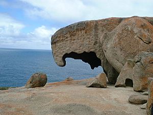
Remarkable Rocks formation in Flinders Chase within the Hundred of McDonald
|
|||||||||||||||
| Established | 1874 | ||||||||||||||
| LGA(s) | Kangaroo Island Council | ||||||||||||||
| Region | Fleurieu and Kangaroo Island | ||||||||||||||
|
|||||||||||||||
| Footnotes | Coordinates | ||||||||||||||
The County of Carnarvon is a special way of dividing land in the Australian state of South Australia. It covers the entire Kangaroo Island and all the small islands nearby. It was officially created in 1874 by Anthony Musgrave, who was the Governor of South Australia at the time. This happened because people wanted more land on Kangaroo Island for farming.
What is the County of Carnarvon?
The County of Carnarvon is a "cadastral unit." Think of it as a big section of land marked out for official purposes. It includes all of Kangaroo Island and the smaller islands around it.
History of the County
The County of Carnarvon was officially announced in 1874. This was a response to a growing demand for land on Kangaroo Island, especially for farming. Governor Anthony Musgrave, the ninth Governor of South Australia, made the announcement on August 13, 1874.
The county was named after Henry Herbert, 4th Earl of Carnarvon. He was an important British politician from Caernarfon, Wales. He served twice as the British Secretary of State for the Colonies, which meant he helped manage British territories around the world.
When the county was created, it was divided into smaller sections called "hundreds." The first of these was the Hundred of Dudley, also created in 1874. Over time, 12 more hundreds were added within the County of Carnarvon. These were created between 1874 and 1960.
The Hundreds of Carnarvon
The County of Carnarvon is made up of 13 smaller land divisions called "hundreds." These hundreds are spread out across Kangaroo Island. Some are along the north coast, some along the south coast, and others cover specific areas like the Dudley Peninsula.
Here are the hundreds within the County of Carnarvon:
- Hundred of Borda was created in 1960. It's named after Cape Borda and includes parts of Flinders Chase.
- Hundred of Cassini was created in 1884. It's named after Cape Cassini and covers an area of about 269 square kilometres (104 square miles).
- Hundred of Dudley was the very first hundred, created in 1874. It covers the Dudley Peninsula and is named after David Dudley Field II.
- Hundred of Duncan was created in 1909. It's named after John Duncan, a South Australian politician. It covers about 404 square kilometres (156 square miles).
- Hundred of Gosse was created in 1931. It's named after William Christie Gosse, an explorer. It covers about 364 square kilometres (140.5 square miles).
- Hundred of Haines was created in 1883. It's named after William Haines, another South Australian politician. It covers about 365 square kilometres (141 square miles).
- Hundred of MacGillivray was created in 1906. It's named after Ivor MacGillivray, a South Australian politician. It covers about 553 square kilometres (213.75 square miles).
- Hundred of McDonald was created in 1910. It's named after Alexander McDonald, a South Australian politician. It includes parts of Flinders Chase National Park.
- Hundred of Menzies was created in 1878. It's named after a friend of Governor William Jervois. It covers about 321 square kilometres (124 square miles) and includes the town of Kingscote.
- Hundred of Newland was created in 1909. It's named after John Newlands, a South Australian politician. It covers about 399 square kilometres (154 square miles).
- Hundred of Ritchie was created in 1909. It's named after George Ritchie, a South Australian politician. It covers about 399 square kilometres (154 square miles).
- Hundred of Seddon was created in 1908. It's named after Richard Seddon, a former Prime Minister of New Zealand. It covers about 404 square kilometres (156 square miles) and includes Parndana.
 | Frances Mary Albrier |
 | Whitney Young |
 | Muhammad Ali |


