County of Forty Mile No facts for kids
Quick facts for kids
County of Forty Mile No. 8
|
||
|---|---|---|
|
Municipal district
|
||
|
|
||
| Country | ||
| Province | ||
| Region | Southern Alberta | |
| Census division | No. 1 | |
| Established | 1954 | |
| Incorporated | 1958 | |
| Area
(2016)
|
||
| • Land | 7,249.31 km2 (2,798.97 sq mi) | |
| Population
(2016)
|
||
| • Total | 3,581 | |
| • Density | 0.5/km2 (1/sq mi) | |
| Time zone | UTC-7 (MST) | |
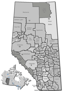
The County of Forty Mile No. 8 is a special type of local government area called a municipal district. It is located in the southeastern part of Alberta, Canada.
This county is found in Census Division 1. It is southwest of the city of Medicine Hat. The main office for the county government is in the Village of Foremost.
Contents
Who Lives Here?
Population Numbers
In 2016, Statistics Canada counted the people living in the County of Forty Mile No. 8. There were 3,581 people living here. This was a small increase from 2011, when the population was 3,336.
The county covers a large area of land, about 7,249 square kilometers (or 2,799 square miles). Because of its large size and smaller population, there are not many people living in each square kilometer. In 2016, there was about 0.5 person per square kilometer.
Changes Over Time
The number of people living in the county has changed a bit over the years.
- In 2011, the population was 3,336. This was a slight decrease from 2006.
- In 2006, there were 3,414 people.
- In 2001, the population was 3,168.
Places in the County
The County of Forty Mile No. 8 includes different types of communities. Some are larger, like towns, while others are smaller, like villages or hamlets.
Towns and Villages
These are urban areas that are surrounded by the county:
- Towns:
- Villages:
Hamlets and Localities
Many smaller communities are also part of the county. These are often rural areas or very small settlements.
- Hamlets:
- Burdett (This used to be a village but changed to a hamlet in 2003.)
- Etzikom
- Manyberries
- Orion
- Skiff
- Localities:
There are many small localities within the county. Some of these include:
- Other Places:


