Dellenbaugh Butte facts for kids
Quick facts for kids Dellenbaugh Butte |
|
|---|---|

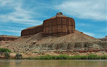
Dellenbaugh Butte, from Green River, June 2019
|
|
| Highest point | |
| Elevation | 4,395 ft (1,340 m) |
| Prominence | 55 ft (17 m) |
| Isolation | 2.23 mi (3.59 km) |
| Geography | |
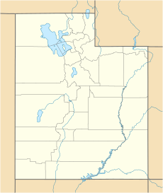
| Location | Grand County, Utah, US |
| Parent range | Colorado Plateau |
| Topo map | USGS Green River SE |
| Geology | |
| Age of rock | Late Jurassic |
| Type of rock | Summerville Formation |
Dellenbaugh Butte is a cool mountain peak located in Grand County, Utah, in the United States. It stands tall at 4,395 feet (1,340 meters) above sea level. This butte is the 2,348th highest peak in the state of Utah.
What is Dellenbaugh Butte?
Dellenbaugh Butte is named after a famous explorer and artist named Frederick Samuel Dellenbaugh (1853–1935). He was part of Major John Wesley Powell's expedition. Powell and his team camped near this spot along the Green River.
The butte is mostly made of a type of rock called the Summerville Formation. This formation has unique, thin layers of different rocks like shale, siltstone, and sandstone. These layers give the butte its special look.
Exploring the Climate
Dellenbaugh Butte is in a "cold semi-arid climate" zone. This means it has cold winters where the average temperature is often below freezing (0°C or 32°F). The area doesn't get much rain, usually less than 10 inches (250 mm) each year. Snowfall in winter is generally light.
Most of the yearly rain falls during spring and summer. The best times to visit Dellenbaugh Butte are during the spring and fall. The weather is usually mild and pleasant then.
 | Lonnie Johnson |
 | Granville Woods |
 | Lewis Howard Latimer |
 | James West |


