Dickinson County, Michigan facts for kids
Quick facts for kids
Dickinson County
|
|
|---|---|

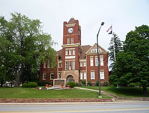
Dickinson County Courthouse
|
|

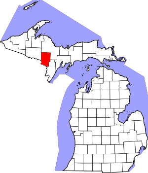
Location within the U.S. state of Michigan
|
|
 Michigan's location within the U.S. |
|
| Country | |
| State | |
| Founded | 1891 |
| Named for | Donald M. Dickinson |
| Seat | Iron Mountain |
| Largest city | Iron Mountain |
| Area | |
| • Total | 777 sq mi (2,010 km2) |
| • Land | 761 sq mi (1,970 km2) |
| • Water | 16 sq mi (40 km2) 2.0%% |
| Population
(2020)
|
|
| • Total | 25,947 |
| • Density | 34/sq mi (13/km2) |
| Time zone | UTC−6 (Central) |
| • Summer (DST) | UTC−5 (CDT) |
| Congressional district | 1st |
Dickinson County is a county located in the Upper Peninsula of Michigan. A county is like a smaller region within a state. In 2020, about 25,947 people lived here. The main town, or county seat, is Iron Mountain.
Dickinson is the newest county in Michigan. It was created in 1891 from parts of other counties: Marquette, Menominee, and Iron. The county was named after Donald M. Dickinson. He was an important person who worked for the U.S. government as the Postmaster General under President Grover Cleveland.
Dickinson County is also part of the Iron Mountain, MI–WI micropolitan statistical area. This means it's a smaller city area that is connected to a larger city's economy.
Contents
Exploring Dickinson County's Geography
According to the U.S. Census Bureau, Dickinson County covers a total area of about 777 square miles. Most of this is land, about 761 square miles, and 16 square miles is water. That's about 2% water.
Dickinson County is special because it's one of only two counties in the Upper Peninsula that doesn't touch a large body of water like a lake or ocean. It's completely surrounded by land, which is called being landlocked.
Main Roads in Dickinson County
These are the major highways that help people travel through Dickinson County:
 US 2
US 2 US 8
US 8 US 141
 M-69
M-69 M-95
M-95 G-69
G-69
Local Airport
- KIMT - Ford Airport is the main airport in the county.
Neighboring Counties
Dickinson County shares its borders with these other counties:
- Marquette County (to the north)
- Menominee County (to the southeast)
- Marinette County, Wisconsin (to the south)
- Florence County, Wisconsin (to the southwest)
- Iron County (to the northwest)
Communities and Towns
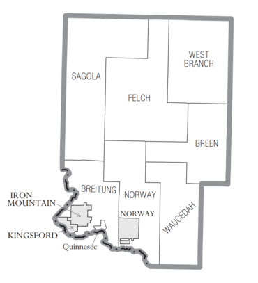
Dickinson County has several different types of communities where people live.
Cities in Dickinson County
These are the largest towns in the county:
- Iron Mountain (This is the county seat, where the main government offices are.)
- Kingsford
- Norway
Townships in Dickinson County
Townships are smaller local government areas.
- Breitung Charter Township (This is a special type of township called a "charter township.")
- Breen Township
- Felch Township
- Norway Township
- Sagola Township
- Waucedah Township
- West Branch Township
Census-Designated Place
- Quinnesec is a community that the census bureau tracks, but it's not officially a city or a township.
Other Small Communities
People in Dickinson County
In 2020, the county had a population of 25,947 people.
See also
 In Spanish: Condado de Dickinson (Míchigan) para niños


