Red Pike (Buttermere) facts for kids
Quick facts for kids Red Pike |
|
|---|---|
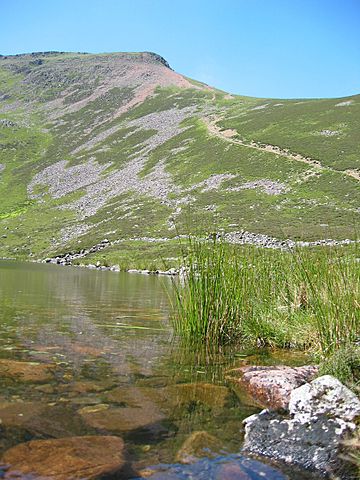
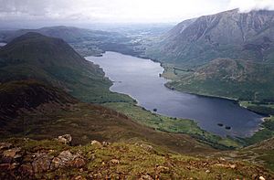
Red Pike from Bleaberry Tarn
|
|
| Highest point | |
| Elevation | 755 m (2,477 ft) |
| Prominence | c. 40 m |
| Listing | Wainwright, Nuttall, Hewitt |
| Geography | |
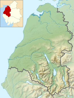
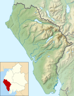
| Location | Cumbria, England |
| Parent range | Lake District, Western Fells |
| OS grid | NY160154 |
| Topo map | OS Landranger 89, Explorer OL4 |
| Listed summits of Red Pike (Buttermere) | ||||
| Name | Grid ref | Height | Status | |
|---|---|---|---|---|
| Dodd | NY163157 | 641 m (2,102 ft) | Nuttall | |
Red Pike is a cool mountain, called a fell, located in the western part of England's famous Lake District. It's part of the High Stile mountain range. This range separates two beautiful valleys: Ennerdale and the valley that holds Buttermere and Crummock Water.
Red Pike stands tall at about 755 meters (2,476 feet) high. Many people love to hike up Red Pike from the village of Buttermere. The walk along the ridge from Red Pike to Haystacks is known for its amazing views. You can see other big mountains like the Scafells, Great Gable, and Pillar from there.
There's another mountain called Red Pike not far away, in Wasdale. It can be a bit confusing! But the Red Pike near Buttermere gets its name from its rich red color. This color comes from a type of rock called syenite found in the mountain's soil. You can really see this red color on the paths, especially near Scale Force and the trail from Bleaberry Tarn to the top.
Contents
Exploring the Western Fells
The Western Fells are a group of mountains in the Lake District. They form a triangle shape. On one side is the River Cocker, and on the other is Wasdale. These mountains get smaller as they go towards the coast.
At the center of these high mountains are Great Gable and its nearby peaks. Two main ridges spread out from Ennerdale, like a giant horseshoe around this long, wild valley. The highest part of the northern ridge includes three famous mountains: High Crag, High Stile, and Red Pike.
Buttermere Mountains and Valleys
The Buttermere Fells, also known as Buttermere Edge, act like a natural wall. They divide the water that flows into Buttermere from the water that goes into Upper Ennerdale. The Ennerdale side of these mountains is very steep and rocky. Some lower parts have been planted with rows of pine trees.
On the other side, facing Buttermere, are deep, bowl-shaped valleys called corries. These corries have dark, rocky walls that look down over the lake. The mountain ridge continues southeast towards Haystacks and the Great Gable group. West of Red Pike, you'll find Starling Dodd, Great Borne, and the Loweswater Fells.
Features of Red Pike's Slopes
Each of the three Buttermere Fells has a short ridge that points towards the lake. Between these ridges are deep hollows. Between Red Pike and High Stile is a place called Bleaberry Comb. It has steep cliffs called Chapel Crags behind it.
Inside Bleaberry Comb is Bleaberry Tarn. This small lake is about 15 feet (4.6 meters) deep. It's often in shadow from November to March. Even so, it's full of trout! Water from Bleaberry Tarn flows into Buttermere through a stream called Sourmilk Gill. This stream reaches the lake very close to where the lake's water flows out.
Red Pike is special because its northeast ridge ends in a noticeable peak called Dodd. Dodd is tall enough to be listed as a Nuttall mountain on its own. The ridge connecting Red Pike to Dodd is called the Saddle.
The ridge continues west from Red Pike, becoming wider and covered in grass. You'll cross Little Dodd first, then reach the grassy top of Starling Dodd. Red Pike also has a northern ridge that goes down towards Crummock Water. This ridge ends at Blea Crag.
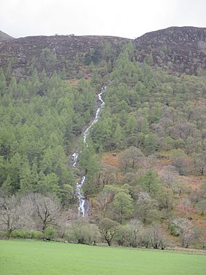
Between Lingcomb Edge and Dodd is Ling Comb. This is another corrie on the Buttermere side of these mountains. Behind Lingcomb Edge, separating Red Pike from Starling Dodd, is the valley of Scale Beck. This valley is home to Scale Force, which is Lakeland's longest single waterfall drop, falling about 100 feet (30 meters). The Ennerdale slopes are steep and have small rocky areas.
What Red Pike is Made Of
Red Pike is mostly made of a type of rock called granophyric granite. This rock comes from something called the Ennerdale intrusion. This is why parts of the mountain have that distinctive red color.
Reaching the Summit
The curved shape of Red Pike's summit looks grand from Crummock Water when High Stile is hidden. The very top is steep on three sides. However, it's covered in grass and has a large pile of stones called a cairn.
Red Pike is unique because you can see many lakes from its top. You can spot Derwentwater, Buttermere, Crummock Water, Ennerdale Water, and Loweswater. Other cool sights include Pillar Rock, Grasmoor, and a close-up view of Chapel Crags.
Popular Hiking Routes
There are several ways to hike up Red Pike from Buttermere. One popular route follows Sour Milk Gill directly from the village into Bleaberry Comb. From there, you can reach The Saddle, which leads to the summit.
Another option is to start on the path to Scale Force. You can climb beside the waterfall itself to reach the back slope of Lincomb Edge. Or, you can turn earlier up Far Ruddy Beck to get into Ling Comb.
If you're coming from Ennerdale, there's only one path through the trees on the northern side. This path follows Gillflinter Beck and leads all the way to the summit. This is the only way to reach the top from the Ennerdale side of Buttermere Edge. Many hikers combine Red Pike with High Stile and High Crag in one long walk, starting from Buttermere or Gatesgarth.
 | James Van Der Zee |
 | Alma Thomas |
 | Ellis Wilson |
 | Margaret Taylor-Burroughs |


