Starling Dodd facts for kids
Quick facts for kids Starling Dodd |
|
|---|---|

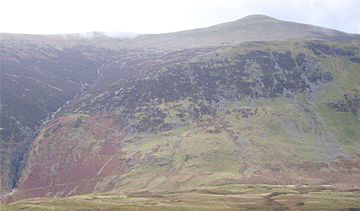
Starling Dodd, with Scale Force on the left, seen from Mellbreak.
|
|
| Highest point | |
| Elevation | 633 m (2,077 ft) |
| Prominence | 60 m (200 ft) |
| Listing | Wainwright, Hewitt, Nuttall |
| Geography | |
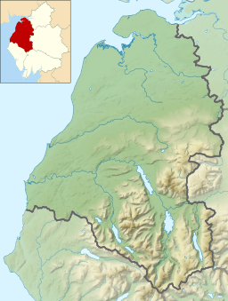
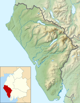
| Location | Cumbria, England |
| Parent range | Lake District, Western Fells |
| OS grid | NY142158 |
| Topo map | OS Landranger 89, Explorer OL4 |
Starling Dodd is a hill, also known as a fell, in the western part of England's Lake District. It sits between two valleys, Ennerdale and Buttermere. This hill is part of a ridge that connects Great Borne to its west and Red Pike to its east. Starling Dodd has a rounded shape and isn't visible from Buttermere village. Because of this, it's a quieter spot that fewer people visit.
Contents
Where is Starling Dodd?
The Western Fells are a group of mountains in the Lake District. They form a large horseshoe shape around the long, wild valley of Ennerdale. Starling Dodd is located on the northern side of this horseshoe. It helps to divide the areas of Buttermere and Ennerdale.
A ridge, which is like a high path, runs from Haystacks. It goes over High Crag, High Stile, and Red Pike. These three hills are known as the Buttermere Edge. After Red Pike, the ridge becomes less rocky and more grassy. It then curves west over Starling Dodd, ending at Great Borne.
The western side of Red Pike slopes down before rising again to a smaller peak called Little Dodd. Starling Dodd officially begins after this dip. A short climb up a grassy slope leads to the top of Starling Dodd. It's a rounded, grassy dome on a wide ridge. The slopes gently go down to the west.
Nature and Water Around the Hill
The southern sides of Starling Dodd are covered with many trees. These are part of the large Ennerdale Forest. Inside this forest is a lower ridge called Latterbarrow. This ridge changes the path of some streams from Starling Dodd.
North of the summit, Starling Dodd flattens out into a wide area. Then, it drops steeply over some small cliffs. At the bottom of these cliffs is a connection to Mellbreak. This low area divides the water flowing north from Starling Dodd. Water to the west flows into a marshy valley called Mosedale. It then travels around Mellbreak to reach Crummock Water. The water from the north-eastern side flows directly into Crummock Water. It drops down the rocky face through a place called Scale Force. This is thought to be the highest single waterfall in the Lake District. It drops about 170 feet down a narrow crack in the rocks.
What Starling Dodd is Made Of
The very top of Starling Dodd is made of rocks from the Buttermere Formation. These rocks are a mix of mudstone, siltstone, and sandstone. Around the top, on almost all sides, you'll find a type of granite rock.
The steep northern slopes of Starling Dodd were once home to iron mines. These mines were active in the late 1800s. You can still find one of the old mine entrances near the bottom of Scale Force waterfall. All mining work stopped by 1877.
The Top of Starling Dodd
The smooth, grassy top of Starling Dodd once had a large pile of stones, called a cairn. This cairn was made stronger with iron posts. These posts were taken from an old fence in Ennerdale. More recently, the iron posts were removed from the stone cairn. A new, all-metal cairn was built next to the original one. It looks quite modern!
From the top, you can get a great view of Ennerdale Water. You can also see parts of Crummock Water and Loweswater. High Stile blocks some of the view of the Western Fells. However, Pillar and its nearby hills create a wonderful view. You can also see the North Western Fells across Crummock Water.
How to Climb Starling Dodd
You can start your climb from Loweswater village. But this means you'll have to walk across the marshy Mosedale valley. You can then follow Red Gill to reach the flat area near the top. You can also reach this spot from Buttermere village or Ennerdale. To do this, you would use Floutern Pass. Be aware that this path can also be boggy. It's often more common to climb Starling Dodd by walking along the ridge from either direction.
A Special Hill for Wainwright
Alfred Wainwright wrote a famous series of books called the Pictorial Guides to the Lakeland Fells. In the very last book, he wrote that Starling Dodd was the final hill he climbed while researching for his guides. Because of this, some people who aim to climb all the Wainwright hills save Starling Dodd for their very last one. It's a way to honor Wainwright's journey.
 | Aaron Henry |
 | T. R. M. Howard |
 | Jesse Jackson |


