
Dore (river) facts for kids
Quick facts for kids Dore |
|
| River | |
 Pont du Diable ("Devil's bridge") in Olliergues.
|
|
| Country | |
|---|---|
| Region | Auvergne-Rhône-Alpes |
| Departments | Puy-de-Dôme |
| Municipalities | Ambert, Courpière, Thiers, Puy-Guillaume |
| Tributaries | |
| - left | Dolore, Miodet |
| - right | Faye, Couzon, Durolle, Credogne |
| City | Ambert |
| Source | Bois de Berny |
| - location | Saint-Bonnet-le-Bourg, Puy-de-Dôme, France |
| - elevation | 1,034 m (3,392 ft) |
| - coordinates | 45°28′32″N 3°34′56″E / 45.47556°N 3.58222°E |
| Confluence | Allier |
| - location | Ris, Puy-de-Dôme, France |
| - elevation | 264 m (866 ft) |
| - coordinates | 46°0′35″N 3°28′26″E / 46.00972°N 3.47389°E |
| Length | 140.5 km (87 mi) |
| Basin | 1,710 km² (660 sq mi) |
| Discharge | for Dorat |
| - average | 19.70 m³/s (696 cu ft/s) |
The Dore is a river in central France. It flows through the Auvergne-Rhône-Alpes region and the Puy-de-Dôme department. The Dore is an important river that flows into the Allier river. It's one of the three main rivers that join the Allier, along with the Sioule and Alagnon rivers.
Contents
River Dore: A Journey Through France
The Dore river is about 140.5 kilometers (87.3 miles) long. It collects water from a large area of about 1,710 square kilometers (660 square miles). This area is called its drainage basin.
Its valley is located between two mountain ranges. To the east are the Monts du Forez, and to the west are the Monts du Livradois.
Where the Dore River Starts
The Dore river begins in a place called Bois de Berny. This is in the commune of Saint-Bonnet-le-Bourg. The starting point is in the Puy-de-Dôme department. It's quite high up, at about 1,034 meters (3,392 feet) above sea level.
From its source, the Dore first flows towards the southeast. Then, it changes direction and flows towards the northwest.
Towns Along the Dore River
The Dore river flows through the Auvergne-Rhône-Alpes region. It passes through the Puy-de-Dôme department. It also flows through 21 different communes (small towns or districts).
Some of the towns it passes through include:
- Dore-l’Église
- Marsac-en-Livradois
- Ambert
- Vertolaye
- Olliergues
- Sauviat
- Courpière
- Néronde-sur-Dore
- Peschadoires
- Dorat
- Puy-Guillaume
The Dore river eventually joins the Allier river. This happens in the commune of Ris.
Main Rivers Joining the Dore
Smaller rivers that flow into a larger river are called tributaries. The Dore river has several important tributaries.
Rivers Joining from the Left
- Dolore - This river is 28.1 km (17.5 miles) long.
- Miodet - This river is 30.4 km (18.9 miles) long.
Rivers Joining from the Right
- Faye - This river is 24.6 km (15.3 miles) long.
- Couzon - This river is 22.4 km (13.9 miles) long.
- Durolle - This river is 32.1 km (19.9 miles) long.
- Credogne - This river is 27.8 km (17.3 miles) long.
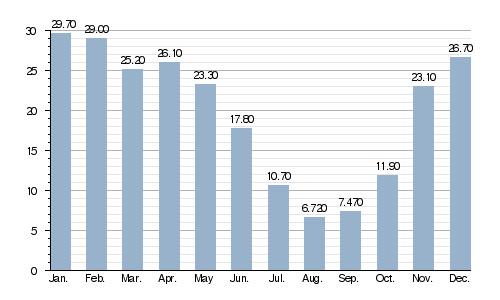
How Much Water Flows in the Dore?
The average amount of water flowing in the Dore river each year is measured. This measurement is called its discharge. It tells us the volume of water that passes through a certain part of the river over a period of time.
At Dorat, in the Puy-de-Dôme department, the average discharge is about 19.70 cubic meters per second (695.7 cubic feet per second). This measurement is based on data collected between 1991 and 2017.
Average monthly discharge (m3/s) at Dorat (1991 - 2017)
Images for kids
-
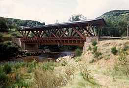
Bridge over the Dore near Saint-Gervais-sous-Meymont.
-
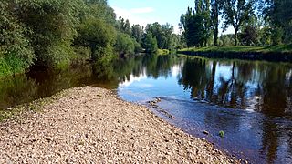
The Dore near Thiers.
-
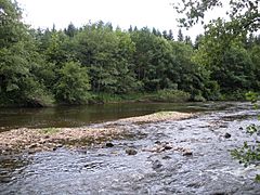
The Dore near Olliergues.
-
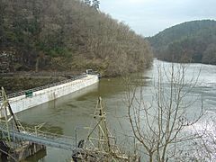
Dam on the Dore in Sauviat.


Related Pages
