
Allier (river) facts for kids
Quick facts for kids Allier |
|
| River | |
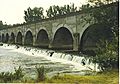
 The Allier river in Brioude
|
|
| Country | |
|---|---|
| Regions | Occitanie, Auvergne-Rhône-Alpes, Bourgogne-Franche-Comté, Centre-Val de Loire |
| Departments | Allier, Ardèche, Cher, Haute-Loire, Lozère, Nièvre, Puy-de-Dôme |
| Tributaries | |
| - left | Chapeauroux, Alagnon, Morge, Sioule |
| - right | Dore, Senouire |
| Cities | Vichy, Moulins |
| Source | Moure de la Gardille |
| - location | Margeride, Massif Central, France |
| - elevation | 1,430 m (4,692 ft) |
| - coordinates | 44°35′16″N 3°47′35″E / 44.58778°N 3.79306°E |
| Mouth | Loire |
| - location | Cuffy, Cher, France |
| - elevation | 167 m (548 ft) |
| - coordinates | 46°57′33″N 3°04′46″E / 46.95917°N 3.07944°E |
| Length | 420.7 km (261 mi) |
| Basin | 14,310 km² (5,525 sq mi) |
| Discharge | for Cuffy |
| - average | 143 m³/s (5,050 cu ft/s) |
The Allier is a river in central France. It's a major branch, or tributary, of the famous Loire River. The Allier river flows through many different parts of France.
The Allier department is even named after this river. Long ago, in Ancient Rome, people called this river Elaver.
Contents
River Facts
The Allier river is about 420.7 km (261.4 mi) long. That's like driving from Paris to Lyon!
The area of land that drains into the Allier river, called its drainage basin, is about 14,310 km2 (5,525 sq mi). This means all the rain and water from this huge area eventually flows into the Allier.
The river's average flow is about 143.0 m3/s (5,050 cu ft/s) near Cuffy. This number tells us how much water passes a certain point in the river every second.
 |
| Average monthly flow (cubic meters per second) at Cuffy (1955 - 2017) |
Where the River Flows

The source of the Allier is high up in the Margeride mountains. These mountains are part of the Massif Central in France. The river starts on a mountain called Moure de la Gardille. This spot is in the Lozère department, at an altitude of about 1,430 m (4,692 ft).
The Allier generally flows north. It passes through several regions and departments:
- Occitanie region
- Auvergne-Rhône-Alpes region
- Ardèche (the river forms a border here)
- Haute-Loire (including Brioude and Langeac)
- Puy-de-Dôme (including Issoire and Cournon-d'Auvergne)
- Allier (including Vichy and Moulins)
- Bourgogne-Franche-Comté region
- Centre-Val de Loire region
- Cher (including Cuffy)
Finally, the Allier joins the Loire river. This meeting point is called the bec d'Allier, which means "beak of the Allier". It's near the city of Nevers, where the Cher and Nièvre departments meet. This happens at an altitude of 167 m (548 ft).
Main Rivers Joining the Allier
Many smaller rivers flow into the Allier. These are called tributaries. Here are some of the main ones that are longer than 40 km (25 mi):
|
Rivers joining from the left:
|
Rivers joining from the right:
|
Gallery
-
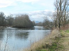
The Allier river near Pont-du-Château.
-
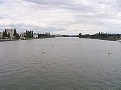
The Allier at Vichy.
-
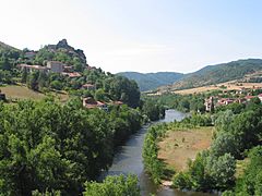
The Allier river.
-

The Bec d'Allier at Cuffy : confluence of the Allier and the Loire.


.jpg)
Images for kids
-
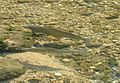
Grayling in a sunny pool
-
The bridge Le Guétin.


See also
 In Spanish: Río Allier para niños
